• Skip to primary navigation
  • Skip to main content
  • Skip to primary sidebar

Have Media Will Travel

A blog about outdoor adventure, family travel, national parks, media, technology, marketing, fitness and me.

  • Travel & Tourism
  • Family
  • Fitness
  • Frontier Life
  • National Parks
  • Life and Leadership
    • Life Coaching
    • Epic Adventure
    • Leadership
    • Keynote Presenting

National Parks

Have Workout, Will Travel

April 21, 2011 by Shelli

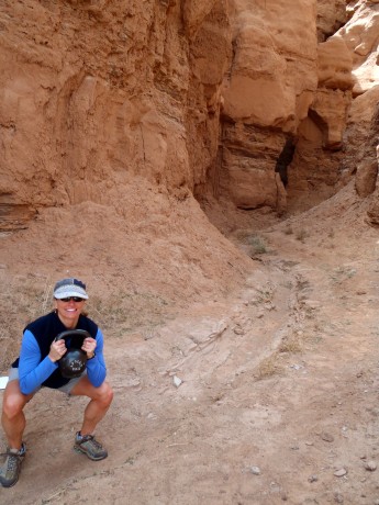
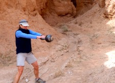
Doing some kettlebell swings during some down time in Goblin Valley.

Normally I would take a reprieve from training during our family’s spring break. After all, I was getting some exercise. We hiked every day. But the hikes were fun and enjoyable — not “training” efforts.

The fact that in less than four weeks I will be hiking from North to South across Zion National Park — about 50+ miles including sidetrips — in a day — means I needed to get some training in during my trip.

No problem. Following our adventuring in Goblin Valley State Park, Jerry, and our 4-year-old son, Fin, took a nap. Wolf and Hayden, our older sons, explored a slot canyon while I did a core and kettlebell workout. In all, it took about 12 minutes to get pretty well worked over, with no sacrifice of family time.

Another day, after our hiking in Grand Staircase-Escalante National Monument, I did some body weight exercises in our campsite while Jerry and the boys built a fire.

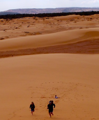
On the final day of our trip, at Coral Pink Sand Dunes, I raced my sons up and down a huge sand dune. We ran, all out, up and down, only a handful of times. It was fun, and a heck of a workout to boot. (I think I’m still sore from that fun, “little” effort.)

I share this to prove that you don’t have to go to a gym, or deprive yourself of family time on a vacation, to get some high quality training in. (Thanks to my trainer and friend, Steve Bechtel, of Elemental Training Center, for influencing me in this regard.)
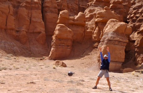
Kettlebell throws.
Goblet squats in a little slot canyon.
Racing our sons up a giant sand dune. (The winner gets extra s'mores.)

Filed Under: Family, Fitness, Frontier Life, Life and Leadership, National Parks, Travel & Tourism Tagged With: Fitness, goblin valley, kettlebells, training, travel, utah

Hiking and Hunting For Treasure in Grand Staircase-Escalante National Monument

April 20, 2011 by Shelli

One of the many highlights of our week-long family camping trip in southwestern Utah was a hike to Calf Creek Falls in the Grand Staircase-Escalante National Monument.

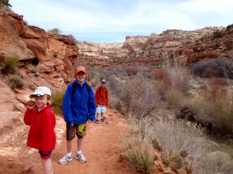
Our sons at the start of the Lower Calf Creek Falls hike.

The Grand Staircase-Escalante National Monument, which was set aside as a national monument in 1996, contains 1.9 million acres of land in southern Utah. There are three main regions: the Grand Staircase, Kaiparowits Plateau, and the Canyons of the Escalante.

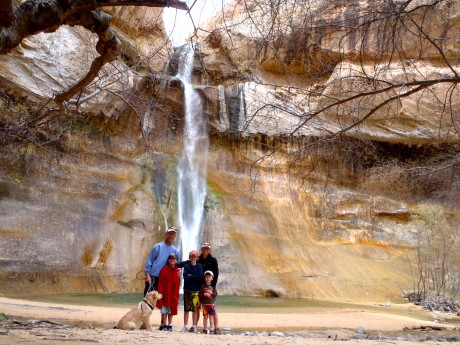
Family photo in front of Lower Calf Creek Falls.

Our trip started in Goblin Valley State Park. On Day Three of our trip, we were going to be traveling along the north boundary of Grand Staircase-Escalante on our way to Kodachrome State Park. Even though we were only traveling through the Escalante area, we wanted to experience it more intimately than simply driving through it, which is how we experienced it a few years ago.

After only brief investigation it became clear that we would be remiss – nuts, even – if we didn’t hike to Lower Calf Creek Falls. The hike is three miles one-way (6 miles roundtrip), and the reward for hikers is big: a 126-foot, beautiful waterfall, at the head of Lower Calf Creek Canyon, which plunges into a perfectly round green pool. Its upper tier fall, which isn’t visible from the base of Lower Calf Creek Falls, is 88 feet tall, making the waterfall’s total height 214 feet. Hikers who want to see the upper fall can scramble about a mile further up to catch a glimpse.

Lower Calf Creek Falls is glorious. The “ribbon-like” waterfall is outlined with green and yellow colors from algae growing on the sandstone, which thrives on the waterfall’s year-round flow.

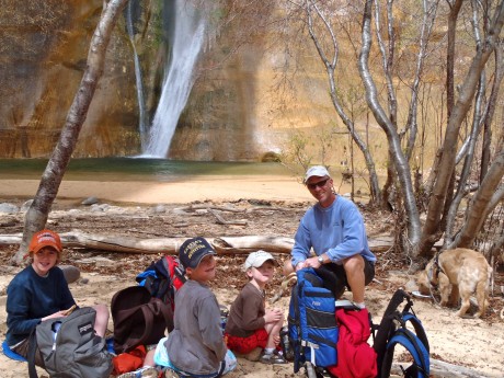
My boys, all five of them, enjoying a picnic at the waterfall.

After a wonderful picnic near the waterfall, we had another adventure to tend to: To find a geocache that was reportedly in the vicinity. Our older sons, Wolf, 11 and Hayden, 9, and I scrambled above the trail in search for the treasure. After using our GPS to determine its location, and some fun exploring and mystery, we were successful in our “hunt.” It was very exciting! Finding the geocache marked our first official geocache find. And, I might add, our family is now hooked on geocaching.

We had big expectations for the hike, and our expectations were exceeded. Our almost-four-year-old son hiked the entire six miles with not too many complaints and after only a handful of bribes. His brothers, ages 11 and 9, were great “adventure leaders” on the hike.

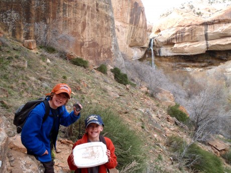
Yeehaw! Our older sons, Wolf and Hayden, pose with the geocache they found.

I highly recommend this hike. The trail is wide and mostly packed dirt. It’s level and easy-going, beautiful, and includes 15 interpretive markers. A bonus are the pictographs hikers can glimpse on the massive, tall cliffs while hiking past interpretive marker #9.

Here’s a short video that shows you some of the scenery included in the Lower Calf Creek Falls hike, as well as a little bit of the geocaching adventure:

Stay tuned for upcoming blog posts about Kodachrome State Park and Coral Pink Sand Dunes.

Filed Under: Family, Frontier Life, National Parks, Travel & Tourism Tagged With: calf creek falls, family adventure, geocache, grand staircase-escalante, hiking, pictographs, utah, waterfalls

Utah’s Goblin Valley is a Hit for Families

April 18, 2011 by Shelli

We recently returned from a week-long camping trip in southwestern Utah for spring break. About every other year we head for southern Utah’s state parks and national parks to get dirty, hike, climb on big rocks, camp, play games, sit around a camp fire, star gaze and eat as many s’mores as possible.

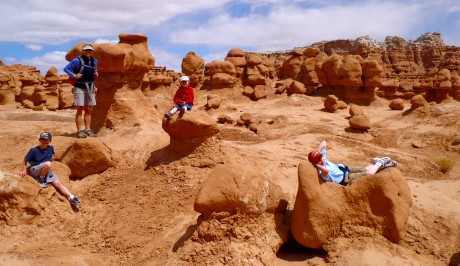
Our boys had fun climbing the formations near our campsite in Goblin Valley.

For this trip, we headed to Utah’s Goblin Valley State Park, then to Grand Staircase Escalante National Monument to hike to Calf Creek Falls, then to Kodachrome State Park and finally, to Coral Pink Sand Dunes State Park. Normally we spend time at Zion and Arches national parks, but since we had our puppy in tow this time, we invested our time in the more pet-friendly areas of the state.

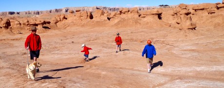
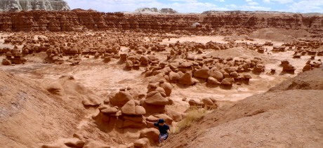
Jerry and our boys begin exploring Goblin Valley.

It was our second time to Goblin Valley. This is a magnificent place to visit, especially if you have young children. It is home to thousands of “hoodoos” — mushroom-shaped rock formations that range in size from a couple feet to several yards high. The uniquely shaped formations are formed of erosion-resistant rock that is on top of softer sandstone.

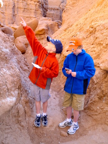
Hayden, 9 and Wolf, 11, check the GPS as they get close to a geocache.

Our three sons played hide-and-seek, and climbed up and over and lounged on top of weird formations while looking for any goblins that might be “fleeting” by in between the odd formations. We also enjoyed our first official “geocaching” adventure here. Members of geocaching.com, we researched geocaches for the area during our trip planning. The one we were looking for in Goblin Valley was reported to have “3 stretchy skeletons” and a recently-activated geocoin in it.

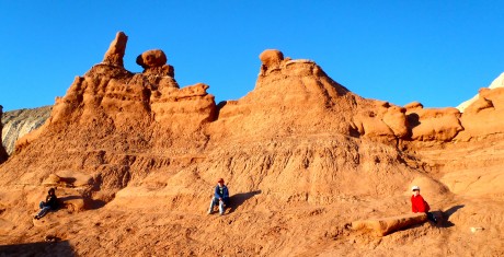
Lounging on hoodoos called 'goblins.'

We followed the hints that were provided and the GPS coordinates to find the area where the treasure was supposedly cached. According to our GPS, we were hot on the signal, but could find no cache. After lots of hunting but nothing to show for it we determined someone had probably taken the skeletons and the cache and left the geocoin behind. Despite our not finding the geocache, we had a blast during our four hours of hiking, climbing, and adventuring throughout the cool landscape of Goblin Valley.

Hayden, scrambling.

We camped in Goblin Valley State Campground, which is a few minutes’ drive from the aforementioned hoodoo-filled area. The campground is situated wonderfully, right below a bunch of towering formations with narrow passages, providing yet more interesting terrain for our boys to explore.

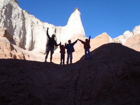
The boys and I proclaiming victory on a formation above camp. 🙂

Here’s a short video of our almost-4-year-old son, Finis, leading us on a geocache adventure:

Stay tuned for upcoming posts, including photos and videos, for our adventures in Grand Staircase Escalante, Kodachrome State Park and Coral Pink Sand Dunes. Please check back soon, and thanks for reading my blog. 🙂

Filed Under: Family, National Parks, Travel & Tourism Tagged With: adventure, camping, family travel, geocache, goblin valley, hiking, utah

The Day Pink Power Ranger Skied 50 Miles

March 28, 2011 by Shelli

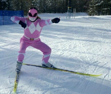
I recently returned from West Yellowstone, Montana, where some girlfriends and I dressed up in super girl costumes and skied. For a very long time.

This is me, the Pink Power Ranger.

The occasion? The Equinox Ski Challenge. This annual event, which is named for the time the sun crosses the plane of the earth’s equator, making night and day of approximately equal length all over the earth, is awesome.

It’s basically a supported ski-a-thon on some of West Yellowstone’s world-famous (read: awesome) ski trails. Categories include: 24-minute kids’ race, 3-hour, 6-hour, 12-hour and 24-hour. Skiers can enter solo or as a team. A small team can have 2-4 members, or a big team has 5-8 members. We each entered “solo,” in the 12-hour, figuring that would give us all day to ski and take it easy in our base camp. We had set up chairs and a cooler and bags full of sustenance that included mountains of energy bars and waters, plus some more tasty items, as well as a bunch of Hotties, and additional layers of clothes.

Logging laps in falling (wet) snow.

The weather forecast for the day of the event was not favorable. It was to be warm — as in 44 degrees warm — with a good chance for snow, which could very likely be rain. (Yuck.) However, we were pleasantly surprised by a partly sunny sky when we arrived at the event.

Each lap measured 8.7 kilometers. However, for some reason (I always round up?) I got it in my mind that each lap was 9k. I had a personal goal to ski 50 miles — or, about 9 laps.

As readers of this blog know, I like to be outside working hard for a long period of time. Plus, I am in training for an epic (54+ mile) “day” hike from north to south of Zion National Park in May. So I figured 50 miles on skis would be great training.

So I skied, and skied, and skied. All of us did. Around and around and around.

The first two laps included great trail conditions and some sunshine. It was looking to be a great day. It was taking me about 39-40 minutes to ski a lap and I was having fun. My skis were gliding and everything. Yeehaw! So far, so good.

Stocking up at the aid station and getting ready to start yet another lap.

Originally my plan was to ski three laps, then take off my skis, go to the restroom and “lounge around” in my comfy little chair, and eat some food and drink some water, then repeat, several times over the course of 12 hours. But like often is the case during an adventure, things didn’t go as planned.

As my third lap started, and so did the falling snow, and the wind. Conditions were rough for the rest of the day, at least for the rest of the 12-hour window. I don’t have the greatest technique, or very much experience, so it was more work than skiing. Sort of like hiking or snowshoeing but with skinny skis on my feet and thankfully, poles in my hands. It was a wet snow, so I was not only getting worked over, I was pretty soaked. Somehow, I still very much enjoyed the experience.

I did change my plans. As the weather and conditions took a turn for the worse, I knew if I stopped, it would be harder to get going again. So, despite the worsening conditions, I kept at it, pretty relentlessly. I resorted to listening to my iPod midway through my fourth lap, and thanks in large part to the Heartless Bastards and the Dirty Heads, it was still a pretty good day and I was able to keep skiing around and around.

The scenery was beautiful and I was able to enjoy a lot of solitude, which was from time to time supported by friendly, cheering people and an aid station stocked full of beverages and yummy, energetic treats. (I love Tram bars.)

There was no shortage of camaraderie, and it seemed the worse conditions got, the more supportive everyone was. We were all in it together, kindred spirits. You could feel this and it really made the event a special one for me. It did not feel like a race, although there were many kick-ass skiers out there logging laps at a high rate of speed.

I can’t help but mention two awesome women skiers who were set up next to our “station:” Becky Wheeler, of Casper, and Jen Ziegler, of Jackson. These two women were entered as a team in the 24-hour category. Their goal was to ski 300k, and looking at the results, I see they did 314k. Now that’s some skiing. With numbers that big I needed a calculator to compute that they skied almost 195 miles! Both women were really supportive and enthusiastic, even as they made the skiing look effortless.

I stopped skiing just past eight hours, after what I figured to be 81 kilometers, which meant I had met (surpassed) by goal of 50 miles.

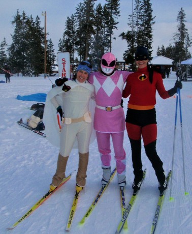
Wind River Super Girls.

But wait! Upon my return, I was on Facebook and the Equinox folks posted the results on their fan page. I learned that I did 78.3k, which is — gasp — just short of 50 miles. On the upside, I got second place. Yeehaw. But really, this was not a race, but a super fun challenge to ski far with support. And that it was. Plus, I figured my short ski trips to the bathroom and back may have put me just at 50 miles. That’s my story, and I’m sticking to it. 🙂

Some people call the Equinox a “race,” and to a few people it may be that. But for most, it’s not a race, buta personal challenge. The event’s mission, which is stated on its website and influenced me to sign up, is: To hold a nordic ski event that brings benefit to our communities, encourages compassion and camaraderie amongst participants, and provides an exceptional opportunity for personal challenge.

A portion of the money raised from the race is donated to the West Yellowstone Ski Education Foundation, which race creator Sam Newbury believes promotes support and health for youth in the community. Funds are also donated to the Livingston-based Manaia Youth Programs.

I love to skate ski. I love being out in nature. I love being around other people who love the outdoors and skiing. I love camaraderie. The Equinox delivered all of these things. I love the Equinox Ski Challenge. Oh, and did I mention we got to dress up in costumes for the event? I was the Pink Power Ranger, and my cohorts dressed up as Padme and Elasta-Girl. I am sure that everyone felt protected and safer as a result of our presence.

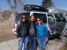
Kathy, me and Holly, or, Wind River Super Girls for the weekend.

Finally, the Equinox Ski Challenge provided an excuse to take a trip with some of my closest girlfriends, Holly Copeland and Kathy Browning. Which meant we sang really loud, ate too much chocolate and drank some wine. In addition to the skiing… 🙂

Thanks so my mom for lending me her Pink Power Ranger costume, and to friend Shannon Kaminsky’s daughter for loaning me the mask!

Filed Under: Family, Fitness, Frontier Life, Life and Leadership, National Parks Tagged With: equinox ski challenge, montana, Nordic, ski, skiing, west yellowstone

Elk, Crashing Surf, Elephant Seals and a Lighthouse Make for Epic Day

March 17, 2011 by Shelli

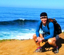
At Tomales Point.

On my most recent trip to the San Francisco, CA, region, I spent a day exploring the Point Reyes National Seashore region, located about an hour-and-a-half northwest of San Francisco.

The highlights were hiking to Tomales Point, which marks the end of land on the Pt. Reyes Peninsula,  seeing elephant seals at Drakes Beach, and exploring the Point Reyes Lighthouse, which was (perhaps aptly?) shrouded in fog.

Point Reyes National Seashore is a 71,000-acre area located on the Point Reyes Peninsula, in Marin County. My hike to Tomales Point would take me to the north end of land for the Point Reyes peninsula, which is geologically separated from the rest of Marin County and almost all of the continental United States by a “rift zone” of the San Adreas Fault, about half of which is sunk below sea level and forms Tomales Bay. (Wikipedia)

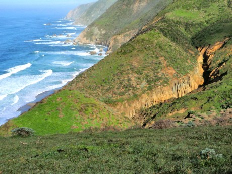
The scenery on my hike to Tomales Point was breathtaking.

The hike to Tomales Point and back is about 9.5 miles. It’s rolling, and I was rewarded the entire way. Earlier in the morning, en route to the trailhead, I was getting rained on as I traveled over the Golden Gate Bridge. I packed my rain gear and planned on getting wet on the hike and yet hoping to at least catch a glimpse of the scenery.

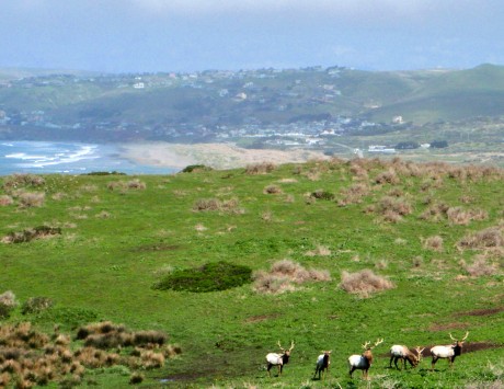
Elk and ocean in the same view.

But I got lucky. When I arrived at the trailhead, it was all blue sky. I left the trailhead mid-morning and had the trail to Tomales Point all to myself. Well, not really. I shared the trail with hundreds of Tule elk.

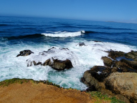
Crashing surf.

I am from Wyoming and spend a lot of time in Yellowstone so seeing elk was not that shocking to me. However, hiking among so many of them certainly was a rare treat. The biggest deal about hiking among the elk on this hike was that I was also hiking amidst crashing surf of the Pacific Ocean. Now that was extraordinary! Many times I had both elk and ocean in my view, and that was really, really cool.

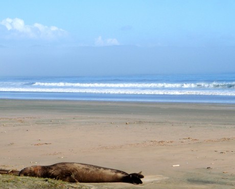
ELEPHANT SEALS AT DRAKES BEACH Just when I thought my day couldn’t get any better, I stopped at Drakes Beach. I was simply going to get a vantage of the ocean from a beach perspective since it was now a bit foggy above the shoreline. When I got out of my car I noticed orange ribbons and warning signs blocking people from accessing the beach, which was right in front of me.

There was a photographer nearby (Jim Coda) and I asked him what the signs were all about. “Probably to protect the elephant seals,” he said. Oh my gosh, I hadn’t even noticed them! There they were — three or four big creatures right in front of me lying on the beach. I had just figured they were big rocks or clumps of beach matter. I watched as the one right in front of me sighed and “waved” at me one time with his tail. It was an amazing experience to be so close to them.

Elephant seal on Drakes Beach.

According to the National Park Service website, elephant seals range from Mexico to Alaska and Hawaii in search of food. They spend 80 percent of their life in the open sea. Not only do they spend most of their life in the ocean, 90 percent of that time is spent underwater: eating, sleeping, digesting, and traveling.

They are built to survive continuous dives to depths that would squeeze the life out of any other mammal. The average dive reaches 1,000 to 2,000 feet, lasts close to half an hour and is followed by only 3-5 minutes at the surface to breathe. Seeing and watching the elephant seals were a major highlight for me and I couldn’t wait to share the news with my husband and three sons.

POINT REYES LIGHTHOUSE After completing the hike, I went to see what all the fuss was about with the Point Reyes Lighthouse. Point Reyes is the windiest place on the Pacific Coast and the second foggiest place on the North American continent. As you probably know, lighthouses provide mariners increased safety by warning them of rocky shores and reefs. They also help mariners navigate by indicating their location as ships travel along the coast. Mariners recognize lighthouses by their unique flash pattern.

On days when it is too foggy to see the lighthouse, a fog signal is essential. Fog signals sound an identifying pattern to signal the location to the passing ships.

According to the National Park Service website, the Point Reyes light first shone in 1870. Its lens and mechanism were constructed in France in 1867. The clockwork mechanism, glass prisms and housing for the lighthouse were shipped on a steamer around the tip of South America to San Francisco.

Meanwhile, 300 feet below the top of the cliff, an area had been blasted with dynamite to clear a level spot for the lighthouse. To be effective, the lighthouse had to be situated below the characteristic high fog. This is all fascinating for this “land-locked” Wyoming girl. 🙂 I hiked the short distance to the lighthouse, although don’t have any great photos because it was so foggy. I’m including a very short clip near bottom of this post to prove it was foggy and that I was there, though.

OTHER MARIN HEADLANDS HIKING BLOG POSTS:
From Surf To Top of Mt. Tamalpais
Surf, Rolling Hills, Lung Busting and Zen

VIDEOS:

TOMALES POINT HIKE – BREAKING SURF CAPTURED FROM STEEP, EXTREME CLIFF

TOMALES POINT – “RICH” AT TOMALES POINT

THE ENTIRE TOMALES HIKE COMPRESSED INTO (12 MINUTES)

ELEPHANT SEALS AT DRAKES BEACH

POINT REYES LIGHTHOUSE (UNDER FOG)

Filed Under: Fitness, National Parks, Travel & Tourism Tagged With: california hiking, elephant seals, hiking, lighthouse, marin headlands, point reyes, tomales point, tule elk

  • « Go to Previous Page
  • Page 1
  • Interim pages omitted …
  • Page 5
  • Page 6
  • Page 7
  • Page 8
  • Page 9
  • Interim pages omitted …
  • Page 14
  • Go to Next Page »

Primary Sidebar

About Shelli

Hi. My name is Shelli Johnson. I live on the frontier in Lander, Wyoming. I’m a wife, a mother, an entrepreneur, certified life/leadership coach, wellness coach, keynote presenter and inspired speaker, leadership development facilitator, personal development strategist, writer and adventure guide. This blog mostly includes stories about adventures and travel, but other passions are reading/books, technology, fitness, nutrition, and national parks, so you’ll find a wide range of articles here. I am founder of Yellowstone Journal and YellowstonePark.com, and NationalParkTrips.com, which was my first business. My current company, Epic Life Inc., is in its 7th year, and going gangbusters. If you’re interested in learning more about my current work, I hope you’ll jump over there and learn more about that. I have a more personal blog, more directly related to life and living and leadership, at YourEpicLife.com/blog. I’d love it if you’d also check out that collection of my writings. Thank you for stopping by! Finally, if you’d like to connect with me directly, please email me if you’d like to connect.

  • Facebook
  • Instagram
  • LinkedIn
  • Twitter

Subscribe For Email Updates

Check your inbox or spam folder to confirm your subscription.

Archives

Links

  • Your Epic Life
Copyright © 2025 · Have Media Will Travel