• Skip to primary navigation
  • Skip to main content
  • Skip to primary sidebar

Have Media Will Travel

A blog about outdoor adventure, family travel, national parks, media, technology, marketing, fitness and me.

  • Travel & Tourism
  • Family
  • Fitness
  • Frontier Life
  • National Parks
  • Life and Leadership
    • Life Coaching
    • Epic Adventure
    • Leadership
    • Keynote Presenting

hiking

Hiking in Landmannalaugar: Climbing Brennisteinsalda and Blahnukur

July 5, 2019 by Shelli

For a range of photos and videos showing the wonders of Landmannalaugar, please visit this blog post.

It wasn’t long after we booked our flights to Iceland and we had started our trip planning that I became enthralled about an area called Landmannalaugar.

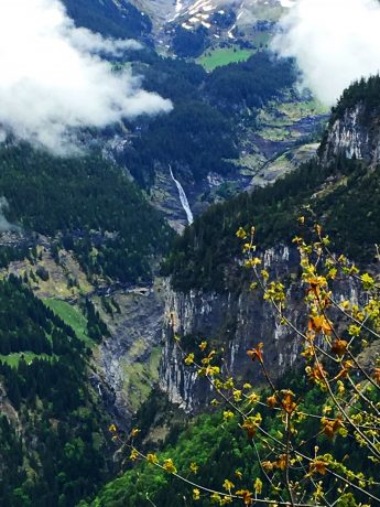
I was completely captivated by the area after seeing photos of mountains that didn’t even look real. The photos and reports promised rainbow-colored hills and mountains, dotted with plumes of smoke and steam rising from the area’s fumaroles.

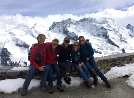
We had an extraordinary day and epic hike in Landmannalaugar. My family and I have hiked in some amazing places all over the U.S. and world. In other words, my list of unforgettable hiking experiences in long. I don’t like to compare hikes because the regions of the hikes are often so different that I love them for their individual characteristics. But that said, Landmannalaugar ranks way up high on my list of favorite unforgettable hiking experiences. I can’t recommend it enough!

As the saying goes, a picture is worth a thousand words. For a more lengthy and information report about hiking in Landmannalaugar, I wrote this article. Otherwise, I just want to leave you with photos and videos of our adventure in Landmannalaugar. They are so much more inspiring than anything I could write. I’m writing words to hopefully provide enough information for you to plan your own Landmannalaugar hike, but when it comes to inspiring you, my words will do nothing compared to the photos and videos.

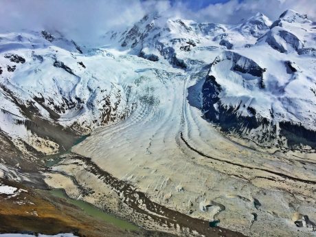
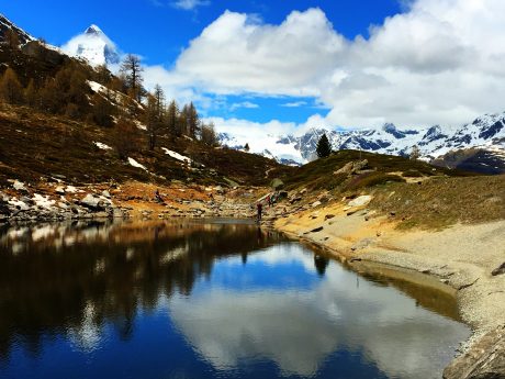
Landmannalaugar is located in the Fjallabak Nature Reserve, in the Highlands of Iceland. It is situated at the edge of the Laugahraun lava field, which was formed in an eruption around the year 1477. The Landmannalaugar region is known for its natural geothermal hot springs and its unique and colorful landscape composed of with rainbow-colored mountains, lava fields and smoking fumaroles.

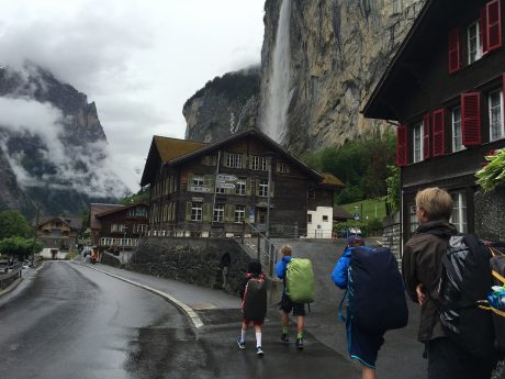
The first thing one needs to know about hiking in Landmannalaugar is you must have a 4×4 vehicle to access this Wonderland. (Or, you could opt for a tour or hire a ride to get there.) Because our Iceland trip was 15 days long and there was a lot we wanted to see that would require driving on dirt roads, we rented a 4×4. On the passenger side dashboard, there was a sticker that essentially granted us permission to drive on dirt roads, and also warning to hold tightly to the car doors when opening and closing them or they could be blown off by the wind.

We had based out the Highland Center Hrauneyjar, which I highly recommend. The rooms were wonderful and the hotel is lovely. The people who work there provided wonderful and friendly service, and there’s even a Ranger on hand to answer questions about the region. We left the Highland Center at 7 am and drove about 1 mile east on the paved road, F26, before taking a right onto the dirt road, F208, that would lead us to Landmannalaugar. We traveled the scenic, bumpy dirt road for 25 miles. It took about one hour to get to Landmannalaugar, and we had the road pretty much to ourselves.

We opted to park our vehicle in the first parking lot. We knew from our research and could see now with our eyes, that it’s possible to drive further to park, to be closer to the main complex and campground, but you’d have to drive through a large puddle that on this day looked more like a small lake. We opted to play it safe and walk the quarter-mile to the main area and trailheads.

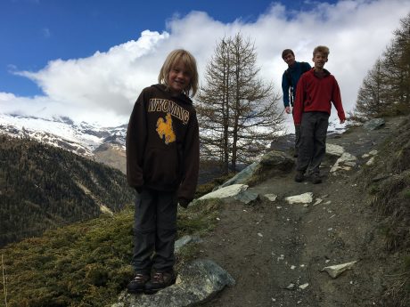
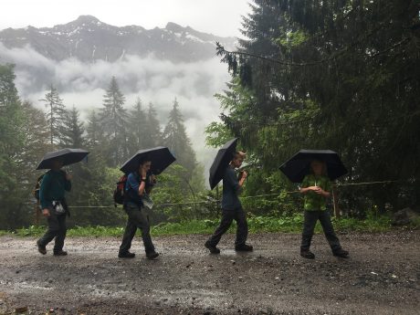
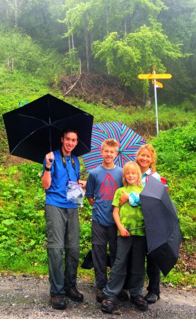
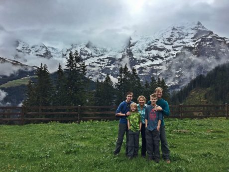
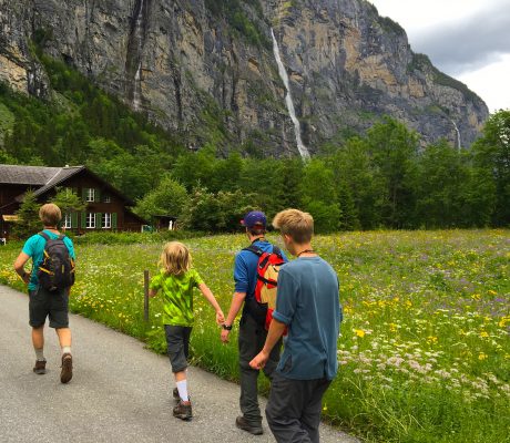
We had lucked out with a favorable weather forecast, but still packed lots of layers and bundled up for the start. We had been in Iceland long enough to know that wind is common and it’s often chilly like our Wyoming winds are in the high country.

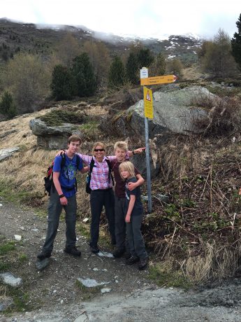
Situated at about 2,000′ (600 meters) elevation, Landmannalaugar is a popular destination for adventurers and this was obvious by the number of colorful tents pitched at the campground and the number of jacked-up 4x4s parked nearby. We used the WC and then reviewed the trail map and started up the trail.

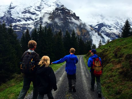
Our plans were to hike a lot and see as much of the area as we could. Our only specific goals were we planned to climb two mountains (volcanos): Brennisteinsalda and Blahnukur.

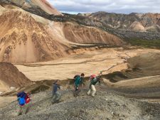
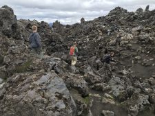
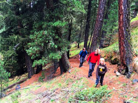
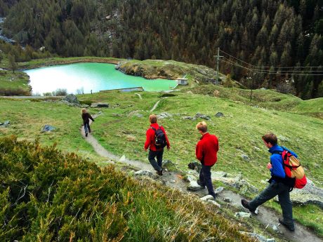
We started up the Laugahringur Circle Trail, which is the most popular trail in Landmannalaugar. The landscape is littered with lava chunks. As we hiked up and through the lava field, our middle son, Hayden, was exuberant at all the obsidian. He had been looking for obsidian our whole trip and here it was abundant.

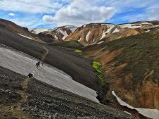
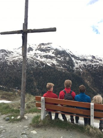
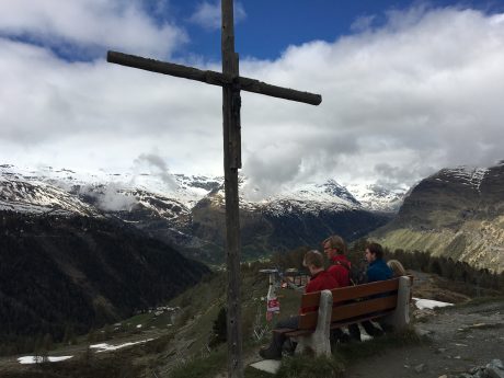
After hiking through the lava field for some minutes, we were treated to breathtaking views of the Vondugil (bad ravines) Canyon. We walked up the canyon to Grænagil, at which point we had a great view of our first objective: Brennisteinsalda (“sulfur hill.”) Brennisteinsalda, which means sulfur wave, is a colorful, 2,800-foot-high mountain (hill) with steam vents around its base that filled the air with sulfur (the smell of rotten eggs). It was a steep effort but it didn’t take us long to climb the volcano and we were on the top.

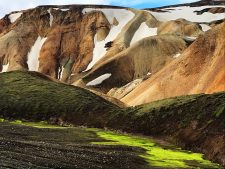
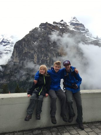
Due to our early start, we had the mountain top to ourselves so we lingered and took lots of photos. You’ll see from some of the photos included that it was a windy, you-better-hold-onto-your-hat summit experience. The views from the top were extraordinary. We could see lava fields, rainbow-colored hills, a lush green meadow, more mountain peaks all around and black lava scattered everywhere.

One thing we noticed was a circular pattern in the black field in the distance. We came to learn the circles are called Nornabaugar, which means Witch’s Rings. The circles are formed by a mushroom trying to grow in Iceland’s’ sensitive highland regions. You’ll see this in one of my photos below.

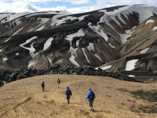
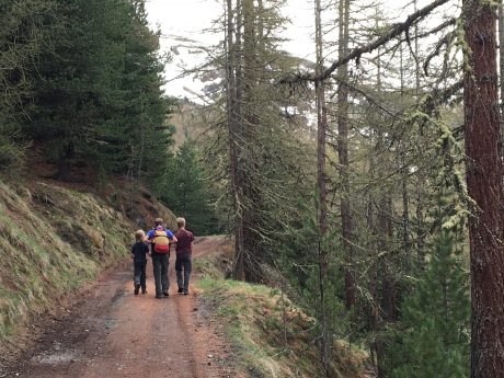
After descending Brennisteinsalda, we found our way to a beautiful creek that separated us from our next mountain climb, Blahnukur. After crossing a creek we found a path that would lead us up a beautiful ravine and eventually to Blahnukur’s summit.

This was harder than our first volcano climb because it’s a little higher. Blahnukur, which means blue peak, is a 60,000-year-old black-blue volcano that stands 3,100 feet tall.

As a family, we have climbed many mountains. Gone are the days when we had to bribe them with sweet treats up the trail. It wasn’t long and the boys and Jerry left me in the dust. I just couldn’t get enough of the views as we ascended the ravine to gain a ridge to climb Blahnukur. The hills to my right were so colorful, and the higher reaches of the hills had snow patches nestled in them that made the mountains and hills look cartoonish. Also, there were enormous patches of neon-green colored moss that didn’t look real. I was in Heaven and as such, I lingered more than I hiked.

Hiking throuigh lava fields.

Eventually, I caught up to the boys and we started the real ascent. After hiking up a worn path for a bit, we gained the mountain’s very exposed ridge. You wouldn’t want to slip either right or left as when climbing Blahnukur.  The panoramic views that unfolded all around as we climbed higher and higher were astonishing. This was probably my favorite part of the day’s adventure because I love climbing ridges and to the tops of mountains.

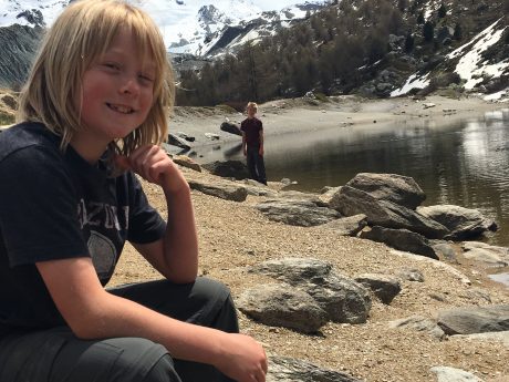
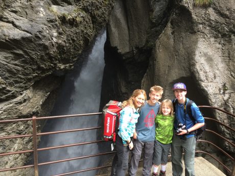
When we reached the top another small group was starting down so again, we had some moments at the top all to ourselves. We sat and hung our legs over the edge of Blahnukur’s top and took some photos before starting our descent. Our descent was quick and we enjoyed a picnic in the fantastic setting that is Graenigil Canyon before eventually finishing the hike through more lava.

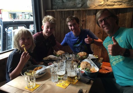
Our entire adventure was about 12 miles, and while we took our time taking in the views and eating snacks, we finished the whole hike in about 4.5 hours. Which meant we had a lot of time to soak in the natural hot springs near the trailhead!

Soaking in Landmannalaugar’s geothermal waters was a perfect ending to our time in Landmannalaugar.

We’re back home in Wyoming and I find myself recalling often the colorful mountains of Landmannalaugar. It truly is an unforgettable experience, and in my humble opinion, a visit to Iceland without time in Landmannalaugar will be incomplete.

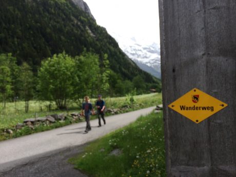
(NOTE: The most famous long-distance trail in Iceland starts here and is called the Laugavegur. The trail is about 34 miles long (55 kilometers) and runs from the Landmannalaugar geothermal springs to the Þórsmörk nature reserve. The Laugavegur trail is considered to be one of the most epic treks in the world, and most people will reserve 3-5 days to hike its entire length. I have added it to my bucket list.)

For the rest of the Iceland story, and for additional Iceland-related blog posts:

Iceland or Bust

Iceland, Part 1 of 7: Blue Lagoon, Kerid Crater, Seljalandsfoss, Sólheimajökull Glacier, Skogafoss and  Reynisfjara Beach

Iceland, Part 2 of 7: Katla Ice Cave, Vatnajökull, Skaftafell, Svartifoss and Svínafelsjökull Glacier

Iceland, Part 3 of 7: Climbing Fjallsjokul, Jökulsárlón Glacier Lagoon, Diamond Beach, Lítanesfoss, Hengifoss and Seydisfjordur

Iceland, Part 5 of 7: Hiking in Landmannalaugar: Climbing Brennesteinsalda and Blahnjukur Volcanos

Iceland, Part 4 of 7: Studlagil Canyon, Dettifoss, Viti Crater, Hverfjall Crater, Lake Myvatn and Godafoss

Iceland, Part 6 of 7: Secret Solstice Music Festival!

Iceland, Part 7 of 7: Our Epic Grand Finale–Climbing Snaefellsjokull Volcano and Glacier

Filed Under: Family, Fitness, Frontier Life, Life and Leadership, National Parks, Travel & Tourism Tagged With: blahnukur, brennisteinsalda, hiking, iceland, iceland epic adventure, iceland hiking, landmannalaugar

Zermatt: Gornergrat Glacier, the Matterhorn, Mountain Lakes, and More Delicious Food

June 3, 2016 by Shelli

Greetings! After successfully making four train connections, we arrived in picturesque Zermatt, Switzerland. Zermatt is in southern Switzerland’s Valais canyon, and is a mountain resort renowned for skiing, climbing and other alpine recreation. The town is set below the iconic, snow-capped Matterhorn peak. Its main street, Bahnhofstrasse, has upscale boutiques, lodging from luxurious hotels to modest chalets. Except for work vehicles and taxis, the town is car-less and accessed only by train.

(By the way, this is my 6th blog post published so far during our 29-day “Epic Europe Family Adventure.” If you’re interested, all previous trip reports from this Epic Family Adventure include are listed and linked to at the bottom of this blog post.)

Hayden Fin and Wolf, in Zermatt, in front of the Matterhorn.
The town of Zermatt, Switzerland, with the iconic Matterhorn in the background.

After checking in and dropping our luggage at the wonderful Chalet Medi, we headed out to buy discount 3:36pm tickets to ride the Gornergrat Bahn. The Gornergrat Railway would take us to the top of the Gornergrat, to an elevation of 10,135′.

The Gornergrat (English: Gorner Ridge) is a rocky ridge of the Pennine Alps, situated at 10,285′ and overlooking the Gorner Glacier. It is the second highest railway in Europe, and the highest open-air railway in Europe.

The Gornergrat Glacier is about 22 square miles, and is on the west side of the Monte Rosa massif. We’d see about 29 tall peaks while at the Glacier.

The train ride was a hit! Check out this video I captured near the top:

Family photo on the top of the Gornergrat.

Once at the top of the Gornergrat, we were fascinated while looking at the glacier.

Gorner Glacier, approximately 22 square miles in size.

We also stopped into a little chapel before taking some panoramic photos from the very top. Called the “Bernhard von Aosta” chapel, it is one of Zermatt’s most visited places of worship. Visitors from all over the world stop to light a candle and enjoy the soothing tranquillity of this mountain sanctuary. We stopped in and donated a franc in a little basket so we could light a candle, and then, since we had the little chapel to ourselves, we said a family prayer, mostly thanking God for our safety, our friends and family, and for all of our blessings. It was very meaningful!

IMG_8677

IMG_8678

Afterward, we bought ourselves a beverage and enjoyed it while taking in the panoramic views before catching our return train ride back to Zermatt. We needed to get back to eat dinner so we could be to bed to get rest for the next day’s epic hike.

We enjoyed a fabulous dinner at The Brown Cow Pub in Zermatt and then hit the hay.

Our middle son, Hayden, pleased with his wings and fries at The Brown Cow Pub.

The next day started early. We had the boys up and at ’em and out the door to start hiking at 8am sharp. Once again, we skipped the tram lifts up and started up a mountain. This time we knew the difference between meters and feet, and still we went for not pursuing the parents of the year award. (The tram didn’t open until 9am, and it was 8am. That explains it, right? Insert smiley face here. LOL)

We hiked basically straight up a mountain… I think it was part of the Cervo boutique mountain resort, but I’m not 100% certain as I write this. Finally, after a long, hard, seemingly endless uphill effort, we arrived at a signed junction that indicated we were 30 minutes from Sunnegga. It was mostly a flat path to Sunnegga, and we had a bunch of our snacks, and some water on a bench under a cross, while taking in views of the valley below, and the Matterhorn and other mountains, whose tops will at the moment obscured by clouds. (We had hoped that the Sunnegga station would be open and have hot chocolate, but no luck. We reached it too early, too!)

Hiking up, up, up.
Hiking up, up, up.

IMG_8724

IMG_8727

IMG_8731

IMG_8790

IMG_8789

IMG_8734

After getting refueled, we continued to Leisee Lake, which was surrounded by jungle gyms and picnic tables. The next lake was Moosjisee which was beautiful turquoise in color.

The boys hung out at this pullup bar? before continuing to another lake.
The boys hung out at this pull-up bar (?) before continuing to another lake.
Almost to Moosjiee Lake.

After that, we still wanted to see another lake, so we continued on and up to Grünsee Lake. This one was a little more hard-earned.

Here’s a short video clip of that stretch:

Finally, we reached Grünsee Lake, which was beautiful, even if it was small. I am NOT complaining, but these “lakes” seem more like ponds to us. They were very tiny by Wyoming standards, so I’d by lying if I didn’t say we were a little disappointed when we crested after a long hill to see the very tiny Grünsee Lake.

On the upside, we had it the lake all to ourselves, and the Matterhorn’s summit was now out of the clouds. We had a wonderful rest at the lake. One of our sons skipped rocks, another took photos of the area, and the other played with the hundreds of minnows he spotted in the lake. We didn’t rest for long, though, as we had a long hike and descent back into Zermatt, and at this point we already had 10 or 11 miles on our legs.

Here are some photos:
IMG_8762

IMG_8765

IMG_8758

It took us some hours to get back because, as per usual for us, we made the hike longer and harder than originally proposed. 🙂 As a result, we saw even more than we imagined was possible and we were more deserving of even more delicious food and drink upon our entry back into Zermatt.

Have I mentioned lately how blessed I am to have such troopers for a husband and three sons? They go on these epic hikes with me, that are always longer than they anticipate, and never complain.

Our champion sons.
Our champion sons.

Here is us after crossing the finish line:

IMG_8799

And, as always, there were so many unexpected surprises, including these beauties:

IMG_8744

IMG_8770

IMG_8791

IMG_8793

IMG_8800

Thanks for following along with us on our Epic Family Europe Adventure. Please stay tuned and check back for more.

Up next: Moneglia, Italy and the Cinque Terre Trail!

If you’re interested, here are all of my previous blog posts about this Epic Europe Family Adventure so far:
• From Wyoming to the British Museum and Shakespeare’s The Taming of the Shrew in 24 hours
• Big Ben, River Thames, Tower of London and Ice Cream
• Munich Day 1: Glockenspiel, Deutsches Museum, Englischer Garten and Beirgarten
• Biking in the Bavarian Alps, Exploring Neuschwanstein Castle, Epic Beer & Food
• Lauterbrunnen, Switzerland: The Land of Many Fountains, Cows with Bells and Epic Food

Filed Under: Family, Frontier Life, National Parks, Travel & Tourism Tagged With: epic life, family adventure, five lakes hike, gornergrat, hiking, matterhorn, swiss alps, switzerland hiking, zermatt

Lauterbrunnen, Switzerland: The Land of Many Fountains, Cows with Bells and Epic Food

June 3, 2016 by Shelli

Oh. My. God. We have arrived. Today we rode many trains from Munich to arrive here, Lauterbrunnen, Switzerland. Immediately it was evident why this place is called Lauterbrunnen –- which means, “Many Fountains.” In the Swiss Alps, Lauterbrunnen is set in a valley featuring tall cliffs, and waterfalls, including the roaring Staubbaach and Trummelbach and the many other tall, ribbon-like and tumbling waterfalls.

(By the way, this is my 5th blog post published so far during our 29-day “Epic Europe Family Adventure.” If you’re interested, all previous trip reports from this Epic Family Adventure include are listed and linked to at the bottom of this blog post.)

Jerry and the boys lead us to our accommmodations in Lauterbrunnen.
Jerry and the boys lead us to our accommodations in Lauterbrunnen.

Waterfalls were tumbling off high cliffs above us and all around us. Below is a lush, green valley with few buildings. We walked in a light sprinkling of rain about one-third of a mile to find what would be our favorite accommodations so far, a really neat cabin in the Jungfrau Campground.

We got settled in our cabin, and then headed for a quick walk. We had been sitting in trains all day so wanted to stretch our legs and check out our new destination. We ventured to the nearby showstopper of a waterfall, Staubbach Falls. With a height of nearly 300 meters, Staubbach Falls is the second highest waterfall in Switzerland. It is one of 72 waterfalls in Lauterbrunnen Valley.

Staubbach Falls.
Staubbach Falls.
Staubbach Falls.
Family selfie in front of Staubbach Falls.

Did I mention how awesome our accommodations were?!! Check out the video I snapped on our first morning waking up. And enjoy the bird songs in the background:

We woke up early in Lauterbrunnen because we had big plans, and wanted to get an early start. Today we would hike the Lauterbrunnen-Murren-Gimmelwald-Trummblebach Falls loop hike.

We’d do it without using any lifts, so it would be a big, long day. Why would you not take the tram lift up at the start in order to remove the several thousand feet of vertical uphill hiking, you ask? Well that is a good question! The reason is Jerry and I mistook meters for feet. What we thought would be a 1,000-foot vertical gain in the beginning of the hike was really 3,000+ feet. Oops. Thankfully we hike a lot with the boys in Wyoming, and they’re used to climbing lots of vertical feet. But, despite what our boys think, ours was an honest mistake!

Add to that it was raining when we started, so we had had on rain jackets, and each of us carried our own umbrella. Our sons are such troopers. And so is my husband. I am so blessed that to have a family of troopers, because today’s outing pretty much required that!

Here are some photos from the first part of our epic hike:

IMG_8486

IMG_8482

IMG_8484

IMG_8485

IMG_8481

IMG_8475

IMG_8523

It was during the grunt of uphill through the lush and wet forest, when I was gasping for air and the miles of uphill were so never-ending that I realized that we had forget to convert meters to feet. Jerry and I would pay for this… We were certainly not winning parents-of-the-year honors this morning…

We had heard that Winteregg would be a stop we could make after the first five or six miles of hiking, and that we may even be able to enjoy some hot chocolate there. Thank God it was true.

After about 2.5 hours of hiking, we spotted it and it just opened as we arrived. Jerry and I enjoyed coffees and the boys had hot chocolates.

My guys, getting a hard-earned rest and beverages from Winteregg, during our hike.

The woman who waited on us was so kind, she offered to take our photo outside under three giant mountains, whose tops were obscured by clouds but whose presence could still be felt. The mountains we stood under are the Eiger, Mönch, and Jungfrau.

Family photo.
Family photo.

After warming up and getting rested, we snarfed some special Swiss chocolate bars we brought. (We are now in love with Milka bars, and of course Toblerone, which are in abundance here.) We loved the next part of the hike becasue it was flat, and led us to the awesome – and car-less – town of Mürren.

Hiking from Winteregg to Mürren.

According to Wikipedia, Mürren is a traditional Walser mountain village in Bernese Oberland, Switzerland, at an elevation of 1,650 m (5,413 ft.) above sea level and unreachable by public road. Tourism is popular through the summer and winter; the village features a view of the three towering mountains: Eiger, Mönch, and Jungfrau. Mürren has a population of just 450, but has 2,000 hotel beds.

Our boys, sitting in front of Jungfrau in Mürren.

All we knew was that it was a beautiful town and soon, we could see it. And more importantly, soon we’d be eating at a restaurant there. By now the boys, and Jerry and I, were famished!

We decided on the Eiger Guesthouse for lunch, and it was an exceptionally good pick. Jerry and I shared cheese fondue and a basket full of fresh baked bread, along with a pint of beer for Jerry and a glass of red wine for me. The boys shared a pizza and also ate some of our fondue. Never has a meal hit the spot so well! Here are some photos:

OMG, we finally got to experience firsthand, Switzerland's cheese fondue. It was worth the wait! Incredibly yummy.
OMG, we finally got to experience firsthand, Switzerland’s cheese fondue. It was worth the wait! Incredibly yummy.

IMG_8515

IMG_8516

After a filling, delicious and long lunch break, we continued down the trail. Next stop: Gimmelwald, a smaller car-less village that Rick Steves recommends. Gimmelwald is a small village situated at about 4,000′ feet elevation.

Gimmelwald also won us over. It’s another charming village. We especially loved their “Honesty Shop – Europe’s First Unattended Self-Service Village Shop.”

Wolf, in front of the Honesty Shop.

And, then, out of nowhere, we stumbled onto the Pension Gimmelwald Biergarten. Can this hike get any better??!! I don’t think so. It’s epic for so many reasons, most of which I’m including here. 🙂

Jerry, two thumbs up for the biergarten that was not a mirage, but a reality!
Biergarten refreshment.

We loved this part of the hike, where we walked past big cows with their jangling bells around their neck, and views of the green lush valley below, toward which we were descending, and of course, waterfalls everywhere around us.

These cows with bells are everywhere, and you can hear their jangling bells as you hike.

See for yourself what this stretch of hike was like:

Jerry and the boys, marching at this point. :) About 2 miles left in the day's trek!
Jerry and the boys, marching at this point. 🙂 About 2 miles left in the day’s trek!
LOL. We think "wanderweg" means wandering. When this photo was taken by my husband of our two oldest sons, we had been wandering all right. All day long! :)
LOL. We think “wanderweg” means wandering. When this photo was taken by my husband of our two oldest sons, we had been wandering all right. All day long! 🙂

We continued down to the valley floor, and another 1.5 hours from there to one of the area’s most famous waterfalls, Trümmelbach Falls.

According to MySwitzerland.com, the Trümmelbach Falls are the world’s only glacier waterfalls that are accessible underground by lift, galleries, tunnels, paths and platforms. They alone carry the meltwater of the glaciers from the Jungfrau down to the valley – up to 20,000 liters of water per second. The water carries with it over 20,000 tons of boulders and scree per year and causes the entire mountain to shudder and make a thundering noise.

We paid to see what all the fuss is about, and it was worth it! Here’s a video:

The boys and I in front of Trümmelbach Falls.

When we got back to our cabin, we had hiked 16 miles, including 3,400′ of gain. We were all completely fulfilled and exhilarated, despite being worn out. It was such a fantastic day that included so many highlhights. I’ve tried to list most of them, but trust me when I say there are even more. I simply need to end this blog post so I can get a little shut-eye before we ride a train tomorrow to Zermatt, Switzerland.

Thank you for following along with us on this Epic Adventure. I hope you’ll stay tuned for our upcoming posts.

Next up: Zermatt, Switzerland (including the Gornergrat train ride and views of the Matterhorn and a report about another epic hike we’ll do in that region.)

If you’re interested, here are all of my previous blog posts about this Epic Europe Family Adventure so far:
• From Wyoming to the British Museum and Shakespeare’s The Taming of the Shrew in 24 hours
• Big Ben, River Thames, Tower of London and Ice Cream
• Munich Day 1: Glockenspiel, Deutsches Museum, Englischer Garten and Beirgarten
• Biking in the Bavarian Alps, Exploring Neuschwanstein Castle, Epic Beer & Food

Filed Under: Family, Frontier Life, Life and Leadership, National Parks, Travel & Tourism Tagged With: eiger, epic hiking, family adventure, fondue, gimmelwald, hiking, jungfrau, lauterbrunnen, monch, murren, staubbach fall, switzerland, switzerland hiking, trummelbach falls, waterfalls, winteregg

Island Lake and Titcomb Basin: Breathtaking

July 22, 2012 by Shelli

Howdy.

It has been a generous summer for me in terms of how much time I’ve had in the high country of my back yard, Wyoming’s Wind River Range. For the last six weeks, I’ve gone on six epic day hikes.

On July 12, my husband, Jerry, and I hiked a 25.5-mile roundtrip hike that took us past a jaw-dropping panoramic view of massive granite peaks and several lakes, and through fields of wildflowers before reaching what is one of the most spectacular sights I’ve ever seen — Island Lake and Titcomb Basin.

We saw this moose right after the sun came up.

This hike would be all new territory for us so we were particularly excited. We started hiking at 5:30 a.m. from the Elkhart Park/Pole Creek Trailhead, located about 15 miles/30 minutes outside of Pinedale, WY. We enjoyed a very gradual uphill hike through a forest for the first few miles. At four miles we noted a cow moose standing near a pond in a meadow to our left. We watched it — had a bit of a (loving) staredown with it — for a few minutes, before quietly moving on. I always see moose, or elk, or both, when I’m hiking with my better half. He’s either good luck, or he and I don’t chat as much as my girlfriends and I do on our epic hikes. At any rate, after seeing a moose so early on, I knew it was going to be a spectacular day.

Photographers Point, enjoyed at the 5-mile mark.
Seneca Lake.

From Photographers point, we descended a mostly-forested trail that was interrupted every once in a while by meadows that are part of Miller Park. These little meadows were full of wildflowers. The show was amazing and included purple lupine, yellow buttercups, and bright red Indian paintbrush. The area also has lots of limber pine.

Next, we hiked past Eklund Lake and Barbara Lake before ascending to Hobbs Lake. At nine miles, we reached Seneca Lake, a beautiful lake that is pretty big. We really enjoyed hiking alongside the long shore of Seneca Lake. At about 11 miles, we hiked past Little Seneca Lake, and soon after, we arrived at a junction. Go right toward Lester Pass, or continue straight toward Island Lake and Titcomb Basin. We did the latter, although we’d like to hike a loop that includes Lester Pass and Pole Creek Lakes next time.

We continued up and over a pass toward Titcomb, whose high, jagged points were becoming visible to us and served as teasers. We hiked through piles of granite and enjoyed views of two or three more beautiful lakes to our left as we continued at 10,500′ en route to Island Lake and Titcomb Basin. Despite having many miles on our legs, our pace quickend in anticipation of the view that awaited us over the pass.

Wyoming’s Titcomb Basin has been featured prominently in Backpacker, Outside, and other magazines. From the photos I had seen and the stories I had heard, I knew it would nothing short of extraordinary.

And yet, it was even better than extraordinary. The view of Island Lake and Titcomb Basin blew our minds and took our breath away. Yes, the view is that good. We experienced the region for 30 minutes before we couldn’t take the bugs anymore. It was fulfilling to drink in the view and the quiet before putting our packs back on and returning the way we had come.

There are many more photos, and a video blog, below. It was another epic day in my back yard.

By the way, when I’m not hiking — and sometimes when I am — I am a life and leadership coach and consultant. Check out EPIC LIFE, my coaching business. Epic Life provides coaching, with an option for a guided epic adventure. I also have a blog there.

Thanks to our wonderful friend, Korinne Thoren, for watching the boys so we could tackle this hike!

Jerry, hiking past one of several lakes on our hike.
Making my way up a pass.
Amazing terrain.
One of several beautiful lakes along the way.

Checking the map -- to make sure we weren't in Heaven?
Timer shot with my best half.
On way back.
12 miles to go.
Jerry.

VIDEO BLOG:

Filed Under: Family, Fitness, Frontier Life, Life and Leadership Tagged With: adventure, epic hike, hiking, island lake, titcomb basin, wind river range, wyoming

Doubletop + New Fork Canyon = Awesome

July 18, 2012 by Shelli

Howdy.

My friend, Tom Carter, is author of Day Hiking the Wind River Range. He has told me, in person, as well as in his guidebook that the hike to the top of Doubletop Mountain, in the northern Wind River Range, provides a 360-degree view of the entire span of the Wind River Range.

For years I have wanted to see if the view is as good as he says it is. I am here to report that indeed, it is.

This was my first time to hike in the northern section of my beloved Wind Rivers, and although getting to the trailhead took more time than usual (located on the other side of the range from us, north of Pinedale, WY), I was eager to see new country.

My comrades for this hike would be my good friends, and frequent epic hiking partners, Kathy Swanson and Holly Copeland. Our hike would be a 21-mile loop connecting Doubletop Mountain, Palmer Lake and New Fork Canyon trails. Our start/finish was at the New Fork Lakes Trailhead, a 45-minute drive north of Pinedale.

For the first two miles, we hiked up, through aspens and over a lateral moraine that rises sharply alongside upper New Fork Lake. The moraine and lake are a result of the “Pinedale Glaciation” that occurred 10,000 years ago. Carter explains in Day Hiking the Wind River Range: For 5,000 years, a river of ice flowed from the mountains, carrying large amounts of rock and glacial debris. It scraped and eroded the canyon walls forming a broad U-shaped gorge. The glacier spilled into the valley floor and scooped out what is now New Fork Lake.

At two miles, you’ll come to an intersection with the Lowline Trail, for which we left the New Fork Canyon trail. Here, we also had to find our way through some willow thickets and cross an inlet to New Fork Lake to the opposite side.

Once across, we started hiking up what is a long, sustained climb up and around Doubletop Mountain. The trail passes through a forest that was pretty well burned up during a human-caused fire in 2008. The elevation gain to Doubletop’s top is about 3,000′ so this isn’t for the faint of heart. We continued hiking up, mostly through forest, until we reached a very buggy Rainbow Lake at 4 miles.

Holly and Kathy, starting up Doubletop Mountain Trail, through a recently-burned forest.

After Rainbow Lake, most of the work is done. It’s just a gradual mile and 400′ more feet of vertical gain before the trail levels out and dishes out the prize — an amazing panoramic view of the entire Wind River Range.

The trail to the epic view Doubletop Mountain provides.

We continued another half or three-quarters of a mile around the mountain, past a junction for the Bluff Creek Trail. Here, we stayed left and left the Doubletop Mountain trail briefly for a scramble to the mountain’s official summit, which stands 10,892′ tall. While Doubletop is not a tall mountain or a spectacular mountain in itself, it sure knows how to dish out a view.

Holly, our spatial ecologist, checks the map with Kathy.

From Doubletop’s top, we could see Temple Peak some 45 miles to the south, Angle Peak, Fremont Peak, Gannett Peak, and many other impressive peaks.

Ascending Doubletop Mountain.
Officially at the top of Doubletop Mountain.
Kathy, Holly and I.
The view of the Wind River Range from Doubletop Mountain is among the best.

After experiencing the awesome views from Doubletop, we continued along the trail toward Palmer Lake. After hiking alongside Palmer Lake’s shores, and spying fish jumping in its waters, we headed for Palmer Canyon, which we would descend toward New Fork Park and New Fork Canyon.

Kathy and Holly approach Palmer Lake.
Kathy and Holly.

Thanks to Tom Carter, I had also learned prior to our hike that New Fork Canyon is the deepest canyon in the Wind River Range. We were all excited to hike through it. But first we would experience Palmer Canyon.

Palmer Canyon was a pleasant surprise. We didn’t expect anything awesome of this “connecting” trail that would help us link Doubletop Mountain and New Fork Canyon into one hike, but the walls of Palmer are tall and impressive. The descent to New Fork Canyon Trail is pretty dramatic.

During the descent of Palmer Canyon.
The big walls reminded us of Yosemite.

We really enjoyed the changing terrain and remarked that the massive granite walls we could see through the forest caused us to feel a little as if we were hiking in Yosemite. (By the way, our map indicates there are lakes — Hidden Lakes and Thompson Lakes — on top of Palmer. Holly, Kathy and I remarked that seeing those lakes might make a cool hike in the future.)

Once in New Fork Canyon, we were in a completely different landscape. Instead of burned forest or mountain top hiking, we were in the depths of a very green and lush park. Our trail meandered near the New Fork River, and with tall walls of the New Fork Canyon looming overhead.

Kathy, during one of several creek and river crossings.
Holly and Kathy, with Palmer behind 'em.

The wildflowers were the most spectacular I’ve ever seen on an epic Wind River hike. Bright red Indian paintbrush and bluebells were everywhere and as tall as our knees. We also saw fireweed, columbine, Queen Ann’s lace and several other varieties.

With about six miles left, we crossed the New Fork River, which was not running very high or swift given last winter’s low snowfall and the current drought conditions. About a half mile farther down, we crossed the river again.

Holly, hiking in New Fork Canyon.

New Fork Canyon.
Indian paintbrush and big granite walls.

With about 3.5 miles to go, we could spy New Fork Lakes as we descended New Fork Canyon.

With just a half mile remaining, the big storm clouds that had been building up for a couple of hours gave way to rain — and even hail! We were thankful we had arrived to the final, “horses to the barn” stage of the adventure when that happened.

It was a fantastic day: Hiking with two of my closest friends, exploring new country, seeing the expanse of my beloved Wind River Range, hiking through canyons and their massive, sheer walls, and knee-deep in wildflowers.

By the way, when I’m not hiking — and sometimes when I am — I am a life and leadership coach and consultant. Check out EPIC LIFE, my coaching business. Epic Life provides coaching, with an option for a guided epic adventure. I also have a blog there.

Yeehaw! We made it!

Filed Under: Fitness, Frontier Life, Life and Leadership Tagged With: doubletop, hiking, new fork, wind river range

  • Go to page 1
  • Go to page 2
  • Go to page 3
  • Interim pages omitted …
  • Go to page 6
  • Go to Next Page »

Primary Sidebar

About Shelli

Hi. My name is Shelli Johnson. I live on the frontier in Lander, Wyoming. I’m a wife, a mother, an entrepreneur, certified life/leadership coach, wellness coach, keynote presenter and inspired speaker, leadership development facilitator, personal development strategist, writer and adventure guide. This blog mostly includes stories about adventures and travel, but other passions are reading/books, technology, fitness, nutrition, and national parks, so you’ll find a wide range of articles here. I am founder of Yellowstone Journal and YellowstonePark.com, and NationalParkTrips.com, which was my first business. My current company, Epic Life Inc., is in its 7th year, and going gangbusters. If you’re interested in learning more about my current work, I hope you’ll jump over there and learn more about that. I have a more personal blog, more directly related to life and living and leadership, at YourEpicLife.com/blog. I’d love it if you’d also check out that collection of my writings. Thank you for stopping by! Finally, if you’d like to connect with me directly, please email me if you’d like to connect.

  • Facebook
  • Instagram
  • LinkedIn
  • Twitter

Subscribe For Email Updates

Check your inbox or spam folder to confirm your subscription.

Archives

Links

  • Your Epic Life
Copyright © 2023 · Have Media Will Travel