• Skip to primary navigation
  • Skip to main content
  • Skip to primary sidebar

Have Media Will Travel

A blog about outdoor adventure, family travel, national parks, media, technology, marketing, fitness and me.

  • Travel & Tourism
  • Family
  • Fitness
  • Frontier Life
  • National Parks
  • Life and Leadership
    • Life Coaching
    • Epic Adventure
    • Leadership
    • Keynote Presenting

Fitness

Doubletop + New Fork Canyon = Awesome

July 18, 2012 by Shelli

Howdy.

My friend, Tom Carter, is author of Day Hiking the Wind River Range. He has told me, in person, as well as in his guidebook that the hike to the top of Doubletop Mountain, in the northern Wind River Range, provides a 360-degree view of the entire span of the Wind River Range.

For years I have wanted to see if the view is as good as he says it is. I am here to report that indeed, it is.

This was my first time to hike in the northern section of my beloved Wind Rivers, and although getting to the trailhead took more time than usual (located on the other side of the range from us, north of Pinedale, WY), I was eager to see new country.

My comrades for this hike would be my good friends, and frequent epic hiking partners, Kathy Swanson and Holly Copeland. Our hike would be a 21-mile loop connecting Doubletop Mountain, Palmer Lake and New Fork Canyon trails. Our start/finish was at the New Fork Lakes Trailhead, a 45-minute drive north of Pinedale.

For the first two miles, we hiked up, through aspens and over a lateral moraine that rises sharply alongside upper New Fork Lake. The moraine and lake are a result of the “Pinedale Glaciation” that occurred 10,000 years ago. Carter explains in Day Hiking the Wind River Range: For 5,000 years, a river of ice flowed from the mountains, carrying large amounts of rock and glacial debris. It scraped and eroded the canyon walls forming a broad U-shaped gorge. The glacier spilled into the valley floor and scooped out what is now New Fork Lake.

At two miles, you’ll come to an intersection with the Lowline Trail, for which we left the New Fork Canyon trail. Here, we also had to find our way through some willow thickets and cross an inlet to New Fork Lake to the opposite side.

Once across, we started hiking up what is a long, sustained climb up and around Doubletop Mountain. The trail passes through a forest that was pretty well burned up during a human-caused fire in 2008. The elevation gain to Doubletop’s top is about 3,000′ so this isn’t for the faint of heart. We continued hiking up, mostly through forest, until we reached a very buggy Rainbow Lake at 4 miles.
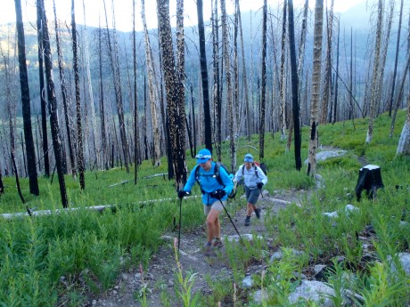
Holly and Kathy, starting up Doubletop Mountain Trail, through a recently-burned forest.

After Rainbow Lake, most of the work is done. It’s just a gradual mile and 400′ more feet of vertical gain before the trail levels out and dishes out the prize — an amazing panoramic view of the entire Wind River Range.
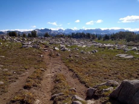
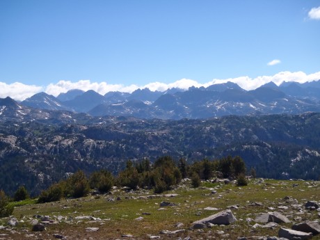
The trail to the epic view Doubletop Mountain provides.

We continued another half or three-quarters of a mile around the mountain, past a junction for the Bluff Creek Trail. Here, we stayed left and left the Doubletop Mountain trail briefly for a scramble to the mountain’s official summit, which stands 10,892′ tall. While Doubletop is not a tall mountain or a spectacular mountain in itself, it sure knows how to dish out a view.
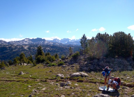
Holly, our spatial ecologist, checks the map with Kathy.

From Doubletop’s top, we could see Temple Peak some 45 miles to the south, Angle Peak, Fremont Peak, Gannett Peak, and many other impressive peaks.
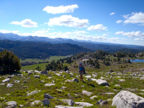
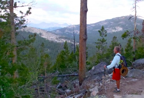
Ascending Doubletop Mountain.
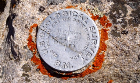
Officially at the top of Doubletop Mountain.
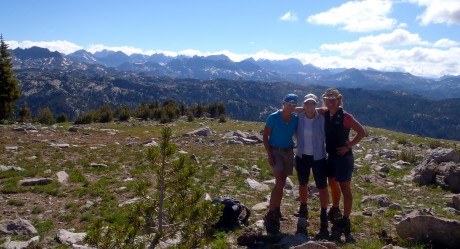
Kathy, Holly and I.
The view of the Wind River Range from Doubletop Mountain is among the best.

After experiencing the awesome views from Doubletop, we continued along the trail toward Palmer Lake. After hiking alongside Palmer Lake’s shores, and spying fish jumping in its waters, we headed for Palmer Canyon, which we would descend toward New Fork Park and New Fork Canyon.
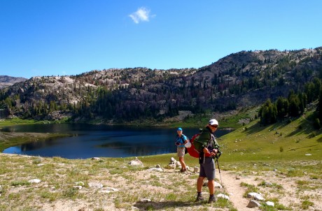
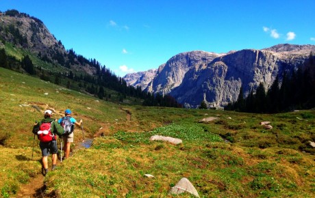
Kathy and Holly approach Palmer Lake.
Kathy and Holly.

Thanks to Tom Carter, I had also learned prior to our hike that New Fork Canyon is the deepest canyon in the Wind River Range. We were all excited to hike through it. But first we would experience Palmer Canyon.

Palmer Canyon was a pleasant surprise. We didn’t expect anything awesome of this “connecting” trail that would help us link Doubletop Mountain and New Fork Canyon into one hike, but the walls of Palmer are tall and impressive. The descent to New Fork Canyon Trail is pretty dramatic.
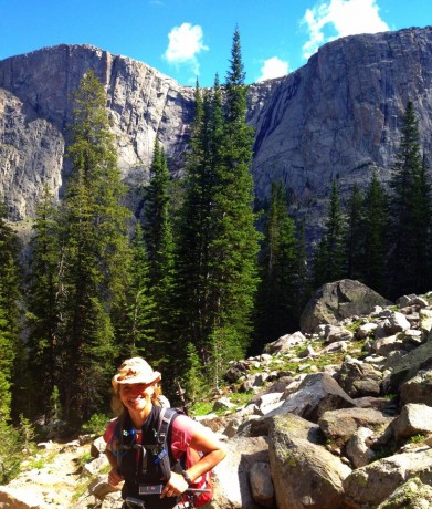
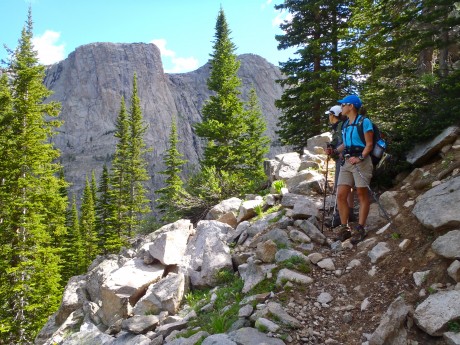
During the descent of Palmer Canyon.
The big walls reminded us of Yosemite.

We really enjoyed the changing terrain and remarked that the massive granite walls we could see through the forest caused us to feel a little as if we were hiking in Yosemite. (By the way, our map indicates there are lakes — Hidden Lakes and Thompson Lakes — on top of Palmer. Holly, Kathy and I remarked that seeing those lakes might make a cool hike in the future.)

Once in New Fork Canyon, we were in a completely different landscape. Instead of burned forest or mountain top hiking, we were in the depths of a very green and lush park. Our trail meandered near the New Fork River, and with tall walls of the New Fork Canyon looming overhead.
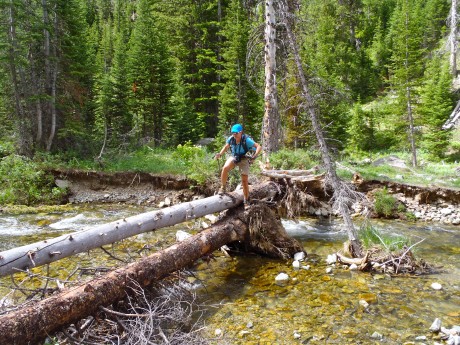
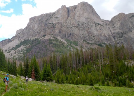
Kathy, during one of several creek and river crossings.
Holly and Kathy, with Palmer behind 'em.

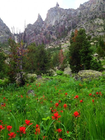
The wildflowers were the most spectacular I’ve ever seen on an epic Wind River hike. Bright red Indian paintbrush and bluebells were everywhere and as tall as our knees. We also saw fireweed, columbine, Queen Ann’s lace and several other varieties.

With about six miles left, we crossed the New Fork River, which was not running very high or swift given last winter’s low snowfall and the current drought conditions. About a half mile farther down, we crossed the river again.
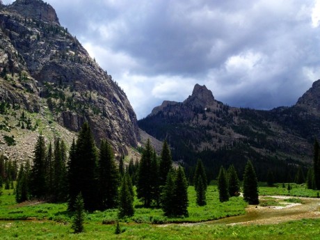
Holly, hiking in New Fork Canyon.

New Fork Canyon.
Indian paintbrush and big granite walls.

With about 3.5 miles to go, we could spy New Fork Lakes as we descended New Fork Canyon.

With just a half mile remaining, the big storm clouds that had been building up for a couple of hours gave way to rain — and even hail! We were thankful we had arrived to the final, “horses to the barn” stage of the adventure when that happened.

It was a fantastic day: Hiking with two of my closest friends, exploring new country, seeing the expanse of my beloved Wind River Range, hiking through canyons and their massive, sheer walls, and knee-deep in wildflowers.

By the way, when I’m not hiking — and sometimes when I am — I am a life and leadership coach and consultant. Check out EPIC LIFE, my coaching business. Epic Life provides coaching, with an option for a guided epic adventure. I also have a blog there.
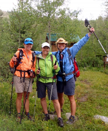
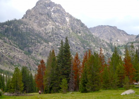
Yeehaw! We made it!

Filed Under: Fitness, Frontier Life, Life and Leadership Tagged With: doubletop, hiking, new fork, wind river range

Wind River Peak in a Day

July 5, 2012 by Shelli

Greetings. We were already 7 miles in when the sun rose.

NOTE: I know this is a long post. It was a long hike. 🙂 If you’re interested in hiking and climbing Wind River Peak, you’ll find key information in this blog. If you’re not interested in details, etc., I hope you’ll at least enjoy the photos and video at bottom. Or, here’s a 7-minute video blog of the adventure.

As a gift for my 44th birthday, my husband, Jerry, agreed to join me in hiking in and climbing Wind River Peak in a day. We had climbed it before — back in 1998 — during an extended backcountry trip we made with rented llamas, who carried our loads. Wind River was our first Wind River mountain to climb, a good one at that. Wind River Peak stands 13,192 feet tall, and is the tallest mountain in the southern Wind River Range of Wyoming.

The mountain is a massive and beautiful mountain, one that stands out from the southern half of the range. We can see the snowy, rounded peak from many of our favorite “back yard” locations.

Wind River Peak. (Photographed from Frye Lake on a different outing)

The last time Jerry and I climbed it, we ascended Wind River Peak’s south slopes, via Tayo and upper Tayo lakes. On this adventure, we would ascend its northeast ridge, above the Deep Creek and Ice Creek lakes region.

Our alarm went off at 2 a. m., which even for us early birds, was dizzying. It was more like the middle of the night than the early morning. But our insanity when we had set the alarm was rationalized by our desire to allow ourselves the biggest window of opportunity to accomplish the objective. We were going to be on a tight timeline because we wanted to make it back to Lander in time for our 10-year-old son’s last baseball game, which also happened to be a championship game, scheduled for 7:15 p.m.

We headed to Worthen Reservoir to find the trailhead, a 40-minute drive from Lander. With headlamps on and under a starry sky, we started hiking at around 3:45 a. m. I don’t mind hiking in the dark, but I prefer doing it pre-sunrise, rather than post-sunset. I like being far into the wilderness when the day is greeted by the first light of the sun.

We hiked three miles to Sheep Bridge, basically from 8,500′ to 9,000′ and back down to about 8,500′ again. As we made our way through the dark and quiet forest, the cool air was full and thick of the smell of a campfire. A fire (known as the Fontenelle Fire) was, and is burning, in southwest Wyoming, just over the range from us. The evening prior, Lander was in the thick of its smoke. We had been concerned that our hike might be smoky and that the peak may be a No Go today as a result of thick smoke. Fortunately the smell was from the smoke that had settled in the forest during the night and, by all indications, a stellar, bluebird day was ahead.

After arriving at Sheep Bridge, we joined the Middle Fork Trail and hiked up, and alongside the Middle Fork of the Popo Agie River for about three miles before approaching Three Forks Park. Here, we stayed right and started up the Pinto Park Trail, which eventually leads to Pinto Park and the North Fork of the Popo Agie.

On this day, the sun began lighting up the wilderness — at least enough for us to turn off our headlamps — at around 5 am. Soon after, at exactly 5:03 a.m., something curious happened. Right at that very moment, we heard birds chirping and singing. Until that moment, except for our huffing and puffing, it had been totally quiet. Then, we watched a small herd of elk emerge about 100 feet in front of us, to our right. Like I said, the day was going to be a good one. 🙂

We reached, and took a left, on the Deep Creek Lakes Cutoff Trail. Per our GPS, we had hiked 10 miles. After starting up the Cutoff Trail we hiked near Lake 10,054′, where we paused to watch several fish jumping and cutting through the otherwise smooth-as-glass water. We hiked for 2.3 miles before reaching the first Deep Creek lake, situated at 10,500′ elevation. Our GPS indicated we had traveled about 12.5 miles, and it was only 7:40 a.m. So far so good.

Steve Bechtel, my friend, and author of Cirque of the Towers & Deep Lake. A Select Guide to the Wind Rivers’ Best Rock Climbing, had provided information for us the day before about following “The Ramp” up Wind River Peak. We hiked another half mile or so beyond the first Deep Creek Lake before spying a trail to our right. Unfortunately I suggested we ignore that trail and keep hiking, thinking we weren’t to the ramp’s base yet. Oops. As we hiked toward Ice Creek lakes, it became obvious we (I) had made the wrong decision. So we backtracked a half-mile and picked up the trail and headed (seemingly straight) up. Nothing like making an epic day hike even longer, right?

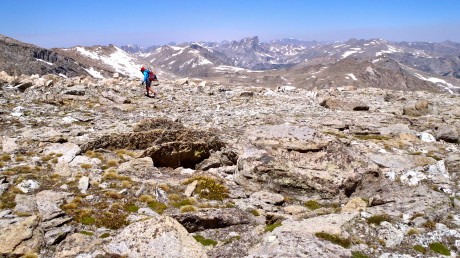
After crossing over a little snow and a boulder field, we found ourselves on the broad ridge that separates Ice Creek and Deep Creek lakes that provides a half-mile-wide “ramp.” Once at the bottom of the ramp, we set our sights on a clump of rocks to the right of Chimney Rock and started up. Wildflowers were everywhere, growing up out of the alpine tundra and gravelly terrain. At times we hiked on tundra, others over rocks and boulders and at others, through snow.

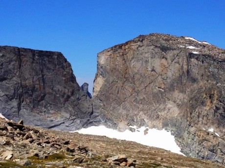
The highlight of this route to Wind River’s summit is the almost-constant view you’re afforded of Little El Capitan, which, as its name suggests, features a massive and sheer wall, along with a notch known as “Surveyor’s Notch.” Little El Capitan is the fourth-tallest mountain in the southern Wind River Range. The sight of this wall is so astounding that we stood and looked at it, our jaws dropping, for quite some time.

At this point, midway up Wind River Peak, we were sucking air. We have climbed peaks before, this one included, so we were not strangers to thinner air. But doggone it anyway. On the upside, although there was a bit of a haze below us, in the direction we had come, we still had clear and bright blue sky around us on Wind River. The views that unfolded below us and around us were nothing short of spectacular.

Soon we reached the first of several snow fields. The snow was only knee-deep in most places and melting fast. Still, we were lucky enough that for most of the snow travel during our ascent we could walk on top of the snow.

Reaching summits takes a while. Especially Wind River Peak’s. The approach is a long haul to get to the base of the mountain, and then it’s a 3.5-mile hike to its top. I think as we were finally approaching the top of Wind River, my husband was wishing I had asked for expensive jewelry for my birthday instead of this epic hike.

Finally, when our GPS indicated we had only 92 vertical feet left to go, we got a surge of energy and soon reached the rock field that is the top of Wind River Peak. We made our way across it and climbed onto the pile of rocks marking the high point.

The views were as we remembered — epic.

We enjoyed a quick lunch break and I captured some photos and video before our time at the summit was up. We remembered that the summit is only the halfway point and we had a long way to go to make it home in time for our son’s baseball game.

Due to our missing the trail up we had logged an extra mile or so. Our GPS indicated we had hiked 17 miles once we reached the summit. And, at least in this case, downhill doesn’t mean easy. Going down is not easier than going up. It’s just that it’s different; it’s more about caution than effort, and our legs were tired.

We started down. Suddenly, Jerry, with much exuberance, exclaimed: “There’s a person!” I looked and spied a person not very far from us, ascending the peak. And then, Jerry yelled “There’s a whole bunch of ’em!” Turns out a NOLS course was summiting. These were the only hikers we’d see the entire day. Even though Jerry and I both love solitude, it was nice to see other human beings. 🙂 After a short visit with one of the instructors and some of the students, we continued.

When we hit the first snow field, our legs sank all the way down to our thighs. The snow was melting fast and it would be a little treacherous descending a couple of the snow fields. But on the final one, the most vertical of the snow fields, we enjoyed a long glissade. Standing on the summit with my better half was my favorite part of the day, but the glissade was a high second. It was a blast!

We got down Wind River much quicker than we got up it and before we knew it we were back on the trail. We still had 13-plus miles to go and not very many hours until game-time.

Finally, at Sheep Bridge, and only after enduring the 600-foot uphill slog it is known for, it was like horses to the barn. We made it back to Lander and to Hayden’s game right at the start of the game. As we arrived to the baseball diamond, we looked up and saw my parents, the boys’ babysitter, and our other two sons in the bleachers. At the top of the bleachers. I considered if I had another 8 steps in me. 🙂 And of course, I did.

What a hike and what a day! Once again it has been confirmed that anything’s possible if you’re willing to get up early in the morning, and, oh how I love my back yard.

By the way, when I’m not hiking — and sometimes when I am — I am a life and leadership coach and consultant. Check out EPIC LIFE, my coaching business. Epic Life provides coaching, with an option for a guided epic adventure. I also have a blog there.
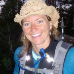
Thanks to our wonderful friend, Korinne Thoren, for watching the boys so we could tackle this hike!

Jerry, catching his breath during the elevation gain on the Pinto Park Trail portion of the hike.
The first Deep Creek lake. Reached at 12.5 miles.
Jerry, in search of the start of The Ramp.
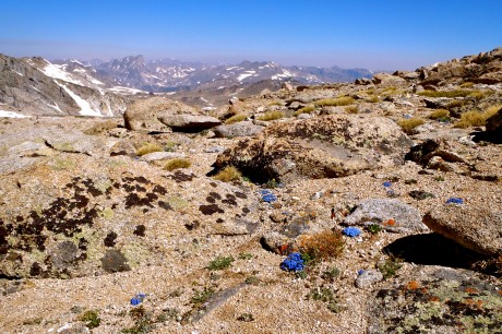
Wildflowers and lichen-covered rocks were in abundance during our ascent of Wind River Peak.
My best half, starting up The Ramp, with Deep Creek lakes in the background.
First glimpse of Little El Capitan.
Little El Capitan, and Surveyor's Notch.
Me, doing a little way-finding. That's Lizard Head Peak in back center.
Alpine tundra. Notice the little blue flowers. They are forget-me-nots, my favorite.
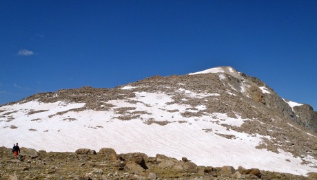
The target: Wind River's summit.
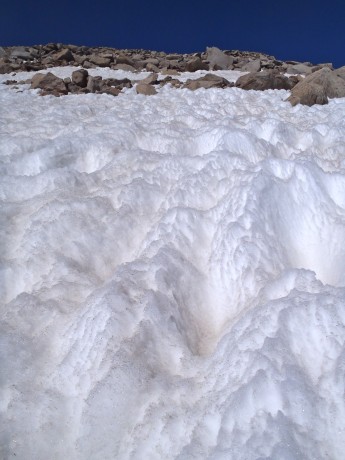
The snowmelt pattern reminded me of ocean water.
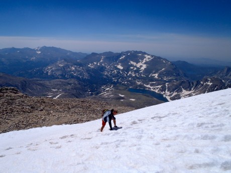
Jerry, hiking up one of the snow fields on Wind River Peak's northeast ridge.
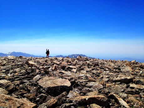
Jerry, at the beginning of Wind River Peak's summit, en route to the pile marking the peak's high point.
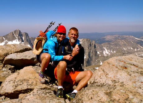
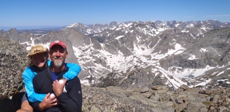
My epic husband and I at the summit.
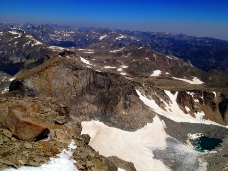
One of many summit views. The big wall is Little El Capitan.
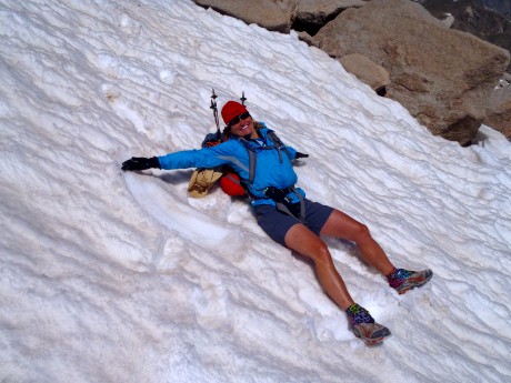
Doing an (awkward backpack-bearing) snow angel on our way down.

A 7-MINUTE VIDEO BLOG OF THE ADVENTURE:

Filed Under: Fitness, Frontier Life, Life and Leadership, Travel & Tourism Tagged With: adventure, epic, epic hikes, hiking, wind river peak, wind river range

Climbing Finis Mitchell’s Mountain

June 26, 2012 by Shelli

Howdy.

Last Thursday, my husband, Jerry, and I left Lander at (gasp) 3:45 am. It was a two-hour drive to the Big Sandy Opening trailhead, and our plans for the day were ambitious: to climb Mitchell Peak and get back to Lander in time for our middle son’s 5:30 pm baseball game.

We made the drive under a star-filled sky, which meant we had picked a stellar day. As we entered the Big Sandy Opening area we noticed our “outside temperature” gauge reporting 21 degrees. OMG. We didn’t plan for below-freezing temperatures. It would be a frigid start. Even with all of our layers on and walking at a brisk pace, we were shivering for the first five miles before the trail left the forest and we could finally feel the warmth of the sun.

We had hiked the route many times before, at least once a year for several years. On this day, we would hike from Big Sandy Opening to Big Sandy Lake, up over the first part of Jackass Pass, to North Lake, where we’d take a hard right and head up Mitchell Peak’s southern slopes before gaining its northwest “walk up” ridge.

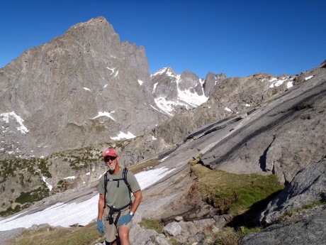
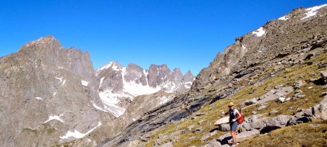
Mitchell Peak is part of the famous Cirque of the Towers, one of the most spectacular sights you will ever see. The sight of the Cirque takes my breath away every time I see it. This is partially due to the effort it takes to get there, but mostly due to its sheer and unspeakable beauty. The sight of the Cirque can move you to tears, and it inspires you for days, weeks and months after.

You can access the Cirque via Big Sandy Opening and Jackass Pass (which straddles the Continental Divide and gets its name because it’s so rugged a donkey can’t pass over it — and a stupid person can – LOL) or via Dickinson Park and the North Fork Trail. The former is a harder hike, but shorter in distance — about 15 miles roundtrip. It is truly an epic hike given the jaw-dropping scenery and the rugged terrain. The latter is easier — with only 900′ of gain over the course of about 15 miles (30 roundtrip), but with 5 river crossings.

My husband, Jerry, at Big Sandy Lake, about six miles into our hike.

Jerry and I have wanted to climb Mitchell Peak since at least 1997, the year we first camped near the Cirque of the Towers. (Prior to Thursday, we had climbed Lizard Head, Wind River Peak and other peaks in the southern Wind River Range.)

Mitchell Peak is named for the late Finis Mitchell, who remains a hero to our family. During The Depression, Mitchell, and his wife, stocked 2.5 million trout in many of the high country lakes in the Wind River Range by carrying the fish in milk jugs on their horses. A true mountaineer, Mitchell knew the Winds like the back of his hand. He climbed all but 20 of the 300 peaks in the range. Mitchell remained an advocate of the Wind River Range until his death in 1995.

We named our youngest son, Finis, after Finis Mitchell. (By the way, many are unaware of this, but Finis’s name was pronounced in a way that rhymes with “highness.”) Anyhow, Finis Mitchell is pretty special to us, and this was another reason we wanted to stand on top of Mitchell Peak.

The hike from the trailhead to Big Sandy Lake is a walk in the park. It’s a pretty flat 6 miles, mostly through forest and sometimes running parallel to Big Sandy River. Big Sandy Lake is beautiful, surrounded by Big Sandy Mountain, Haystack Mountain, East Temple and Mt. Scheistler. In our experience, sunlight is almost always dancing on the lake’s surface. The lake looks like it has “dancing diamonds” on top of it.

Walk past the lake and you’ll see a sign directing you up toward Jackass Pass. Think of this next section as a lung-buster — or as I like to say, an opportunity to snack on a little humble pie. excuse my language, but we often call Jackass Pass “kick your ass pass.” It’s that good. 🙂

We hiked uphill for a bit. The views, looking back, are impressive. We could see Schiestler Peak, East Temple and Temple peaks behind us. To our left was Warbonnet. Up ahead we were getting teased by Pingora, and the Cirque of the Towers, which were starting to jut out of the pass ahead of us. Also about this time, we were able to get a glimpse of Mitchell Peak.

Mitchell Peak, along with Dogtooth Mountain and Big Sandy Mountain, form a high northwest-southeast ridge on the Continental Divide.

I get excited when I am hiking along the Continental Divide. This means that precipitation that falls on the Big Sandy side eventually makes its way to the Gulf of California and the Pacific Ocean, by way of the Big Sandy, Green and Colorado rivers. Precipitation that falls to the other side eventually flows 4,000 miles to the Gulf of Mexico, by way of the Popo Agie, Bighorn, Yellowstone, Missouri and Mississippi rivers. It’s pretty cool to be walking along the backbone that splits these two realities.

North Lake.

We would descend to North Lake and then take a hard right and start our scramble up the mountain’s southern slopes. In reading about Mitchell Peak, we came across a report where Finis had indicated “even a 10-year-old could walk up.” It sounded like the route for us. (Disclaimer, a very fit 10-year-old could definitely summit Mitchell Peak, but would probably be best advised to do it during an extended camping trip in the area, rather than as a day hike from Big Sandy Opening.)

Pointing to our destination: Mitchell Peak's summit.

Beautiful flowers and Mitchell Peak in the same frame.

At just under seven miles, we reached the end of North Lake and left the trail for Mitchell. My GPS indicated we were at 10,500′, so we had about 2,000′ of vertical to go to claim Mitchell’s summit. Alrighty then. (Access to information is not always a good thing, right?) We paused and considered which route we would take. We could go to the left and follow a spring up. It looked most direct, but more treacherous than our option to the right. The route at right appeared to be more gentle so we headed that way.

This shows the terrain of our ascent.

It wasn’t long and we got past the big rocky outcrop and could start heading more directly toward Mitchell’s top. I didn’t need to check my GPS to learn we had arrived at 11,500′. I knew from past experience that, at least for me, once above 11,000,’ it’s like breathing with only part of a lung, or like someone knocked the wind out of me. So our going got slower but we could taste the summit. I mean, it was right there.

The scenery behind us and before us, was astounding. Silver granite towers jutted out of seemingly fragile alpine tundra, which was littered with boulders and delicate wildflowers.

Jerry, catching his breath.
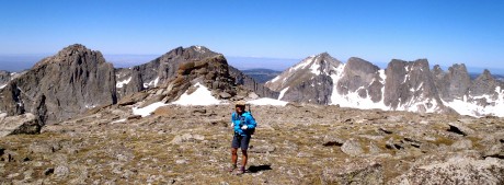
Resting midway up Mitchell. That's the Cirque of the Towers in the background.

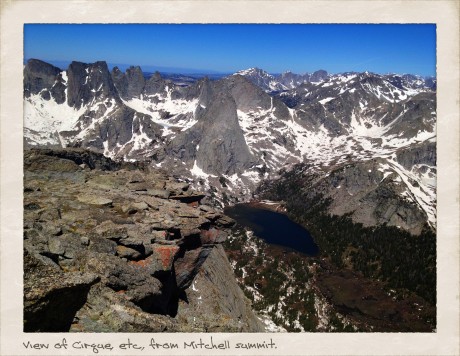
Finally we made it to the top. The views were even grander than we expected. We looked down upon the Cirque of the Towers, and because we were above the towers, we could see the depth of the Cirque. In all directions we had views of granite mountains, rivers and lakes tucked under cirques, some still with “blue ice” on them. Except for the summit’s high point, Mitchell’s top is pretty flat and broad. I was especially awe-struck after we ventured over to take in the views from directly above Mitchell’s 1,000-foot-tall and sheer north face. Wow.

Finis Mitchell, in his Wind River Trails book, said: “…Seldom does man ponder his own insignificance. He thinks he is master of all things. He thinks the world is his without bonds. Nothing could be farther from the truth. Only when he tramps the mountains alone, communing with nature, observing other insignificant creatures about him, to come and go as he will, does he awaken to his own short-lived presence on Earth.”

Indeed. As I sat on Mitchell’s summit taking in views of my beloved Wind River mountains, which are composed mostly of granite rock formed deep under the surface of the Earth over 1 billion years ago, I was humbled, and grateful.

By the way, when I’m not hiking — and sometimes when I am — I am a life and leadership coach and consultant. Check out EPIC LIFE, my coaching business. Epic Life provides coaching, with an option for a guided epic adventure. I also have a blog there.
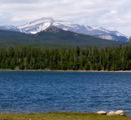
Here are some photos, as well as a video blog of the day (compressed to 7 minutes).

Top of Mitchell, not quite to the high point.

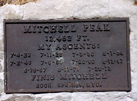
Evidence that we were there.
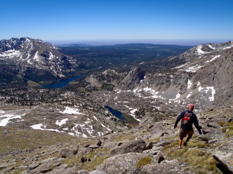
This is what I call a peak experience.

As the saying goes: the summit is only the half-way point. To finish our epic hike, we had to turn around and return to our start. Here, Jerry starts down.
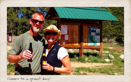
Cheers to an epic hike.

VIDEO BLOG OF THE HIKE:

Filed Under: Family, Fitness, Frontier Life, Life and Leadership Tagged With: cirque of the towers, finis mitchell, hiking, mitchell peak, wind river range, wyoming

Muir Beach Bliss

May 10, 2012 by Shelli

I was in the San Francisco area all last week for meetings and a presentation. It was a treat to return to the Marin Headlands, and area I fell in love with during my frequent trips to the area in the past for mycoaching courses.

Last week I was headed to the hotel gym when I remembered where I was. Why would I spend time on an elliptical trainer when Muir Beach is 20 minutes away? Duh.
I enjoyed a 6-mile trail run to start the day. I love being in the presence of the ocean.

Here’s a short clip:

Filed Under: Fitness, Life and Leadership, National Parks, Travel & Tourism Tagged With: adventure, Fitness, hiking, marin headlands, muir beach, san francisco

My Brooks Range People Made Me Better

September 14, 2011 by Shelli

In the Brooks Range, on our last night.

This is Post 2 in a series about my recent Alaska Brooks Range backpacking course.

It was Aug. 6, the afternoon before the start of my NOLS Brooks Range Hiking course. I was in Alaska, enjoying the comforts of the Ah, Rose Marie Bed & Breakfast, in Fairbanks, while waiting for others enrolled in the course to arrive.

As I waited to meet my course-mates, I wondered: What kind of person signs up for a Brooks Range NOLS course?

I generally love people. I get energy from people, and am inspired by people. Still, I get a little nervous before meeting new people.

We would be dropped off by the side of the road, north of the Arctic Circle, a region where evacuation is nearly impossible. We would be off the grid, and we would not be “picked up” for 12 days.

We would be “stuck,” together.

Strangers, dropped off on side of road in the Far North.

After being dropped off, and watching the van drive off, I recalled a quote by John Kauffmann in John McPhee’s Coming Into the Country: “You come to this place on its terms. You assume the risk.”

For me, part of the risk (read: scary part) of the NOLS course was setting off into The Far North with people I didn’t know.

I did not enroll in a NOLS course for the people I would meet. I enrolled in the NOLS Brooks Range Hiking course because I wanted to experience an epic place that is wild and vast and home to very few people, and to learn leadership and outdoor skills from the world’s premier teacher.

The NOLS course is not a guided tour or a vacation. It’s a lot of work. In fact, it is mostly work. The easiest part of the Brooks Range Hiking course was the hiking. When we weren’t hiking, we were setting up camp, cooking or baking, cleaning up, only to wake up again the next morning to break it all down and pack it all up and start all over again.

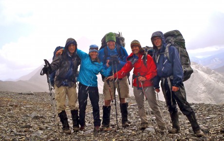
My hiking team on top of a snowy pass.

At times there was torrential rain, cold, and even snow, and steep slopes and loose rock, and sinking, squishy tundra over which to hike, or tussocks, which felt like hands coming out of the tundra and pulling/tugging your ankles down as you tried to take a hiking step, and there were deep rivers to cross.

We had to work together, which at times meant working out differences and supporting each other in a wide range of circumstances. We had to pull together in times of hardship to move the group forward. It meant being selfless.

Each of us was vulnerable during the course, and often, which meant we really got to know each other.

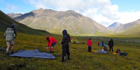
Working together to set up camp.

Perhaps course-mate Jon (Rosenfield) said it best, in his informal video interview, which I captured near the course’s end, when he said the Brooks Range experience meant “coming back in contact with myself, because there’s no hiding from all parts of yourself out here.”

Indeed. Each of us revealed ourselves in The Far North.

Hiking up a hill toward a mountain pass.

Through thick and thin, I came to love these people who were on my course.

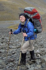
The hardest part of the course for me was being away from, (and out of contact with) my three young sons and husband. My Brooks Range comrades – Antonia, Chris, Jon, JJ, Marc, Pat, Cutter, Lauren and Amy – were a wonderful surrogate family for me. They are not merely friends; they’ve made it all the way into my inner circle, which is saying something because before the course, I already had plenty of wonderful people in my life.

By the end of the trip, I felt right at home. Marc, Chris and Jon, who were part of my cook group, were rolling their eyes at me -- much like my boys do to me at home. 🙂

A couple of weeks before I departed Wyoming for Alaska, I went to coffee with a friend who is a former NOLS instructor and who has spent time in Alaska’s Brooks Range. She shared her photos and further whetted my appetite for the upcoming adventure. One of the things she told me, that struck me, was that the experience would change me, and that one thing I may notice upon my return will be I will have changed, but the world and people around me won’t have changed.

Sure, I changed as a result of experiencing, so intimately, Alaska’s stunning Arctic National Wildlife Refuge and Brooks Range.

But the biggest change in me was brought about by my course-mates. Because they were/are so different from me, I learned much from them, while discovering new things about myself. And in the process, we shared what was for me an unforgettable, experience of a lifetime.

The best way I can describe the way these special people changed me is to say I am better because of them.

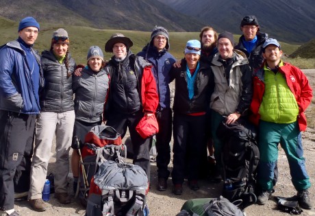
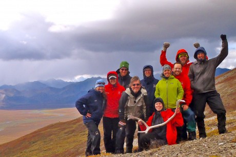
My Brooks Range people, on top of our last pass, toward the end of our course.

Antonia, Chris, Jon, “JJ”, Marc, Pat, Cutter, Lauren and Amy: Thank you from the bottom of my heart!

I would love to introduce you to them here:

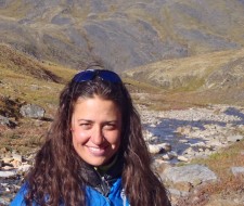
Antonia Ruppel (or “Toni”), 32, is a native German, with a B.A., Masters and Ph.D. from Cambridge University, is a Senior Lecturer in Classics, teaching Greek, Latin and Sanskrit at Cornell University. Antonia speaks beautiful, “proper” English. I could listen to her for hours if afforded the privilege.

Antonia Ruppel.

I loved having her as a tent-mate. She is the wittiest person I have ever met, and is fascinating to converse with, what with her wealth of knowledge and what is a wide range of interests. Except for our two female instructors, Antonia and I were the only women on the course. As hopefully women readers will appreciate, we girls like our girlfriends for particular types of conversations. It was a treat to retreat to the tent each night and have important – and rich – conversations with Antonia. I would share some of them but then I’d have to kill you. Yes, the conversations were that great. I have never met anyone like Antonia. She is that much of a treat. She is brilliant, charming, and I have to say it again, fantastically funny. I also loved her enthusiasm for hunting down wild blueberries, and her skills at finding (usually several) antlers on every single hike. We will remain friends forever, and I consider myself lucky as a result. 🙂

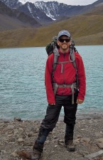
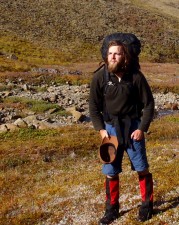
Chris Scovil, 28, is a Tax Manager at Deloitte Tax LLP, in Chicago, IL. At 6’9”, Chris was “the tall man” on the course. He is a triathlete, has an appreciation for fine food, and his passions include international relations, cooking, thoughtful conversation and the outdoors.

Chris Scovil.

Chris’s courage on loose, exposed terrain, despite his discomfort, was an inspiration to me during the course. I was fortunate to be in Chris’ cook group, and on many days, in his hiking group, and can fondly recall many meaningful conversations we shared. Chris was often the first to start doing the “common work” that had to be done every morning and evening, even as all of us were getting soaked in a downpour. He placed a great deal of respect on goals and schedules, which I really appreciated during our course, and in my life, in general. One other thing about Chris is that he has a big vocabulary. Prior to this course I was proud of the extent of my vocabulary, but on a few occasions Chris used words I didn’t know the meaning for. A word lover, I found these instances exciting. 🙂 I would be on Chris’s team any day. He is not only really smart and driven, but also courageous, loyal and generous.

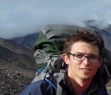
Jon Rosenfield, 42, is a Ph.D. conservation biologist for the Bay Institute in the San Francisco area. This was his fifth NOLS adventure, which to me, meant he is an expert at all things NOLS. He took me under his wing and taught me how to master the camp stove and the spice kit.

Jon Rosenfield.

He helped me turn unspectacular entrĂ©es into spectacular entrĂ©es, such as the apricot, cashew and sunflower nut quinoa meal I made for our cook group the night before an arduous hike over a big mountain pass. Jon is engaging and smart and funny. He had many of us in stitches for long periods of time. We had many great conversations “in the kitchen” and while sharing caffeinated mud from his coffee press. Due to his many NOLS experiences and his unending good nature, it really was a gift to be on the course with him. By the end of our trip I felt like I had known Jon for most of my life. He was probably the first of my course-mates to make it into my inner circle. Which is really saying something. 🙂

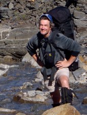
Marc Morisset, 31, was born in Belgium, Brussels, but now lives in Paris, France, where he is an international sales manager. Marc is well-traveled (he has traveled to 50 countries), and after our initial conversation, I sensed he was hungry for an outdoor experience and a physical challenge.

Marc Morisset.

Throughout the course, I admired Marc’s quiet leadership, especially the way he would step up and lead, with conviction, when he was asked to be “on point.” I remember the day our group was crossing the Continental Divide, and Marc was asked to take point on what was a very steep, loose slope of rock sliding on top of more sliding rock. He rose to the occasion and did a phenomenal job of route finding. As someone who asks a lot of questions, I appreciated Marc’s own questions of others in his desire to learn. He was there to be challenged, and to learn, and he applied himself to the course, and to our mission, to the full extent. When I first met him my impression was that he was a very serious man, which certainly I think he is, but I also got to see a very fun, and funny side of him when we taught him how to play gin rummy, and during his telling a story about his role in playing high stakes poker. I am glad that I met Marc, and that he is among my friends.

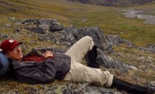
Cutter Williams turned 27 during our course, and is from Portland, OR. He is a writer, who works as a barista at a popular coffee house. When he’s not a barista, he is working toward publishing a magazine called Cavalcade Literary Magazine. I found Cutter and I to be kindred spirits in that we both would like to, well, just walk, preferably forever, even it’s all uphill.

Cutter Williams.

Introspective, Cutter was often laying in the tundra reading a novel or writing in his journal along a babbling brook. I envy Cutter’s ability to “chill.” I have three unforgettable memories that occurred on the course involving Cutter: an air ping pong game on his birthday that we played until we realized we didn’t have anyone willing to chase the ball for us, skipping rocks across the Chandalar River, and also his finishing my “Yeehaw” bear calls with his signature finish. Watch for his name in future literary works. I have a hunch that great literary things are in store for Cutter. I also hope to take him “walking” in my back yard, the Wind River Mountains, one day. I think he’d love ‘em.

Pat Kirby, 25, is an investigator for The Public Defender Service for the District of Columbia, in Washington, D. C. Two things I’m absolutely certain of after having spent time with Pat is that he is an extraordinary friend to his friends, and that his employer is lucky to have him on board. He very evidently cherishes his friends. This was obvious when he referred to them in conversation.

Pat Kirby.

It is obvious to all around Pat that he is a man of honor and integrity, which must serve him well in his work, which he loves, including the responsibility that comes with it. Pat is a natural team player. I witnessed him many times winning consensus while leading or being on point during a hike, or even during tasks at our camp. He is a good initiator, but is also an active follower. It is evident that in all areas of his life, he is a contributor. He is someone I’d want on my team, and I would be honored to be on his. He is sometimes quiet, and so it’s an exceptional treat when he finds something really funny because his laugh is quite boisterous, and when he gets going, it’s contagious. I imagine those closest to him get to hear that a lot, and I envy them for that. 🙂

John Jostrand, or “JJ,” is 57, and is a partner in an investment management and banking firm in Chicago, IL. John is married and has two grown sons. I connected with JJ for many reasons, but initially because we are both spouses and parents and had those things in common. He was also the oldest (yet as fit as a 25-year-old) on the course, so I, the second-to-oldest, looked to him for his wisdom on all kinds of fronts. JJ (very obviously) is an effective leader.

John (JJ) Jostrand.

He is enthusiastic, warm and engaging. His love for the outdoors and physical challenge was evident throughout our course. Others gravitate toward him. I was fortunate to be in JJ’s hiking group often, but a few of the experiences with JJ that I’ll never forget include the time we had a “Vista Data” break and he discovered a location at which an unfortunate dall sheep met its end. It was quite a find! JJ was also along when we “went swimming” in the Brooks Range, and again during our “rock sledding” adventure. JJ had many notable bear calls, but “Booyah!” was his signature call and I will think of him now whenever I hear that word. He also had a stash of Brazil nuts that he shared with me throughout the course. JJ is a kindred spirit. I admire him and am better for having met him.

(Instructor) Lauren Rocco, 25, is in her second year as a NOLS field instructor and recently relocated to Palmer, AK. She graduated from Dartmouth College in 2008 with a degree in Government and an interest in Computer Science. Upon graduating, she caught what she calls a “travel-exploratory bug,” and wanted to travel and learn more. In 2008-09 and 2009-10, she went to Antarctica to shovel snow and work in the carpentry shop.

Lauren Rocco.

Most recently she was a teacher at a charter school in Boston, MA. Lauren is currently enrolled in an EMT course and in addition to leading NOLS courses, she would like to volunteer for the local Search and Rescue. Lauren told me that she finds instructing for NOLS is meaningful, impactful, challenging, and “it obliges everyone involved to become better human beings.” When she’s not leading a NOLS course, she’s likely learning something, constructing something, reading, cooking, programming, or going for walks and exploring. I found Lauren to be a most effective leader, engaging and sensitive to both the environment and those around her. Her love of learning and her genuine interest in others was demonstrated throughout our course. She often read poetry to us during our evening meeting. In addition to being a great leader, Lauren is a lot of fun to be around. I went swimming, “rock sledding” and played “Ninja” in the Brooks Range – all of which happened when I was in the company of Lauren.

(Instructor) Amy Davidson, 36, is a NOLS field instructor and program supervisor. She graduated from the University of California at Berkeley with a major in Linguistics and a minor in Education. She took her NOLS Instructor course in May 1999 and worked her first course that summer. Subsequently she worked one summer course per year while working in San Francisco as a creative services consultant to the advertising industry.

Amy Davidson.

In the past two years, Amy has been a full-time NOLS employee, working in Alaska during the boreal Summer and in New Zealand during the balance of the year. Amy is smart and very funny. Her style is directive and yet engaging. As someone who wants to be a leader but can use more directive, I learned a lot on the course by watching Amy’s leadership style. She was well liked – loved – and yet has a knack for being directive and decisive. In being that way, Amy really enables her students to become more than what they otherwise would become as leaders in the outdoors. Amy is a high level leader who instills confidence in those she leads by challenging them to not be afraid to try, and even fail, and to embrace doing so in the pursuit of learning. I really enjoyed having Amy as one of our instructors and she is a great model for me.

Thanks for reading! Please check back soon for more blogging about my Brooks Range experience.

FOR MORE PHOTOS, AND VIDEOS:

Videos

Photos – part 1 of 2

Photos – part 2 of 2

————————————————————————————–

The National Outdoor Leadership School is the world’s premier teacher of outdoor skills and leadership. Consider enrolling in a NOLS course. There are many to choose from, throughout the world. Or, request a catalog that provides in-depth course information.

Filed Under: Family, Fitness, Frontier Life, Life and Leadership, National Parks, Travel & Tourism Tagged With: adventure, alaska, brooks range, camaraderie, NOLS

  • « Go to Previous Page
  • Page 1
  • Interim pages omitted …
  • Page 6
  • Page 7
  • Page 8
  • Page 9
  • Page 10
  • Interim pages omitted …
  • Page 24
  • Go to Next Page »

Primary Sidebar

About Shelli

Hi. My name is Shelli Johnson. I live on the frontier in Lander, Wyoming. I’m a wife, a mother, an entrepreneur, certified life/leadership coach, wellness coach, keynote presenter and inspired speaker, leadership development facilitator, personal development strategist, writer and adventure guide. This blog mostly includes stories about adventures and travel, but other passions are reading/books, technology, fitness, nutrition, and national parks, so you’ll find a wide range of articles here. I am founder of Yellowstone Journal and YellowstonePark.com, and NationalParkTrips.com, which was my first business. My current company, Epic Life Inc., is in its 7th year, and going gangbusters. If you’re interested in learning more about my current work, I hope you’ll jump over there and learn more about that. I have a more personal blog, more directly related to life and living and leadership, at YourEpicLife.com/blog. I’d love it if you’d also check out that collection of my writings. Thank you for stopping by! Finally, if you’d like to connect with me directly, please email me if you’d like to connect.
  • Facebook
  • Instagram
  • LinkedIn
  • Twitter

Subscribe For Email Updates

Check your inbox or spam folder to confirm your subscription.

Archives

Links

  • Your Epic Life
Copyright © 2025 · Have Media Will Travel