• Skip to primary navigation
  • Skip to main content
  • Skip to primary sidebar

Have Media Will Travel

A blog about outdoor adventure, family travel, national parks, media, technology, marketing, fitness and me.

  • Travel & Tourism
  • Family
  • Fitness
  • Frontier Life
  • National Parks
  • Life and Leadership
    • Life Coaching
    • Epic Adventure
    • Leadership
    • Keynote Presenting

Travel & Tourism

Another Best Wind River Hike, Ever…

September 22, 2010 by Shelli

Hi from the Wind Rivers.

I have had a great four months. My beloved Wind River Range has been good to me. I have been lucky enough to experience seven or eight long and stunning day hikes in my back yard plus a bunch of smaller hikes and outdoor adventures with my family.

Most recently, my husband, Jerry, and I hiked up (and down) and up to the end/top of Roaring Fork Mountain. The mountain itself it not that spectacular. Its high point is a little over 12,000′. But the mountain is broad, and as its name suggests, it forks into what are two pretty long mountains/ridges that are all part of The Roaring Fork. We are pretty sure the Roaring comes from the roaring nature of the wind, but we’re only guessing?
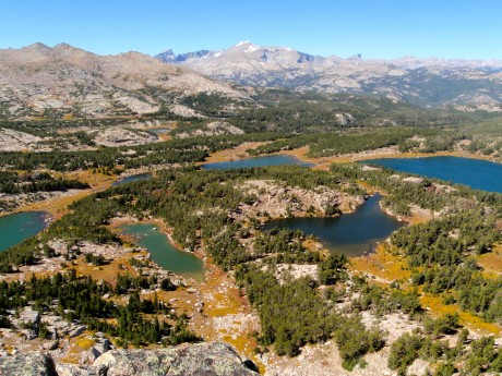
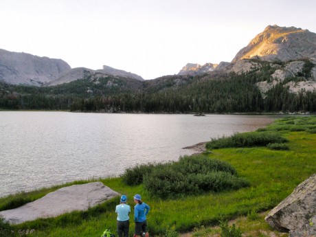
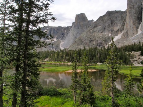
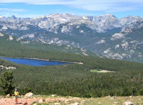
One of our many spectacular views. These are a handful of lakes in the Stough Creek Lakes Basin.

There are two reasons this hike was/is so special to Jerry and I. For one, we can see this mountain from most of the hikes we do in the southern Wind Rivers as well as from the deck of our mountain cabin. The Roaring Fork, complete with its notch (“bite”) in its summit ridge, are iconic if you live and play in the mountains above my town of Lander, WY.
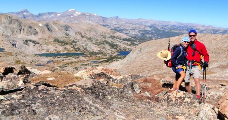
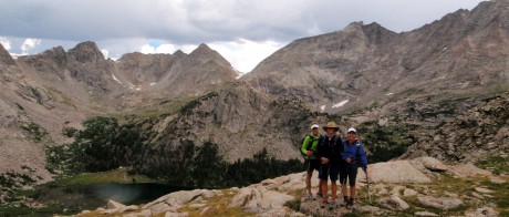
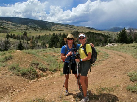
Jerry and I with some Stough Basin lakes and much of the southern Wind River Range as a backdrop.

The second reason is Roaring Fork Mountain juts out of a landscape composed of regions marked by spectacular canyons, cirques and lakes. We have hiked into, or taken llamas into, most of these awesome regions. Standing on the top of Roaring Fork and getting up-close and more intimate with it, was quite a meaningful experience for us.

I wish I could take credit for thinking up this hike, but I can’t. A friend, Jared Kail, has talked about wanting to do a version of it for some time. For his 40th birthday he was going to hike it and invited us along. Unfortunately, he came down with a cold the day before and had to forego it. But I owe Jared for thinking of the hike.

I have pretty much hiked and camped in and explored a good majority of the trails in the southern Wind River Range. And yet, somehow this one eluded me until last Sunday. And, turns out, it’s a major favorite. I cannot wait to return when I have more time to explore the mountain even further.
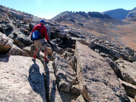
There is quite a bit of scrambling and boulder field hiking.

For the record, we did a long version. We did an out and back. We started at Worthen Reservoir and hiked the Stough Creek Lakes Trail for almost 4 miles to the Stough Saddle. This saddle is a favorite day hike that affords one of the best views of Wind River Peak, the tallest peak in the southern Winds, standing 13,192′ tall. (Jerry and I climbed it in 1997.)
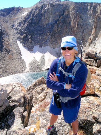
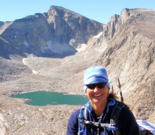
Standing in front of LF Lake, at far end/above Silas Canyon area lakes.

From there, we headed left, off-trail for approximately five miles of tundra, scree, boulder field hiking. It was quite windy in the Winds! The Winds, as well as the Roaring Fork lived up to their names on Sunday. But no complaints — we had a perfectly brilliant Autumn day for the adventure.
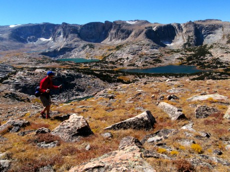
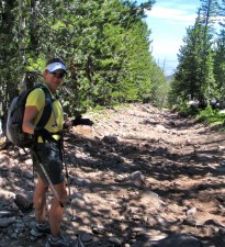
Jerry hiking over the tundra.

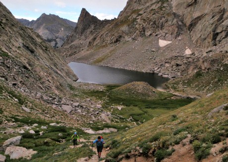
We had jaw-dropping, awe-inspiring scenery pretty much constantly, and in all directions. To our right, for the five miles we hiked toward the end/high point of Roaring Fork Mountain, numerous lakes and cirques unfolded to our right that make up the spectacular Stough Creek Lakes Basin region. At any single vantage, we could count six to seven lakes and cirques. This is how it was the whole way to our right.

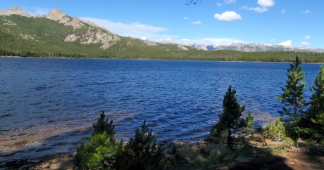
To our left, especially when we gained the high point of the ridge, we had similarly spectacular views, including the Roaring Fork Lake/Creek, Leg Lake, Silas Canyon and its lakes, Atlantic Canyon and its lakes, not to mention Fossil Hill, Frye Lake and Worthen Reservoir. And, let’s not forget the view that unfolded behind us, which was basically one containing most of the southern Wind River Range, complete with iconic Wind River Peak, Temple and East Temple Peaks and Lizard Head peak standing out. We could also see Shoshone Lake, the lake we hiked to the previous week.

Another friend of ours, Mike Lilygren, had hiked a different variation of the same hike a week prior and provided invaluable input to us the night before. Basically he instructed us to not head directly over the rocky mounds immediately to our left of the Stough saddle, but to instead keep them to our left. This was great advice.

Still this adventure found us ascending to 11,000, then descending 200′, then gaining 400′, then descending 200′ and so on. All told we hiked out about 9.3 miles and gained 6,600′ in elevation gain due to the aforementioned contour of the mountain (and due to our route-finding decisions).

By the time we were back at the car, our GPS indicated we had ascended 7,900′, despite the fact our high point was just about 12,000′ for the day, and hiked almost 19 miles. There are ways to make this hike a little shorter and probably have a little less elevation gain/loss, but that’s another conversation. And, um, we like ’em long. 🙂

VIDEO BLOG OF THE ROARING FORK HIKE:

LINKS TO MY OTHER HIKING ADVENTURE POSTS:
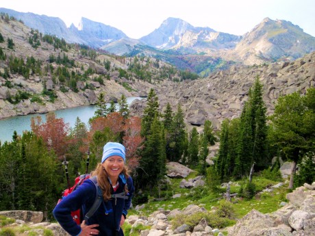
  • Big Sandy to Jackass Pass to Cirque of Tower, North Fork, Middle Fork
  • Shoshone Lake
  • The Bears Ears Trail
  • Historic Blue Ridge Lookout
  • Deep Creek and Ice Lakes
  • Jackass Pass to Cirque of Towers
  • Grand Teton Expedition (4 parts)
  • The Olympic Peninsula
  • Skate Skiing at Beaver Creek
  • Grand Canyon Rim-to-Rim-to-Rim
  • Filed Under: Family, Fitness, Frontier Life, Travel & Tourism Tagged With: adventure, hiking, wind river range

    I Ate A Grasshopper. On Purpose.

    September 14, 2010 by Shelli

    So, I’m trying for my own survival show. Friends have been pressuring me to eat an insect. They said it would help my chances if I had a video of me doing so. So, here it is. It was hard. (And by the way, if you know anyone at Discovery Channel, please share this with them. :>)

    Filed Under: Frontier Life, Media, Travel & Tourism Tagged With: eating a grasshopper, man vs. wild, reality show, survival

    Shelli and Friends Vs. Wild

    September 6, 2010 by Shelli

    I love survival reality shows like Man Vs. Wild and Dual Survival. They showcase great challenges, stunning scenery and “news you can use.” Who knows when I might need to know how to skin and cook a field mouse, or start a fire without matches.

    Here’s my first effort at my own such show. I hope you enjoy it. 🙂
    Part 1:

    Part 2:

    Part 3:

    Filed Under: Fitness, Frontier Life, Travel & Tourism Tagged With: challenge, Fitness, hardship, man vs. wild, survival

    My Most Epic Wind River Day Hike

    August 18, 2010 by Shelli

    Me, hiking Jackass Pass, above North Lake.

    I just completed a life list hike that’s in my back yard, Wyoming’s southern Wind River Range. As those of you who know me, or read this blog, know, I live for these “epic” hikes in the Wind River Range. This year I had a list of five major ones I wanted to do. Due to a late summer start (the result of local flooding and lots of snow accumulation in the high country), and more than the usual number of thunderstorms during the first half of August, I’ve been able to complete only two of the ones on the list.

    Thankfully, the most coveted one on this year’s list is the one this post is about, which means I completed it.

    On Monday, I hiked almost 32 miles in a day — from sunrise to sunset — from Big Sandy Opening, over Jackass Pass to the Cirque of the Towers, to Lizard Head Meadows, along the North Fork Trail to Pinto Park, to the Middle Fork of the Popo Agie, to Sheep Bridge and finally, to our destination, Bruce’s Bridge, just beyond Sinks Canyon State Park outside of my hometown of Lander, WY.

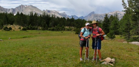
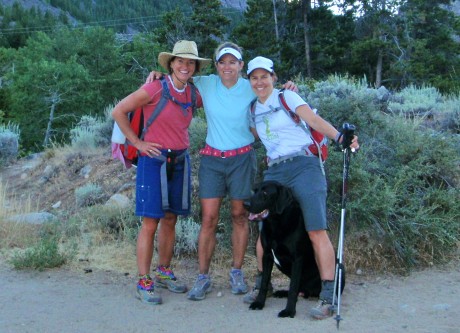
    Along for the hike were two of my good friends, Holly Copeland and Kathy Swanson.

    Although I had previously hiked all of the trails we would travel, except for a 3-mile stretch, I had never linked them all into one trip. In fact, unless you’re looking to challenge yourself, as we were, you could spend a week or two or three, easily, hiking and exploring the route we traveled and the sights we enjoyed. And of course, that is more reasonable. But I relish these endurance challenges that afford so many spectacular views in a single day, not to mention the great camaraderie and conversation that is shared along the way. And, the fact I’m only away from my husband and three young sons for one day, also makes these epic day hikes appealing to me.

    But okay, let’s talk about the hike…

    Kathy and Holly enjoy views of Big Sandy Lake right after sunrise.

    We departed Lander at 2:45 am and drove for 2 hours, 15 minutes to the Big Sandy Opening trailhead, accessed from Wyoming Highway 28/South Pass. With headlamps on, we started down the trail a little after 5 a.m. The first 5.5 miles is pretty flat and forested and parallels Big Sandy Creek for much of the way. This stretch was uneventful as the sun began to rise.

    The sun was up before we reached our first major milestone, Big Sandy Lake, a beautiful lake that is surrounded by Schiestler Peak, Temple Peak, East Temple Peak, Haystack Mountain and Big Sandy Mountain. The trail follows the northwest shore of the lake. I always like to stop at the big flat rock near the end of the lake just before we start ascending Jackass Pass. It’s a great spot to adjust clothing, snap some photos and snarf a quick snack…

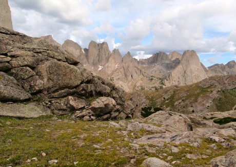
    The spectacular granite towers that form the world-famous Cirque of Towers reveal themselves while hiking across Jackass Pass.

    …And, get ready for the trail’s personality to change. Dramatically. From Big Sandy Lake, we hiked up over Jackass Pass, so named because a donkey cannot pass over it. It’s not only a significant uphill effort, it traverses a rocky side of North Lake and eventually leads hikers up, up and up some more.

    The views are breath-taking, literally and figuratively. We’re talking jaw-dropping scenes. As soon as you’re beyond North Lake, you get a glimpse of Pingora, peeking through from the still-distant Cirque of Towers. To your immediate left, though, and towering majestically, is Warbonnet Peak.

    We enjoyed views in all directions. Behind us was North Lake and the distinctive East Temple Peak and Temple Peak. And, unfolding in front of us were the towering granite walls and peaks that form the Cirque of the Towers. We were hiking in alpine tundra — a mess of vehicle- and small building-sized granite, a mess of rocks scattered throughout the alpine tundra, sprinkled with tiny wildflowers of all colors, and of course the aforementioned granite giants.

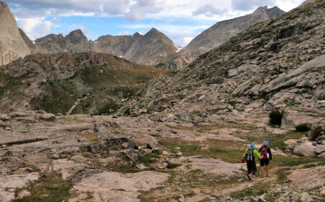
    Jackass Pass travels through a mess of granite and alpine tundra, complete with lichen-covered rocks and wildflowers of all colors.

    Before reaching the end of the pass, you descend a short but steep hill before ascending to 10,780 feet and the end of Jackass Pass. While making this last ascent, be sure to stop and take a look behind you at the aptly named Arrowhead Lake. This is one of my favorite views along Jackass Pass.

    Holly and Kathy ascending the last stretch to the end of Jackass Pass. That's Arrowhead Lake.

    At the end of Jackass Pass, we enjoyed our first actual break and sat down briefly to consume another snack and take in the views of Lonesome Lake and the Cirque of the Towers.

    Group timer photo at end of Jackass Pass, above Lonesome Lake and the Cirque of Towers.

    Next, we descended a small, steep hill and hiked around the south shore of Lonesome Lake.

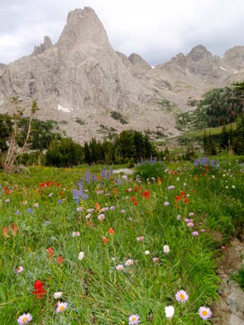
    Pingora, with wildflowers in the foreground.

    From there we picked up the North Fork trail, named for the North Fork of the Popo Agie River and hiked to Lizard Head Meadows.

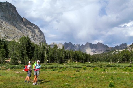
    Kathy and Holly pause briefly in Lizard Head Meadows.

    At Lizard Head Meadows, we stopped to watch a moose graze on the lush grasses and then continued on a trail that follows alongside the North Fork of the Popo Agie. This was an amazing stretch of trail: forested but with huge granite mountains to our right. It sort of made us feel as if we were hiking in Yosemite National Park, under and near the likes of El Capitan, but with one significant difference – our trail was lonely. It was almost as if we had it to ourselves. (We saw only approximately 10 other hikers, all backpackers, the entire 32 miles.)

    The Monolith, towering over a calm stretch of the North Fork of the Popo Agie.

    A great sight was the river, complete with fish jumping out of its calm waters, and a huge peak towering over it that is aptly named The Monolith.

    From here, the trail gets a little mean-spirited. It goes uphill. For a long time. Finally, we arrived at Pinto Park, a great expanse of lush grass, surrounded by forests and more granite peaks in the distance.

    Kathy and I in Pinto Park. The uniquely-shaped peak at right is Lizard Head Peak, which is part of the Cirque of Towers. (My husband and I climbed Lizard Head in 1998.)

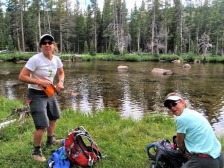
    After more hiking, we arrived at the Middle Fork trail, which parallels the Middle Fork of the Popo Agie River, the river that flows through my hometown of Lander, WY. There, we refilled our hydration packs with treated water and continued on.

    Holly and Kathy, refilling their hydration packs at the Middle Fork of the Popo Agie.

    Next was Sheep Bridge. And, as we were about four miles out from the trek’s end, my husband, Jerry, and Holly’s husband, Scott, and their dog, Milo, met us on the trail. Their presence provided a little surge of energy for us. (I’m guessing the cooler of ice-cold PBR they hauled in for us helped, too.) We finished the hike with a fair amount of daylight remaining.
    Yay! We did it! 31.9 miles and finished without injury and with daylight remaining.

    To be sure, completing this hike was a phenomenal personal achievement for me and my friends. But spectacular sights we saw and the great conversation we shared along the trail are what will remain with me for days and months to come.

    It was another memorable day in my back yard, and I will not forget it.

    Here’s a video of the various segments of our adventure patched together. Enjoy!

    Filed Under: Fitness, Frontier Life, Travel & Tourism Tagged With: adventure, cirque of towers, hike, jackass pass, wind river range, wyoming hiking

    Good Views Come to Those Who Hike Uphill

    August 9, 2010 by Shelli

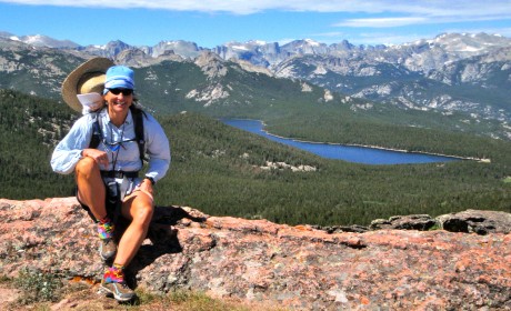
    Taking quick break at top of Cyclone Pass, overlooking Shoshone Lake and much of the southern Wind River Range.

    I just returned from my annual hike to Shoshone Lake above my town of Lander, WY. There’s no other way to describe this 22-mile hike. It’s a grunt.

    The trail is not necessarily spectacular, and in fact much of it follows a two-track and is a popular ATV trail. Solitude isn’t the reason you hike to Shoshone Lake. But I’m not complaining!

    As long as you’re willing to go uphill for a long time on a steep, rugged, loose and rocky trail, and then downhill for a long time on a steep, rugged, loose and rocky trail, then this hike is worth it. The rewards make it so.

    Reward number one: Shoshone Lake.

    A good friend, Kathy (Doyle) Swanson, of Casper, WY, joined me on the hike. We started beyond Sinks Canyon State Park, about eight miles southwest of my hometown of Lander, WY, at the base of Fairfield Hill.

    We started at 5 am, with headlamps on, with a 1,000-foot elevation gain over one mile. Along the way to Shoshone Lake, we hiked through McMahone Park, by Pete’s Lake, Twin Lakes, and through the vast and awesome Shoshone Basin.

    Shortly after hiking through Shoshone Basin and alongside a creek for a short bit, after about 11.5 miles of hiking, we arrived at our first reward: Shoshone Lake. The mountain lake is huge and scenic. For about a mile or so, we hiked along the lake’s shore.

    The second, and biggest reward, is what one sees from the top of Cyclone Pass. And the effort it takes to get to this point makes it even more grand. (I’ve done this hike every summer for the last five summers. Every time, regardless of my fitness level, Cyclone Pass is a lung-buster.)

    Kathy, hiking up Cyclone Pass. Here, she's almost to the top.

    Basically, at about mile 14 of this epic day hike, we faced a rocky incline that climbs close to 1,000 feet in a little over a half of a mile. It’s a combination of where in the hike this uphill grunt presents itself, and its steep nature that makes it grueling. Every time.

    No matter that this was my fifth time to see the view from Cyclone Pass. Every time I see it, I am overcome with emotion — i.e. goosebumps and happy tears. One thing I like to do when I have Shoshone Lake first-timer hikers with me is make them promise to not look back while ascending Cyclone Pass. The temptation is huge, if for no other reason you want to stop and catch your breath and take a look around.

    I made Kathy promise me she would not look down or back. As far as I know, she kept her word. :>

    When we got to the top I told her she could finally look behind her. Watching her take in the view for the first time was almost as great as taking in the view for the first time myself. She was stunned, as you’ll see in the first embedded video near the bottom of this blog post.

    After about 20 minutes of taking in the views, taking some video and photos, and snarfing a gourmet PB&H “rollover,” we were on our way to Point B, the point at which my husband, his dad, and my three sons would await for us in a car that would drive us back into Lander.

    Kathy, on part of the infamous "Chute." (This is actually the good part of it, though!)

    The way back, although it’s almost all downhill, is not for the faint-of-heart hiker. “The Chute” is the most notable reason for this. It’s a 1.5-mile long section on what resembles a dried up creek bed — make that a downhill, dried up creek bed with extra layers of rock for good measure.

    Here you walk on rocks and more rocks downhill. It seems like it goes for at least three miles, but it’s one and half miles. Trust me, that’s plenty.

    We made really good time on this hike, but The Chute (Yourself?) always slows you down. You can only walk so fast on piles of rocks without turning an ankle or falling down.

    We ended near the Switchbacks on Shoshone Lake Road, above Baldwin Creek road. Jerry and his dad awaited us at the top of the last stretch of trail with cold beers in hand (with our names on them.)

    It was another awe-inspiring day in my back yard.

    At the finish. (Notice the beverages in our hand. My wonderful husband was waiting with beers for us!)

    Some video clips of the hike:

    Filed Under: Fitness, Frontier Life, Travel & Tourism Tagged With: hiking, shoshone lake, wind river range, wyoming

    • « Go to Previous Page
    • Page 1
    • Interim pages omitted …
    • Page 16
    • Page 17
    • Page 18
    • Page 19
    • Page 20
    • Interim pages omitted …
    • Page 29
    • Go to Next Page »

    Primary Sidebar

    About Shelli

    Hi. My name is Shelli Johnson. I live on the frontier in Lander, Wyoming. I’m a wife, a mother, an entrepreneur, certified life/leadership coach, wellness coach, keynote presenter and inspired speaker, leadership development facilitator, personal development strategist, writer and adventure guide. This blog mostly includes stories about adventures and travel, but other passions are reading/books, technology, fitness, nutrition, and national parks, so you’ll find a wide range of articles here. I am founder of Yellowstone Journal and YellowstonePark.com, and NationalParkTrips.com, which was my first business. My current company, Epic Life Inc., is in its 7th year, and going gangbusters. If you’re interested in learning more about my current work, I hope you’ll jump over there and learn more about that. I have a more personal blog, more directly related to life and living and leadership, at YourEpicLife.com/blog. I’d love it if you’d also check out that collection of my writings. Thank you for stopping by! Finally, if you’d like to connect with me directly, please email me if you’d like to connect.

    • Facebook
    • Instagram
    • LinkedIn
    • Twitter

    Subscribe For Email Updates

    Check your inbox or spam folder to confirm your subscription.

    Archives

    Links

    • Your Epic Life
    Copyright © 2025 · Have Media Will Travel