• Skip to primary navigation
  • Skip to main content
  • Skip to primary sidebar

Have Media Will Travel

A blog about outdoor adventure, family travel, national parks, media, technology, marketing, fitness and me.

  • Travel & Tourism
  • Family
  • Fitness
  • Frontier Life
  • National Parks
  • Life and Leadership
    • Life Coaching
    • Epic Adventure
    • Leadership
    • Keynote Presenting

wind river range

Climbing Finis Mitchell’s Mountain

June 26, 2012 by Shelli

Howdy.

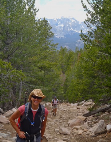
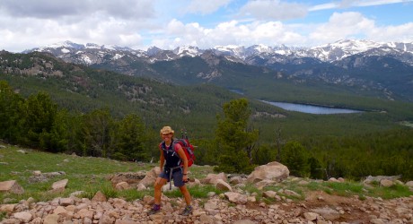
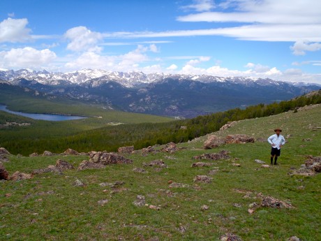
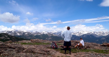
Last Thursday, my husband, Jerry, and I left Lander at (gasp) 3:45 am. It was a two-hour drive to the Big Sandy Opening trailhead, and our plans for the day were ambitious: to climb Mitchell Peak and get back to Lander in time for our middle son’s 5:30 pm baseball game.

We made the drive under a star-filled sky, which meant we had picked a stellar day. As we entered the Big Sandy Opening area we noticed our “outside temperature” gauge reporting 21 degrees. OMG. We didn’t plan for below-freezing temperatures. It would be a frigid start. Even with all of our layers on and walking at a brisk pace, we were shivering for the first five miles before the trail left the forest and we could finally feel the warmth of the sun.

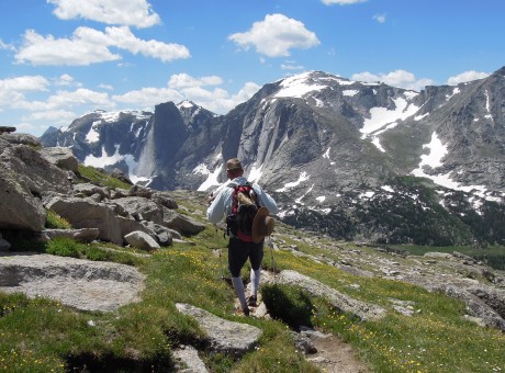
We had hiked the route many times before, at least once a year for several years. On this day, we would hike from Big Sandy Opening to Big Sandy Lake, up over the first part of Jackass Pass, to North Lake, where we’d take a hard right and head up Mitchell Peak’s southern slopes before gaining its northwest “walk up” ridge.

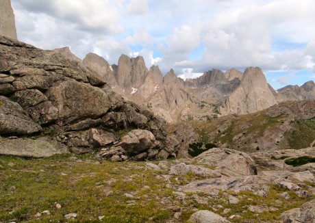
Mitchell Peak is part of the famous Cirque of the Towers, one of the most spectacular sights you will ever see. The sight of the Cirque takes my breath away every time I see it. This is partially due to the effort it takes to get there, but mostly due to its sheer and unspeakable beauty. The sight of the Cirque can move you to tears, and it inspires you for days, weeks and months after.

You can access the Cirque via Big Sandy Opening and Jackass Pass (which straddles the Continental Divide and gets its name because it’s so rugged a donkey can’t pass over it — and a stupid person can – LOL) or via Dickinson Park and the North Fork Trail. The former is a harder hike, but shorter in distance — about 15 miles roundtrip. It is truly an epic hike given the jaw-dropping scenery and the rugged terrain. The latter is easier — with only 900′ of gain over the course of about 15 miles (30 roundtrip), but with 5 river crossings.
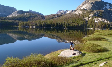
My husband, Jerry, at Big Sandy Lake, about six miles into our hike.

Jerry and I have wanted to climb Mitchell Peak since at least 1997, the year we first camped near the Cirque of the Towers. (Prior to Thursday, we had climbed Lizard Head, Wind River Peak and other peaks in the southern Wind River Range.)

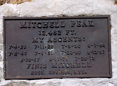
Mitchell Peak is named for the late Finis Mitchell, who remains a hero to our family. During The Depression, Mitchell, and his wife, stocked 2.5 million trout in many of the high country lakes in the Wind River Range by carrying the fish in milk jugs on their horses. A true mountaineer, Mitchell knew the Winds like the back of his hand. He climbed all but 20 of the 300 peaks in the range. Mitchell remained an advocate of the Wind River Range until his death in 1995.

We named our youngest son, Finis, after Finis Mitchell. (By the way, many are unaware of this, but Finis’s name was pronounced in a way that rhymes with “highness.”) Anyhow, Finis Mitchell is pretty special to us, and this was another reason we wanted to stand on top of Mitchell Peak.

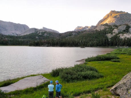
The hike from the trailhead to Big Sandy Lake is a walk in the park. It’s a pretty flat 6 miles, mostly through forest and sometimes running parallel to Big Sandy River. Big Sandy Lake is beautiful, surrounded by Big Sandy Mountain, Haystack Mountain, East Temple and Mt. Scheistler. In our experience, sunlight is almost always dancing on the lake’s surface. The lake looks like it has “dancing diamonds” on top of it.

Walk past the lake and you’ll see a sign directing you up toward Jackass Pass. Think of this next section as a lung-buster — or as I like to say, an opportunity to snack on a little humble pie. excuse my language, but we often call Jackass Pass “kick your ass pass.” It’s that good. 🙂

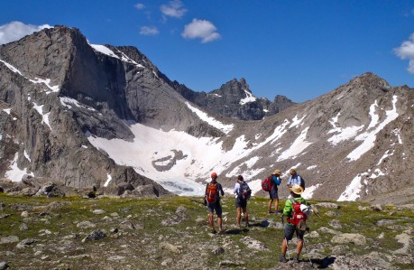
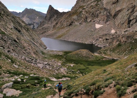
We hiked uphill for a bit. The views, looking back, are impressive. We could see Schiestler Peak, East Temple and Temple peaks behind us. To our left was Warbonnet. Up ahead we were getting teased by Pingora, and the Cirque of the Towers, which were starting to jut out of the pass ahead of us. Also about this time, we were able to get a glimpse of Mitchell Peak.

Mitchell Peak, along with Dogtooth Mountain and Big Sandy Mountain, form a high northwest-southeast ridge on the Continental Divide.

I get excited when I am hiking along the Continental Divide. This means that precipitation that falls on the Big Sandy side eventually makes its way to the Gulf of California and the Pacific Ocean, by way of the Big Sandy, Green and Colorado rivers. Precipitation that falls to the other side eventually flows 4,000 miles to the Gulf of Mexico, by way of the Popo Agie, Bighorn, Yellowstone, Missouri and Mississippi rivers. It’s pretty cool to be walking along the backbone that splits these two realities.
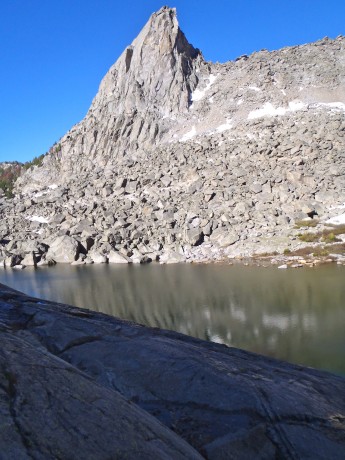
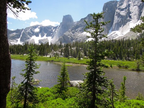
North Lake.

We would descend to North Lake and then take a hard right and start our scramble up the mountain’s southern slopes. In reading about Mitchell Peak, we came across a report where Finis had indicated “even a 10-year-old could walk up.” It sounded like the route for us. (Disclaimer, a very fit 10-year-old could definitely summit Mitchell Peak, but would probably be best advised to do it during an extended camping trip in the area, rather than as a day hike from Big Sandy Opening.)
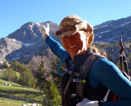
Pointing to our destination: Mitchell Peak's summit.

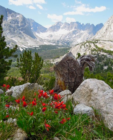
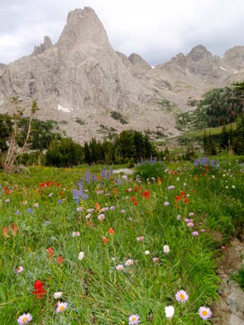
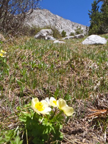
Beautiful flowers and Mitchell Peak in the same frame.

At just under seven miles, we reached the end of North Lake and left the trail for Mitchell. My GPS indicated we were at 10,500′, so we had about 2,000′ of vertical to go to claim Mitchell’s summit. Alrighty then. (Access to information is not always a good thing, right?) We paused and considered which route we would take. We could go to the left and follow a spring up. It looked most direct, but more treacherous than our option to the right. The route at right appeared to be more gentle so we headed that way.
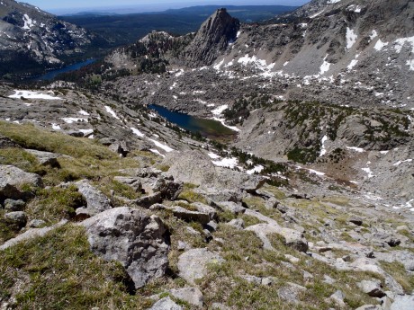
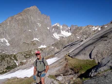
This shows the terrain of our ascent.

It wasn’t long and we got past the big rocky outcrop and could start heading more directly toward Mitchell’s top. I didn’t need to check my GPS to learn we had arrived at 11,500′. I knew from past experience that, at least for me, once above 11,000,’ it’s like breathing with only part of a lung, or like someone knocked the wind out of me. So our going got slower but we could taste the summit. I mean, it was right there.

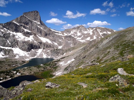
The scenery behind us and before us, was astounding. Silver granite towers jutted out of seemingly fragile alpine tundra, which was littered with boulders and delicate wildflowers.
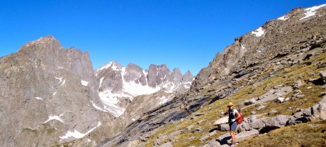
Jerry, catching his breath.
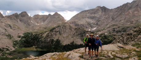
Resting midway up Mitchell. That's the Cirque of the Towers in the background.

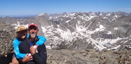
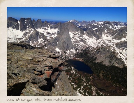
Finally we made it to the top. The views were even grander than we expected. We looked down upon the Cirque of the Towers, and because we were above the towers, we could see the depth of the Cirque. In all directions we had views of granite mountains, rivers and lakes tucked under cirques, some still with “blue ice” on them. Except for the summit’s high point, Mitchell’s top is pretty flat and broad. I was especially awe-struck after we ventured over to take in the views from directly above Mitchell’s 1,000-foot-tall and sheer north face. Wow.

Finis Mitchell, in his Wind River Trails book, said: “…Seldom does man ponder his own insignificance. He thinks he is master of all things. He thinks the world is his without bonds. Nothing could be farther from the truth. Only when he tramps the mountains alone, communing with nature, observing other insignificant creatures about him, to come and go as he will, does he awaken to his own short-lived presence on Earth.”

Indeed. As I sat on Mitchell’s summit taking in views of my beloved Wind River mountains, which are composed mostly of granite rock formed deep under the surface of the Earth over 1 billion years ago, I was humbled, and grateful.

By the way, when I’m not hiking — and sometimes when I am — I am a life and leadership coach and consultant. Check out EPIC LIFE, my coaching business. Epic Life provides coaching, with an option for a guided epic adventure. I also have a blog there.

Here are some photos, as well as a video blog of the day (compressed to 7 minutes).
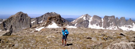
Top of Mitchell, not quite to the high point.

Evidence that we were there.

This is what I call a peak experience.

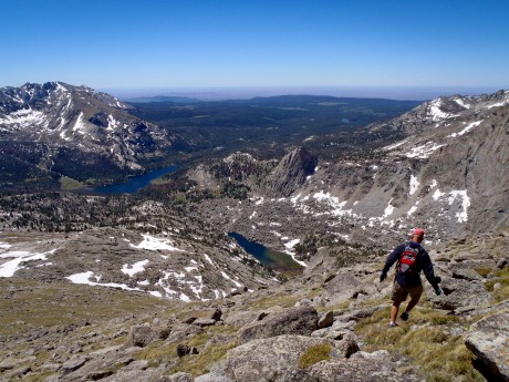
As the saying goes: the summit is only the half-way point. To finish our epic hike, we had to turn around and return to our start. Here, Jerry starts down.
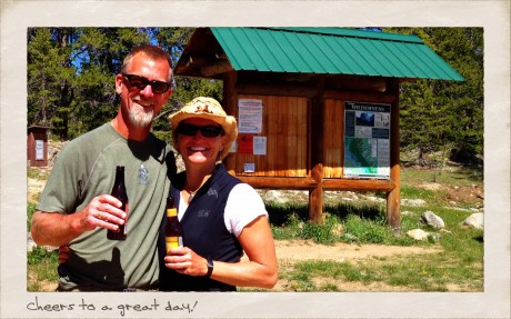
Cheers to an epic hike.

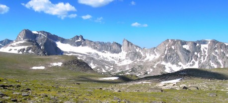
VIDEO BLOG OF THE HIKE:
Filed Under: Family, Fitness, Frontier Life, Life and Leadership Tagged With: cirque of the towers, finis mitchell, hiking, mitchell peak, wind river range, wyoming

This Hike Takes Your Breath Away

July 31, 2011 by Shelli

Hi.

It was very early morning on July 29, when reasonable people were still in their beds sleeping.

Four of my closest girlfriends met my husband and I at our house at 3:09, and by 3:17, we departed for the trailhead at Dickinson Park, about an hour-and-a-half drive. Despite the early hour, as we left Lander, it was 67 degrees outside. A couple miles outside of town, a star shot across the black sky that was heavily dotted with dazzling, sparkling stars. As we approached the trailhead, we watched a small herd of elk cross in a meadow in front of us.

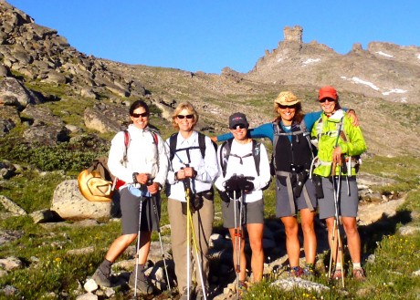
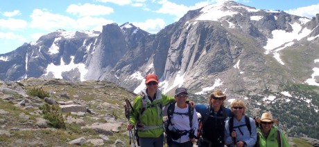
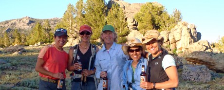
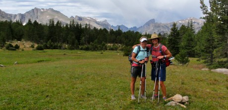
Holly Copeland, Leann Sebade, Kathy Swanson, me, and Kathy Browning, on the Bears Ears Trail. (See the Bears Ears in the background)

By all indications, the day would be a stellar one.

This “epic adventure” is a trip I planned back in late spring. As readers of this blog know, one of my passions is long distance day hiking, particularly in my backyard, Wyoming’s southern Wind River Range. I love to hike far in a single day, in a landscape whose natural beauty takes my breath away, with people who are positive, interesting, fit, funny, and who are a pleasure to be around. If all goes well, my heart, mind, soul and health benefit.

I feel so strongly about the benefits of this type of epic pursuit that this hike would serve as sort of a “test drive” for a product I plan to offer in my new leadership/coaching business.

Hiking near the end of the Bears Ears Trail.
We enjoyed epic views like this one, of Grave Lake and Musembeah Peak.

There were six in our group, including Kathy Swanson, Kathy Browning, Leann Sebade and Holly Copeland, and my better half and frequent hiking companion, my husband, Jerry. (Jerry and I had this hike on our life list, but he also generously offered to help me by taking additional photos to capture the magnificence of the day.)

We would start at Dickinson Park, hike the Bears Ears Trail to its end, connect to and hike the Lizard Head Trail to the North Fork Trail, and then head back toward Dickinson Park. The start and finish are separated by two miles of dirt road. If there’s one thing we like to think we are, it’s smart, so we took two cars and dropped one at the end before we started hiking.

We hiked at altitudes of 11,000 feet to 11,700 feet for much of the day.
A huge rock formation between Bears Ears and Lizard Head trails.

The hike, according to the maps we had on hand, indicated the adventure would be about 26.2 miles — a marathon hike. (Turns out the maps were wrong; our trusty GPS, along with the signage on the trails, would indicate that in fact our loop hike measured 29.3 miles.)

The hike would start at 9,400 feet elevation and climb to just under 12,000 feet in places. For much of the hike, we would be between 11,000′ and 11,700′. All told, there was 5,700′ of elevation gain.

In other words, this adventure would be more than a long walk; it would involve some lung-busting and muscle-tearing. The payoff, of course, would be panoramic mountain views that would continue to unfold in front of us for long periods of time, as well as meaningful conversation and a fun time with kindred spirits.

Ascending a snow field at our start on the Lizard Head Trail.
My husband, Jerry, waiting for us girls.

The first three miles are a climb through gradual, but seemingly endless switchbacks through lodgepole forest. Once out of the trees, we were at 11,000′ and hiking in alpine tundra by sunrise. Like I said, by all (continuing) indications, it would be a stellar day.

The Bears Ears Trail gets its name for a rock tower formation that looks exactly like a (teddy) bear’s head, complete with its two ears on top. You can see the Bears Ears from various spots in the front/low country we frequent, so it’s a treat to walk right under it and to see it up close.

Early Native Americans, particularly the Shoshone and Crow Indians, frequented this area to hunt for bighorn sheep, and to perform religious ceremonies.

Alpine tundra and granite peaks were the flavor of the day on the Lizard Head Trail.
Brief celebration along the way.
Quick huddle.
Enjoying some thin air.

At this point, you can see Funnel Lake, before continuing through a low saddle called Adams Pass before dropping to a bridged (marsh) crossing of Sand Creek.

After crossing Sand Creek, we continued to the right of Sand Creek and ascended a rocky trail. The granite is this area is 2.5 billion years old. It’s hard not to feel insignificant in the spectrum of time when hiking amongst such old rock.

Stopping to take in the views.
Lizard Head Peak.
Happy hikers.

At the seven-mile mark, we were handed our first real prize – a jaw-dropping, awe-inspiring, panoramic view of the Wind River Range. Mount Washakie and Washakie Pass, Bernard Peak, Lock Leven Lake, Chess Ridge, Mount Hooker (with its perpendicular 1,600-foot-tall face), Grave Lake, Mount Bonneville, Musembeah Peak, and more. Imagine a view of towering, silver granite, snow-covered mountain peaks with a scattering of glaciers and lakes and you get the picture.

This is a great turn-around spot for reasonable-but-fit day hikers. Even better, though, would be to do a quick scramble to the top of Mt. Chauvenet, which stands 12,250 feet tall and is right there behind you as you’re taking in these magnificent views of the Wind River Range. Jerry and I climbed it about 12 years ago and I can’t recommend it enough.

We stayed on the Bears Ears Trail and continued up, until the trail crested and we opted to enjoy a short break while taking in the awesome views.

Up next for us was connecting to the Lizard Head Trail. The Lizard Head Trail would connect us to the North Fork Trail. Some of us had previously hiked the Bears Ears Trail, as well as the North Fork Trail, but always on separate occasions and had never linked the two trails. Jerry and I had long wanted to see what Lizard Head Trail was like. In looking at a map, and having climbed the massive Lizard Head Peak in 1999, we knew it could only be awesome.

And boy, were we right about that.

Lunch with a view.
My husband, Jerry, leading us on the descent into the North Fork.

After connecting to the Lizard Head Trail and ascending a snow field, or two, we reached sweeping views of additional sections of the Wind River Range. In fact, for the next several (seven?) miles we hiked on alpine tundra that was littered with an abundance of tiny, fragile wildflowers of all colors and kinds, and lichen-covered rocks while being overshadowed by one granite peak after another to our right.

We’re talking jaw-dropping scenery. The kinds of views that can move you to tears, and, especially given the altitude, take your breath away and leave you speechless. For moments at a time.

I’m usually a swift hiker and we had a timeline to keep for this long hike. But, during this stretch, I “strolled” quite a bit. It was impossible not to. The views were just so amazing and the hiking too enjoyable. The air is thinner on this trail, though. Some of us had faint headaches and I reminded the group — and myself — to take deep breaths to counter the effects of the thin, oxygen-deprived, high altitude air. I, as well as Jerry, and the others, snapped tons of photos along this section. (As you can see from the number included in this post!)

Wildflowers and Cirque of the Towers.

After about seven miles of hiking on the Lizard Head Trail, we were afforded views of the famous Cirque of the Towers. (Yeehaw!) The Cirque of the Towers are an amazing collection of 17 peaks that provides world-class climbing. We could also see Lonesome Lake, which is situated directly below the Cirque.

Lizard Head Peak stands 12,842′ tall and is the star of this section of the Lizard Head Trail. No wonder it is the trail’s namesake. 🙂 About one mile northeast of the Cirque of the Towers, Lizard Head is the area’s dominant peak. From our vantage we enjoyed a magnificent view of its east face, which towers 2,300 feet above Bear Lake.

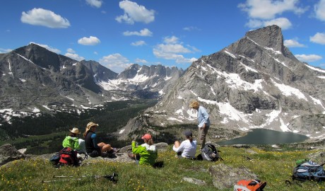
Here, with Lizard Head, Bear Lake, the Cirque of the Towers, Lonesome Lake, Mitchell Peak, Lizard Head Meadows and The Monolith as visuals, we stopped for a short break. This now marks the best lunch spot I’ve ever experienced.

Because we were on a timeline, and by now, knowing that the hike would be a few miles longer than the original marathon distance we had anticipated, we started moving again, descending toward the North Fork of the Popo Agie River, where we would connect to the North Fork Trail.

Once we hit the North Fork Trail, we were back in the forest. The trail was more kind — both in terms of grade and terrain. The shade was also nice, given it was early afternoon and we were hiking at a reasonable elevation. Here, many of us (re)lathered ourselves with bug spray and some of us donned head nets. Darn it — the mosquitos were out in force. Fortunately we had all expected this.

The Monolith and the North Fork of the Popo Agie River.

Rivers in the Wind River Range were/are raging right now compared to normal, given the abundance of snow and moisture our mountains received this past winter and spring. We knew we had at least four river crossings to contend with but had been informed before our departure that they were all passable. Still, we were a little anxious in anticipation, as turning back was not something we wanted to consider.

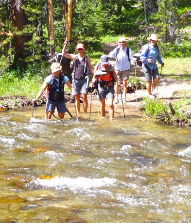
It was a few miles of level, fast hiking before we reached the first crossing. The water was swift and hit most of us in the mid- to upper-thigh for part of it. But the water felt great and we all crossed successfully, although some of us did so with more mental ease than others. I’m not a huge fan of river crossings so was glad to have this first one behind us. Reportedly, it would be the worst of the crossings.

One of five water crossings on the North Fork Trail.

The next one, however, proved to be swifter than our first. We took our time, and again, we all crossed with no more than some anxiety.

Turns out there were three other crossings that required us to de-shoe, but they were easy and the water provided a welcome relief to our tired, dirty, “protesting” feet.

Except for the bugs and the water crossings, in my opinion, the North Fork Trail is a walk in the park. From Lizard Head Meadows to Dickinson Park the distance is 13 miles and the elevation change is a mere 1,000 feet.

That said, as is usual for these long hikes, the last two miles feels like four, if not more. With about 25 miles on our legs, we were pretty much cruising through the forest with little effort. At one point, I asked Jerry, the GPS-carrier, what our elevation was and he said, “8,600 feet.” What? I asked him again two more times and each time the answer was the same. This was a little demoralizing considering I/we knew the end was located at about 9,400 feet.

The character-building portion of the hike (if there was one?) for me, and I’m guessing for the others, was at about the 26-mile mark, where we walked on a dusty, hot trail through a recently-burned section of forest and then had to grunt up a hill for about 1,000 feet only to descend a couple hundred feet and go for what was a couple more miles (that seemed like five or six) to get to the end.

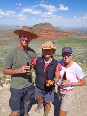
Once at the end, we had cold beers in a cooler (a surprise reward from Jerry), and Kettle Chips and Rainier cherries from Leann. All hit the spot!

But the biggest reward for me, and hopefully for my comrades, is that I had gained an epic experience, memories to last a lifetime, inspiration that will serve as fuel for me, stronger friendships, and a health benefit to boot.

Yeehaw! Beers all around after an epic day.

A SHORT VIDEO:

Filed Under: Fitness, Frontier Life, Life and Leadership, Travel & Tourism Tagged With: adventure, endurance, epic, hiking, wind river range

Cyclone Pass “Prize” Makes Shoshone Lake Hike (Grunt) Worthwhile

July 21, 2011 by Shelli

On Cyclone Pass July 8.

Shoshone Lake is a big lake that is in my backyard. Tucked in the foothills of Wyoming’s southern Wind River Range, the lake is situated at about 10,000′, and in the Shoshone National Forest.

My husband, Jerry, a friend, Kathy Swanson, of Casper, WY, and I hiked to Shoshone Lake and beyond on July 8. The route we hiked follows some trail, but mostly two-track/ATV road. As a result, many hikers do not hike to Shoshone Lake. Pity!

Kathy and I, with the Popo Agie Falls in the background. This is about 3 miles into the hike, on the Middle Fork Trail.

I hike to Shoshone Lake 2-3 times a year if possible. In my humble opinion, it’s the hardest (best training) marathon hike near my town of Lander, WY, and it provides one of the best views of my backyard.

Kathy, and my husband, Jerry, in Shoshone Basin.
Kathy, cruising on one of the hike's only level sections, alongside Shoshone Lake.

The “prize” — the reason we go to such great lengths on this hike — is Cyclone Pass. The top of Cyclone Pass provides one of, if not the, most glorious views of the southern Wind River Range. While one could do this as an out-and-back hike, or ride a jeep or  an ATV to Cyclone Pass and Shoshone Lake, we typically choose to hike a point-to-point route.

Kathy and I, midway up Cyclone Pass. It's a grunt!
Almost to the top of Cyclone Pass.

Our hike started at Bruce’s Bridge, about nine miles southwest of Lander. From there, we hiked seven miles on the Middle Fork Trail, to a junction that took us uphill, on a grunt, for three miles, before joining the Shoshone Lake Trail at 10 miles. From there, we hiked briefly through the forest before it opened up into the vast — and lush — Shoshone Basin. After hiking through the basin, we arrived at Shoshone Lake, which marked a little over 13 miles.

My husband, Jerry, checking out the views from top of Cyclone Pass.
Jerry and Kathy, taking in the views, and I'm guessing, voicing their relief that Cyclone Pass is behind them.

From there, it’s a mostly-level trail alongside the lake’s shore for a little over two miles. Next up is Cyclone Pass. And there are no two ways about it. Ascending Cyclone Pass is a grunt. It’s pretty much straight up over all kinds of rock scatter, and on July 8, some running water. The ascent of Cyclone Pass is about 1.5 miles and 650 vertical feet. Because it comes at a point when you have about 15 miles of mostly uphill miles on your legs, it’s a real “character-builder.”

Group timer shot.

No matter. Going uphill is not an unreasonable cost, given the prize at the top. You can hopefully see in the photos here of Cyclone Pass and get the picture. 🙂

After an extended break at top of Cyclone while taking in the awesome views, we then started our descent toward Baldwin Creek.

Kathy, on the dreaded Chute.
Jerry, on The Chute, which was more like a creek.

Despite the fact it’s all downhill from Cyclone Pass, arguably the toughest part of the day is what’s next, a 2-mile section known as The Chute. This is basically a dried-up creek bed. Some areas are nothing but rock on rock. For our hike there was a actually a stream running down much of the middle of the The Chute. It’s hard on the legs. It is sustained and unrelenting downhill on nothing but rocks on rocks. Let’s just call it what it is: another character-builder.

Following The Chute, we hike by Suicide Point, a great feature that is aptly named. From there it’s just downhill, downhill and downhill, and more rocks and rocks and rocks. To be sure, the descent, even beyond The Chute, is a very rocky one.

Kathy, in bottom right, descending last few miles of our hike.
Almost to The End of our hike.

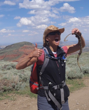
My dad was to pick us up at the parking lot above the Shoshone Lake Switchbacks, off Baldwin Creek Road at 3 pm, but he was delayed in receiving our Spot Messenger text regarding our ETA, so we ended up descending a few of the switchbacks. (By then, in dire straits, I took a small bite of a snake on that portion. It’s my dad’s fault?) All told, we hiked about 25 miles, including 4,300′ of elevation gain.

I ate a snake. Or not. You decide.

It was an epic day. I would even go so far as to say it was stellar. It had all the important features: camaraderie, stunning views, character-building, and a reat health benefit to boot.

Beers All Around!

Here is a very short video from Cyclone Pass:

Filed Under: Family, Fitness, Frontier Life, Travel & Tourism Tagged With: adventure, epic, hiking, shoshone lake, wind river range

Another Best Wind River Hike, Ever…

September 22, 2010 by Shelli

Hi from the Wind Rivers.

I have had a great four months. My beloved Wind River Range has been good to me. I have been lucky enough to experience seven or eight long and stunning day hikes in my back yard plus a bunch of smaller hikes and outdoor adventures with my family.

Most recently, my husband, Jerry, and I hiked up (and down) and up to the end/top of Roaring Fork Mountain. The mountain itself it not that spectacular. Its high point is a little over 12,000′. But the mountain is broad, and as its name suggests, it forks into what are two pretty long mountains/ridges that are all part of The Roaring Fork. We are pretty sure the Roaring comes from the roaring nature of the wind, but we’re only guessing?

One of our many spectacular views. These are a handful of lakes in the Stough Creek Lakes Basin.

There are two reasons this hike was/is so special to Jerry and I. For one, we can see this mountain from most of the hikes we do in the southern Wind Rivers as well as from the deck of our mountain cabin. The Roaring Fork, complete with its notch (“bite”) in its summit ridge, are iconic if you live and play in the mountains above my town of Lander, WY.

Jerry and I with some Stough Basin lakes and much of the southern Wind River Range as a backdrop.

The second reason is Roaring Fork Mountain juts out of a landscape composed of regions marked by spectacular canyons, cirques and lakes. We have hiked into, or taken llamas into, most of these awesome regions. Standing on the top of Roaring Fork and getting up-close and more intimate with it, was quite a meaningful experience for us.

I wish I could take credit for thinking up this hike, but I can’t. A friend, Jared Kail, has talked about wanting to do a version of it for some time. For his 40th birthday he was going to hike it and invited us along. Unfortunately, he came down with a cold the day before and had to forego it. But I owe Jared for thinking of the hike.

I have pretty much hiked and camped in and explored a good majority of the trails in the southern Wind River Range. And yet, somehow this one eluded me until last Sunday. And, turns out, it’s a major favorite. I cannot wait to return when I have more time to explore the mountain even further.

There is quite a bit of scrambling and boulder field hiking.

For the record, we did a long version. We did an out and back. We started at Worthen Reservoir and hiked the Stough Creek Lakes Trail for almost 4 miles to the Stough Saddle. This saddle is a favorite day hike that affords one of the best views of Wind River Peak, the tallest peak in the southern Winds, standing 13,192′ tall. (Jerry and I climbed it in 1997.)

Standing in front of LF Lake, at far end/above Silas Canyon area lakes.

From there, we headed left, off-trail for approximately five miles of tundra, scree, boulder field hiking. It was quite windy in the Winds! The Winds, as well as the Roaring Fork lived up to their names on Sunday. But no complaints — we had a perfectly brilliant Autumn day for the adventure.

Jerry hiking over the tundra.

We had jaw-dropping, awe-inspiring scenery pretty much constantly, and in all directions. To our right, for the five miles we hiked toward the end/high point of Roaring Fork Mountain, numerous lakes and cirques unfolded to our right that make up the spectacular Stough Creek Lakes Basin region. At any single vantage, we could count six to seven lakes and cirques. This is how it was the whole way to our right.

To our left, especially when we gained the high point of the ridge, we had similarly spectacular views, including the Roaring Fork Lake/Creek, Leg Lake, Silas Canyon and its lakes, Atlantic Canyon and its lakes, not to mention Fossil Hill, Frye Lake and Worthen Reservoir. And, let’s not forget the view that unfolded behind us, which was basically one containing most of the southern Wind River Range, complete with iconic Wind River Peak, Temple and East Temple Peaks and Lizard Head peak standing out. We could also see Shoshone Lake, the lake we hiked to the previous week.

Another friend of ours, Mike Lilygren, had hiked a different variation of the same hike a week prior and provided invaluable input to us the night before. Basically he instructed us to not head directly over the rocky mounds immediately to our left of the Stough saddle, but to instead keep them to our left. This was great advice.

Still this adventure found us ascending to 11,000, then descending 200′, then gaining 400′, then descending 200′ and so on. All told we hiked out about 9.3 miles and gained 6,600′ in elevation gain due to the aforementioned contour of the mountain (and due to our route-finding decisions).

By the time we were back at the car, our GPS indicated we had ascended 7,900′, despite the fact our high point was just about 12,000′ for the day, and hiked almost 19 miles. There are ways to make this hike a little shorter and probably have a little less elevation gain/loss, but that’s another conversation. And, um, we like ’em long. 🙂

VIDEO BLOG OF THE ROARING FORK HIKE:
LINKS TO MY OTHER HIKING ADVENTURE POSTS:
  • Big Sandy to Jackass Pass to Cirque of Tower, North Fork, Middle Fork
  • Shoshone Lake
  • The Bears Ears Trail
  • Historic Blue Ridge Lookout
  • Deep Creek and Ice Lakes
  • Jackass Pass to Cirque of Towers
  • Grand Teton Expedition (4 parts)
  • The Olympic Peninsula
  • Skate Skiing at Beaver Creek
  • Grand Canyon Rim-to-Rim-to-Rim
  • Filed Under: Family, Fitness, Frontier Life, Travel & Tourism Tagged With: adventure, hiking, wind river range

    My Most Epic Wind River Day Hike

    August 18, 2010 by Shelli

    Me, hiking Jackass Pass, above North Lake.

    I just completed a life list hike that’s in my back yard, Wyoming’s southern Wind River Range. As those of you who know me, or read this blog, know, I live for these “epic” hikes in the Wind River Range. This year I had a list of five major ones I wanted to do. Due to a late summer start (the result of local flooding and lots of snow accumulation in the high country), and more than the usual number of thunderstorms during the first half of August, I’ve been able to complete only two of the ones on the list.

    Thankfully, the most coveted one on this year’s list is the one this post is about, which means I completed it.

    On Monday, I hiked almost 32 miles in a day — from sunrise to sunset — from Big Sandy Opening, over Jackass Pass to the Cirque of the Towers, to Lizard Head Meadows, along the North Fork Trail to Pinto Park, to the Middle Fork of the Popo Agie, to Sheep Bridge and finally, to our destination, Bruce’s Bridge, just beyond Sinks Canyon State Park outside of my hometown of Lander, WY.

    Along for the hike were two of my good friends, Holly Copeland and Kathy Swanson.

    Although I had previously hiked all of the trails we would travel, except for a 3-mile stretch, I had never linked them all into one trip. In fact, unless you’re looking to challenge yourself, as we were, you could spend a week or two or three, easily, hiking and exploring the route we traveled and the sights we enjoyed. And of course, that is more reasonable. But I relish these endurance challenges that afford so many spectacular views in a single day, not to mention the great camaraderie and conversation that is shared along the way. And, the fact I’m only away from my husband and three young sons for one day, also makes these epic day hikes appealing to me.

    But okay, let’s talk about the hike…

    Kathy and Holly enjoy views of Big Sandy Lake right after sunrise.

    We departed Lander at 2:45 am and drove for 2 hours, 15 minutes to the Big Sandy Opening trailhead, accessed from Wyoming Highway 28/South Pass. With headlamps on, we started down the trail a little after 5 a.m. The first 5.5 miles is pretty flat and forested and parallels Big Sandy Creek for much of the way. This stretch was uneventful as the sun began to rise.

    The sun was up before we reached our first major milestone, Big Sandy Lake, a beautiful lake that is surrounded by Schiestler Peak, Temple Peak, East Temple Peak, Haystack Mountain and Big Sandy Mountain. The trail follows the northwest shore of the lake. I always like to stop at the big flat rock near the end of the lake just before we start ascending Jackass Pass. It’s a great spot to adjust clothing, snap some photos and snarf a quick snack…

    The spectacular granite towers that form the world-famous Cirque of Towers reveal themselves while hiking across Jackass Pass.

    …And, get ready for the trail’s personality to change. Dramatically. From Big Sandy Lake, we hiked up over Jackass Pass, so named because a donkey cannot pass over it. It’s not only a significant uphill effort, it traverses a rocky side of North Lake and eventually leads hikers up, up and up some more.

    The views are breath-taking, literally and figuratively. We’re talking jaw-dropping scenes. As soon as you’re beyond North Lake, you get a glimpse of Pingora, peeking through from the still-distant Cirque of Towers. To your immediate left, though, and towering majestically, is Warbonnet Peak.

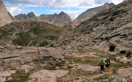
    We enjoyed views in all directions. Behind us was North Lake and the distinctive East Temple Peak and Temple Peak. And, unfolding in front of us were the towering granite walls and peaks that form the Cirque of the Towers. We were hiking in alpine tundra — a mess of vehicle- and small building-sized granite, a mess of rocks scattered throughout the alpine tundra, sprinkled with tiny wildflowers of all colors, and of course the aforementioned granite giants.

    Jackass Pass travels through a mess of granite and alpine tundra, complete with lichen-covered rocks and wildflowers of all colors.

    Before reaching the end of the pass, you descend a short but steep hill before ascending to 10,780 feet and the end of Jackass Pass. While making this last ascent, be sure to stop and take a look behind you at the aptly named Arrowhead Lake. This is one of my favorite views along Jackass Pass.

    Holly and Kathy ascending the last stretch to the end of Jackass Pass. That's Arrowhead Lake.

    At the end of Jackass Pass, we enjoyed our first actual break and sat down briefly to consume another snack and take in the views of Lonesome Lake and the Cirque of the Towers.

    Group timer photo at end of Jackass Pass, above Lonesome Lake and the Cirque of Towers.

    Next, we descended a small, steep hill and hiked around the south shore of Lonesome Lake.

    Pingora, with wildflowers in the foreground.

    From there we picked up the North Fork trail, named for the North Fork of the Popo Agie River and hiked to Lizard Head Meadows.

    Kathy and Holly pause briefly in Lizard Head Meadows.

    At Lizard Head Meadows, we stopped to watch a moose graze on the lush grasses and then continued on a trail that follows alongside the North Fork of the Popo Agie. This was an amazing stretch of trail: forested but with huge granite mountains to our right. It sort of made us feel as if we were hiking in Yosemite National Park, under and near the likes of El Capitan, but with one significant difference – our trail was lonely. It was almost as if we had it to ourselves. (We saw only approximately 10 other hikers, all backpackers, the entire 32 miles.)

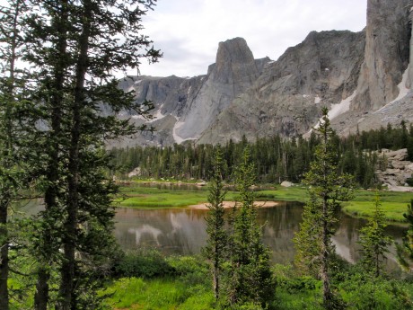
    The Monolith, towering over a calm stretch of the North Fork of the Popo Agie.

    A great sight was the river, complete with fish jumping out of its calm waters, and a huge peak towering over it that is aptly named The Monolith.

    From here, the trail gets a little mean-spirited. It goes uphill. For a long time. Finally, we arrived at Pinto Park, a great expanse of lush grass, surrounded by forests and more granite peaks in the distance.

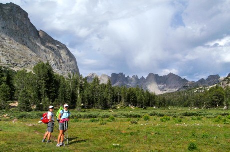
    Kathy and I in Pinto Park. The uniquely-shaped peak at right is Lizard Head Peak, which is part of the Cirque of Towers. (My husband and I climbed Lizard Head in 1998.)

    After more hiking, we arrived at the Middle Fork trail, which parallels the Middle Fork of the Popo Agie River, the river that flows through my hometown of Lander, WY. There, we refilled our hydration packs with treated water and continued on.

    Holly and Kathy, refilling their hydration packs at the Middle Fork of the Popo Agie.

    Next was Sheep Bridge. And, as we were about four miles out from the trek’s end, my husband, Jerry, and Holly’s husband, Scott, and their dog, Milo, met us on the trail. Their presence provided a little surge of energy for us. (I’m guessing the cooler of ice-cold PBR they hauled in for us helped, too.) We finished the hike with a fair amount of daylight remaining.
    Yay! We did it! 31.9 miles and finished without injury and with daylight remaining.

    To be sure, completing this hike was a phenomenal personal achievement for me and my friends. But spectacular sights we saw and the great conversation we shared along the trail are what will remain with me for days and months to come.

    It was another memorable day in my back yard, and I will not forget it.

    Here’s a video of the various segments of our adventure patched together. Enjoy!

    Filed Under: Fitness, Frontier Life, Travel & Tourism Tagged With: adventure, cirque of towers, hike, jackass pass, wind river range, wyoming hiking

    • « Go to Previous Page
    • Page 1
    • Page 2
    • Page 3
    • Page 4
    • Go to Next Page »

    Primary Sidebar

    About Shelli

    Hi. My name is Shelli Johnson. I live on the frontier in Lander, Wyoming. I’m a wife, a mother, an entrepreneur, certified life/leadership coach, wellness coach, keynote presenter and inspired speaker, leadership development facilitator, personal development strategist, writer and adventure guide. This blog mostly includes stories about adventures and travel, but other passions are reading/books, technology, fitness, nutrition, and national parks, so you’ll find a wide range of articles here. I am founder of Yellowstone Journal and YellowstonePark.com, and NationalParkTrips.com, which was my first business. My current company, Epic Life Inc., is in its 7th year, and going gangbusters. If you’re interested in learning more about my current work, I hope you’ll jump over there and learn more about that. I have a more personal blog, more directly related to life and living and leadership, at YourEpicLife.com/blog. I’d love it if you’d also check out that collection of my writings. Thank you for stopping by! Finally, if you’d like to connect with me directly, please email me if you’d like to connect.

    • Facebook
    • Instagram
    • LinkedIn
    • Twitter

    Subscribe For Email Updates

    Check your inbox or spam folder to confirm your subscription.

    Archives

    Links

    • Your Epic Life
    Copyright © 2025 · Have Media Will Travel