• Skip to primary navigation
  • Skip to main content
  • Skip to primary sidebar

Have Media Will Travel

A blog about outdoor adventure, family travel, national parks, media, technology, marketing, fitness and me.

  • Travel & Tourism
  • Family
  • Fitness
  • Frontier Life
  • National Parks
  • Life and Leadership
    • Life Coaching
    • Epic Adventure
    • Leadership
    • Keynote Presenting

hiking

Hiking the Bears Ears Trail

July 24, 2010 by Shelli

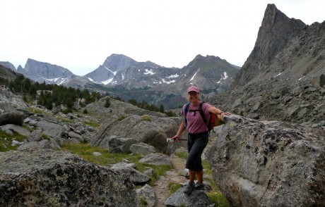
Me, on the Bears Ears Trail. You can see by looking at Bears Ears Mountain behind me in this photo where the trail gets its name.

The Bears Ears Trail is one of my favorite trails in all of Wyoming’s Wind River Range. This is due to the nature of the trail and the views it provides.

After a little more than three miles of switchbacks through forest, the trail opens up into alpine tundra and hands out spectacular views as it ascends Adams Pass.

We had set out with plans for a long and epic hike that would include the Bears Ears Trail and the Lizard Head Trail as an out-and-back day hike that would total about 28 miles. Mother Nature had other plans, though. Thunder and rain crashed our party around 11 a.m., which meant we did not get to hike the Lizard Head Trail. It was still a phenomenal adventure I will not forget.

We had a generous winter this year, which meant on our July 21 hike, the trail was still wet in many places. We even hiked over snow a handful of times. But it also meant the wildflowers were amazing.
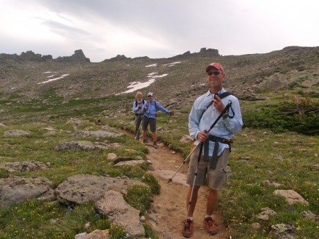
My husband, Jerry, and friends Holly and Leann hiking Adams Pass on the Bears Ears Trail.

Adams Pass is amazing in its own right. But the hands-down prize is the view hikers are provided after about seven miles of hiking. What hikers get to see seven miles into this hike has got to be one of the best views in and of Wyoming’s southern Wind River Range.
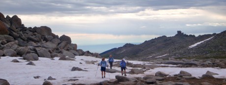
We hiked over some snow in a handful of places along the trail.

What you see is an awesome panorama of rugged country, including Mount Washakie, Washakie Pass, Bernard Peak, Lock Leven Lake, Chess Ridge, Mount Hooker, Mount Bonneville, and Musembeah Peak, which towers over Grave Lake.

We chose our turnaround point to be the area in front of a deep and dramatic cirque that lay directly in the foreground of the aforementioned view. We pulled just off the trail to what looked like a mess of huge boulders that fell out of the sky, leading to a sudden and deep hole/cirque. We all agreed you would not want to walk around this area in the dark!

Well, what more can I say? This was yet another epic day in my back yard. Another reminder of how lucky I am to live here.
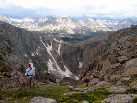
My husband, Jerry, standing in front of a sudden cirque and an amazing, panoramic view of the southern Wind River Range.

NOTE: The trailhead is in Dickinson Park, about 37 miles northwest of my hometown of Lander, WY. The trail starts at about 9,300′ elevation and gains about 2,600′. It’s recommended you hike the eight miles to the junction of the Lizard Head Trail, and then scramble approximately 350 feet up to the top of Mt. Chauvenet, via its western slope. We didn’t on this day, but Jerry and I did so about 11 years ago and it’s highly recommended!

HERE ARE 3 SHORT VIDEO CLIPS THAT PROVIDE A GLIMPSE INTO THE BEAUTY OF THIS HIKE. ENJOY!
Filed Under: Frontier Life, Travel & Tourism Tagged With: bears ears trail, hike, hiking, wind river range, wyoming

Blue Ridge Lookout: A Perfect Family Hike

July 22, 2010 by Shelli

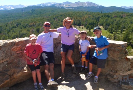
Blue Ridge Lookout is a short, but exciting hike for families, especially those who have small children. These are our boys.

I live in Lander, Wyoming, which is an awesome town with about 7,000 people in it, located in the foothills of the spectacular Wind River Range. Those of you who follow me and this blog are well aware of my love of this area and for hiking.

Recently, my husband, Jerry, and I took our three young sons on a favorite local day hike. The hike is only one mile round trip, making it an “easy adventure” for young children with small legs. (The hike starts at 9,600 feet elevation so there could be some effort and huffing and puffing even from the adults in the group.)

Family timer photo on top of the historic Blue Ridge Lookout.

The Blue Ridge Lookout was constructed in 1938. The views from the top are magnificent. Among other sights, you’ll see Wind River Peak and Atlantic Peak, Fiddler Lake and lots of forest. I have fond memories of making this hike with my siblings and parents when I was a kid. It is truly one of the best short hikes and picnic spots for families here in my back yard.

The trailhead is located about 23 miles southwest of Lander, along the Sinks Canyon-Louis Lake Road. The trail, which starts at about 9,600′ elevation gains about 365 feet by the time you reach the top of the lookout.

Note: Keep your young children on a short leash. This could be a dangerous destination for kids left unattended due to the heights of the lookout.

Here’s a short “video journal” of the day’s outing. It will provide visuals for the actual hike, as well as the lookout. Enjoy!

Filed Under: Family, Travel & Tourism Tagged With: blue ridge lookout, family adventure, hiking, wind river range, wyoming hikes

Deep Creek & Ice Lakes hike is epic

October 4, 2009 by Shelli

As I write this blog post, it’s Oct. 4 and we’ve had 18 inches of snow fall on my hometown of Lander, Wyoming.

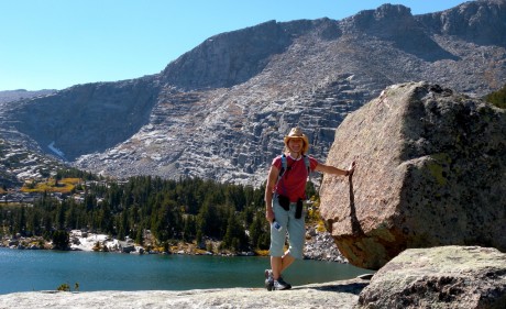
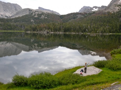
Stopping to pose by one of many beautiful lakes on a recent 25-mile day hike in Wyoming's Wind River Range.

Boy, I’m sure glad I was able to do the epic hike to Deep Creek and Ice Lakes in the southern Wind River Range a week ago. Last Saturday, on Sept. 26, we had a stellar Autumn day. Bluebird sky all day long and the trail — all 25 miles of it — seemingly to ourselves.

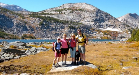
Holly Copeland, Leann Sebade, me, Milo the dog, and Florian Herrmann, in front of the first lake in the Deep Creek Lakes basin.

The hike was epic because it was beautiful. But also it was epic because it was long for a day hike. At 25 miles, the hike was one I thought I’d be taking alone. My husband, who is usually my companion on these long day hike efforts, is recovering from a 4-level neck fusion, so he was out. And, when I asked some friends if they’d be interested, one said: “Hmmm. How do I say this? I would do it if we had 2-3 days.”

But by some miracle, within a couple of days, I had 4 takers. I had a “group” to accompany me on this long day hike.

The cast of characters included Florian Herrmann, Leann Sebade and Holly Copeland, and her black lab, Milo.

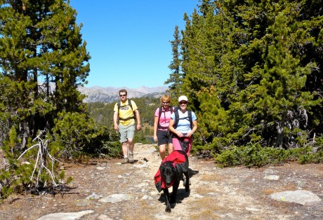
Holly and her dog, Milo, Leann and Florian, hiking through the Deep Creek and Ice Lakes region.

We departed down the Sheep Bridge Trail from Worthen Reservoir at 6:15 am with headlamps on.

We hiked to Sheep Bridge, then up the Middle Fork toward Pinto Park before taking the Deep Creek and Ice Lake Cutoff Trail. Then, for several miles we hiked amongst lakes and granite cirques and tundra. We returned via the Tayo Park, Middle Fork and Stough Creek Lake trails.

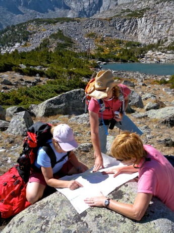
Oh oh, girls and a map. Trying to find our way. And we did, thank you very much.

It was a spectacularly beautiful hike. I was inspired by the stunning sights, the effort and the good company.

It was another remarkable day in this paradise in my back yard, the Wind River Range of Wyoming.

It’s tough to beat seeing so much of our magnificent Wind River Mountains as I can in one day while getting a great workout and spending time with great friends who are positive people and who are a great influence on my life. I feel very lucky.

By the way, my husband and three sons were able to track our progress and whereabouts all day long thanks to the Spot Satellite Messenger I had attached to my backpack. It logged GPS coordinates throughout the hike and Jerry and our sons watched us on Google Maps. Very cool. Here, I mapped the trip on Backpacker.com:

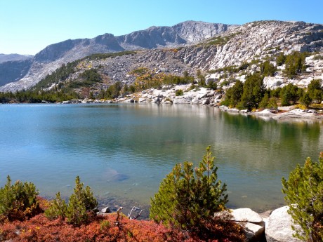
One of several beautiful lakes we hiked by.

Here are some video clips captured on the great hike. Enjoy!

Filed Under: Fitness, Frontier Life, Travel & Tourism Tagged With: backcountry, deep creek, deep creek lakes, hiking, ice lakes, middle fork of the popo agie, stough creek basin, wind river range, wyoming

Jackass Pass & Cirque of the Towers

July 25, 2009 by Shelli

Yesterday it became vividly clear to me, once again, why I love living in Lander, Wyoming.

Feeling giddy, and lucky, while hiking to the Cirque.

I was on an epic day hike that’s in my back yard in Wyoming. Along with a dear friend, Kathy Browning (also of Lander), I hiked the Big Sandy Lake trail over Jackass Pass to Lonesome Lake and the Cirque of the Towers. It was not my first time. I’ve been to the Cirque 3 times before. Still, every time I travel Jackass Pass and see the Cirque is like the first time. It is stunning. There’s no other way to describe it.
Kathy at Big Sandy Lake, 6 miles into our hike.

We left our home base of Lander, WY, at 5 am, and by 7 am, we were starting down the trail. By late morning we were having a picnic lunch above Lonesome Lake and the Cirque of the Towers.

The hike was about 18 miles roundtrip. Words fall short, and honestly I can’t find the words to adequately describe the sights on this hike. So this post will be mostly photos and video clips.

But since I’m a woman of (too) many words and can type 150 words per minute, what the heck, I will provide some verbage.

The first six miles from Big Sandy Trailhead to the end of Big Sandy Lake is an almost-flat “walk.” It’s mostly forested and follows alongside the Big Sandy River. If you look closely, you can see brook and cutthroat trout in its clear waters. This 6-mile stretch provides nice scenery and a gentle grade, but nothing spectacular.

Me, on start of Jackass Pass, along the Continental Divide.

Big Sandy Lake, however is spectacular I think. Although we didn’t see any yesterday, Big Sandy Lake is a great place to see black bears. The lake has a surface area of 71 acres. This is a great place to camp or for families to hike to – or to base out of on extended trips. The lake was like glass, reflecting the granite monoliths that tower over it, including Big Sandy Mountain, Schiestler Peak, Haystack Mountain, Temple and East Temple Peaks.

The Jackass Pass trail starts at the end of Big Sandy Lake and is what we went for. It’s breathtaking in more ways than one! The pass is said to have been named because “only a jackass would travel it.” I’ve hiked this trail with people who renamed it “The Dumbass Pass” (that only a dumbass would hike up) because it can make you discouraged on one of the steep, rocky inclines.

Kathy on Jackass Pass, with the prize--the Cirque of the Towers--showing themselves.

But what the heck, Kathy and I each have Grand Teton expeditions planned in August (mine in a week, hers in 2 weeks) and we were looking for a lung-buster workout. And trust me, the views Jackass Pass provides are extraordinary, and well worth the effort.

Jackass Pass sits atop the Continental Divide. Here, precipitation that falls on the Big Sandy side of the Divide eventually makes its way to the Gulf of California and the Pacific Ocean via the Big Sandy, Green and Colorado rivers. Precipitation that falls on the opposite side flows some 4,000 miles to the Gulf of Mexico via the Popo Agie, Wind, Big Horn, Yellowstone, Missouri, and Mississippi rivers. (BTW, much of the information about this hike, including the aforementioned, comes from Tom Carter’s Day Hiking the Wind River Range, a pocket-sized favorite of mine.)

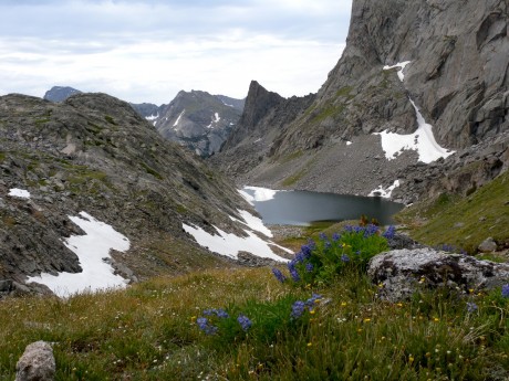
Arrowhead Lake (as you can see from its shape) is the view looking back, right before we arrive at the crest overlooking Lonesome Lake and the Cirque.

Basically the rest of the story goes like this: We climbed switchbacks, huffed and puffed, and oohed and aahhed at the spectacular views all around us.
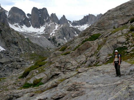
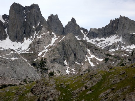
Cirque of Towers, about halfway across Jackass Pass.

Schiestler Peak, Temple Peak, East Temple Peak, Wind River Peak, Haystack Mountain, North Lake, Arrowhead Lake, War Bonnet, the Warriors, Pingora, Mitchell Peak, Lizard Head Peak, Wolf’s Head, Lonesome Lake, and other notable sights were in our view.

The views of the granite, glaciers and alpine tundra just take your breath away. I found myself trying to literally breathe in the sights before me. It’s amazing to me to know that we could leave our house in the morning in Lander, drive 2 hours in the car to the trailhead and somehow be sitting at the Cirque of the Towers for an early lunch.

By the way, it would be a real disservice to not mention here that the Cirque is home to world-class climbing. People come from all over the world every year to climb the walls found here. (Interested in climbing this area? Check out Cirque of the Towers & Deep Lake. A Select Guide to the Wind Rivers’ Best Rock Climbing, by Steve Bechtel.)

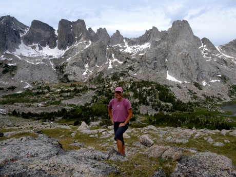
Me, posing at our destination, the prize. Cirque of the Towers.

For complete photos of the hike, click here.

Here are 2 video clips, of many, that we captured:

(The first is recorded especially for Steve Bechtel, my personal trainer at Elemental Gym. Without his fitness demands I would not be able to so easily pull off a long day-hike like this one. Here, I did an interval in his honor. : >)

and

Filed Under: Fitness, Frontier Life, Travel & Tourism Tagged With: cirque of towers, continental divide, hiking, jackass pass, lander, wind river range, wyoming

Angel’s Landing Hike in Zion National Park

April 24, 2009 by Shelli

Zion Trip, Pt. 2

Wow. I knew Angel’s Landing was exposed and that as a result of its heights and exposed nature it was to be an adventure.

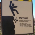
Important Information.

We had been to Zion a few other times but as a family. Our sons are small so we had been (wisely) advised to stay away from Angel’s Landing… until the kids grow up.

But in early March, Kathy and I were going on a girlfriend adventure vacation and Angel’s Landing would be the “big star” on our itinerary, around which everything else revolved.

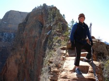
Holding on for dear life.

We got to the trailhead around 7 am to get an early start. We highly recommend that hikers start early. This way they’ll get to enjoy the views and the trail in solitude. I can’t imagine what it would be like hiking the narrow ridge to the top of Angel’s Landing if there was a line of hikers coming up and down. You don’t go hiking in a national park’s backcountry to be pressed and crowded. You can sleep in another time. (Or so we thought…)

We started up. It was pretty mild. A climbing and switchbacking trail to be sure, but nothing too tough to start. However, we had hiked to Observation Point the previous day which was 8 miles roundtrip and a gain/loss of 8,000 vertical feet. So we were “warmed up” anything this hike would throw at us.

Angel’s Landing is a 5 mile, roundtrip hike. For the first two miles, it’s a climbing trail but on a good trail that isn’t scary. Then, at two miles, the trail’s personality changes, big-time.

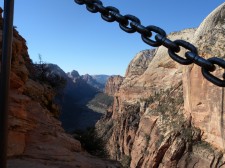
When we arrived at a narrow slick rock ridge that had chains/cables on which to hold, I thought to myself: “This must be where we get our money’s worth… This must be what all the fuss is about.” Even though I’d heard it was exposed and that small children shouldn’t go on the hike due to heights, for some reason I wasn’t mentally prepared for the reality.

Chains to hold onto.

I think it’s safe to say that Kathy, a flatlander from Omaha, was even more surprised than I was.

We ooohed and aahhhed and took in the views in all directions. I knew we hadn’t received the prize yet, but I think Kathy thought we had reached the end. Certainly the views were breathtaking and spectacular. The views at that point would have met my expectations in terms of scenery, no doubt.

But then when I was capturing some video I noticed that the cables/chains went all the way up, much further over a knife’s edge and to a precipice about a quarter mile away, yet.

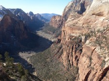
The Prize – well worth the anxiety.

Kathy’s response when I pointed out the cables that followed the very narrow steep ridge to the “top” was priceless. But she’s a trooper and we were off.


It was a thrilling adventure that left us anxious at times. The views at the top, and all the way up and down really, were striking and beyond words. The beauty was worth the hike, and all of the anxiety is stirred in us.
For an 8-minute clip of the “middle” of the Angel’s Landing Hike/Trail:

Filed Under: National Parks, Travel & Tourism Tagged With: adventure, angels landing, backcountry, backpacking, exposure, heights, hiking, national park, recreation, travel, utah, vacation, zion national park

  • « Go to Previous Page
  • Page 1
  • Interim pages omitted …
  • Page 3
  • Page 4
  • Page 5
  • Page 6
  • Go to Next Page »

Primary Sidebar

About Shelli

Hi. My name is Shelli Johnson. I live on the frontier in Lander, Wyoming. I’m a wife, a mother, an entrepreneur, certified life/leadership coach, wellness coach, keynote presenter and inspired speaker, leadership development facilitator, personal development strategist, writer and adventure guide. This blog mostly includes stories about adventures and travel, but other passions are reading/books, technology, fitness, nutrition, and national parks, so you’ll find a wide range of articles here. I am founder of Yellowstone Journal and YellowstonePark.com, and NationalParkTrips.com, which was my first business. My current company, Epic Life Inc., is in its 7th year, and going gangbusters. If you’re interested in learning more about my current work, I hope you’ll jump over there and learn more about that. I have a more personal blog, more directly related to life and living and leadership, at YourEpicLife.com/blog. I’d love it if you’d also check out that collection of my writings. Thank you for stopping by! Finally, if you’d like to connect with me directly, please email me if you’d like to connect.

  • Facebook
  • Instagram
  • LinkedIn
  • Twitter

Subscribe For Email Updates

Check your inbox or spam folder to confirm your subscription.

Archives

Links

  • Your Epic Life
Copyright © 2025 · Have Media Will Travel