• Skip to primary navigation
  • Skip to main content
  • Skip to primary sidebar

Have Media Will Travel

A blog about outdoor adventure, family travel, national parks, media, technology, marketing, fitness and me.

  • Travel & Tourism
  • Family
  • Fitness
  • Frontier Life
  • National Parks
  • Life and Leadership
    • Life Coaching
    • Epic Adventure
    • Leadership
    • Keynote Presenting

epic adventure

Spain or Bust: Camino de Santiago, Here We Come

May 27, 2018 by Shelli

“Twenty years from now you will be more disappointed by the things you didn’t do than by the ones you did. So throw off the bowlines, sail away from the safe harbor. Catch the trade winds in your sail. Explore. Dream. Discover.” –Mark Twain

Hi there!

Our Epic family trip is fast approaching, and we are so excited! We’ll spend a few days in Paris, then we’ll fly to Spain, where we’ll start out in Madrid for a couple of days, before embarking on the main part of our Adventure – our 160-mile pilgrimage on the Camino de Santiago. We’ll mark the end of our pilgrimage in Santiago de Compostela, before flying to Barcelona to celebrate the last four days of our Epic trip.

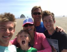
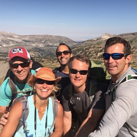
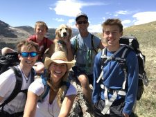
Four years ago, my husband, Jerry, and I resolved that we – our family – were going to start taking almost-month-long vacations. We have three sons, Wolf, 18, Hayden, 16, and Fin, 11. We have always enjoyed many family trips and adventures, but, until three years ago, we had never gone on a trip that lasted more than 7-10 days. What a gift it would be if we could take an entire month to experience new places, sights, cultures and activities as a family.

As a parent, I doubt myself often. I don’t boast a lot about my parenting abilities, but this idea is one I’m so proud of, and as parents, it’s definitely one of the best ideas Jerry and I have had.

Family selfie. That’s our dog, Buddy.

Some people may wonder how we can take a month off to make a trip every year. That’s a good question. It’s not easy, and it hasn’t always been possible. Our ability to do so is hard-earned and intentional. Having the time available is a gift. For us, time is worth more than money. Jerry’s a teacher, so he and the boys all get out of school at the end of May each year. Jerry didn’t always have his summers free, though. When we had our first company, Yellowstone Journal and YellowstonePark.com, for 15 years (from 1994-2008), Jerry’s summers were spent working tirelessly delivering magazines and helping me with the company. He worked so hard for so many years, logging endless hours and miles on the road. Fortunately, since selling that company in 2008, Jerry’s summers have been his. As for me, I work for myself, and since starting Epic Life Inc. in 2011, I have kept my summers mostly free.

These trips aren’t cheap even if we do our best to be frugal. We don’t make a very big income, but we are careful about our spending throughout the year, and over the years, have worked to eliminate most of our debt. We don’t live lavishly. (Our house needs a lot of work and updating, but we have not made it a top priority in the interest of this travel we’re wanting to do at this stage of our family’s life. We seldom go out to dinner, in an effort to save money for travel, and so on.)

That said, it would be easy to not embark on these trips. They are big undertakings, especially when they’re a month long and involve international travel, and a family of five that includes three growing boys with insatiable appetites for food. It would be easy to chicken out and say No. But we want to say Yes, so we book them far in advance, when we’re initially inspired, so we can’t draw back.

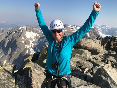
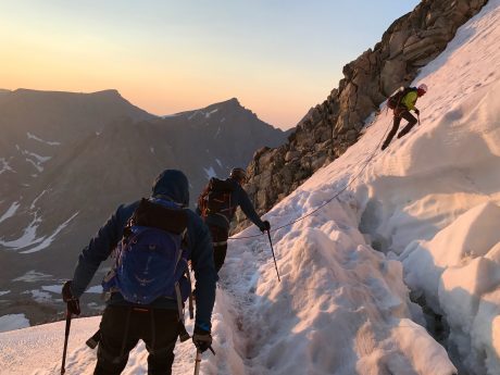
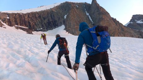
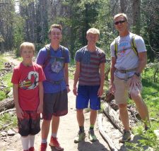
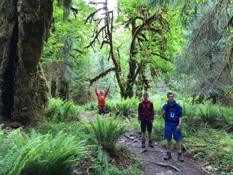
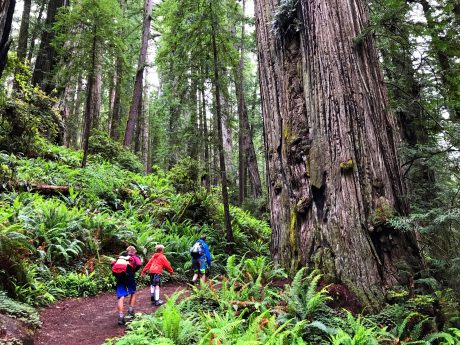
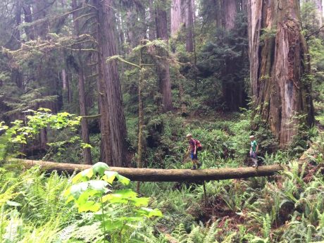
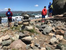
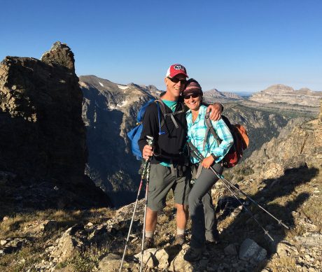
In 2016, we made our first international trip and explored several countries in Europe. It was an unforgettable experience that included time in London, Munich, Switzerland, Italy (Moneglia and Rome, etc.), and Portugal. We visited numerous historic and cultural sites, hiked many miles in Switzerland and Italy, drank beer and wine, indulged in the many delicious and unique foods of the countries, and met so many kind and interesting people. Plus, we successfully made about 100 train connections, which is no small feat for these country bumpkins from Wyoming! We kept a family journal, and each of us wrote something at the end of each of our 30 days in Europe. Each of us walked, on average, 13 miles per day, which is indicative of how much we saw and experienced. Every time we arrived to a new destination, by train, we’d hike 1-3 miles to discover what our accommodations would be like. It was all new and exciting and unforgettable, and to do it all as a family, was/has been such a blessing.

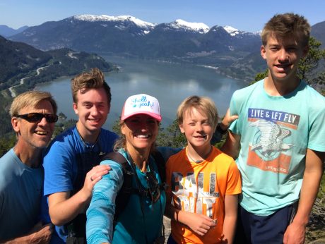
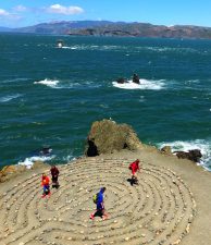
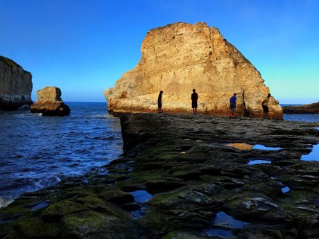
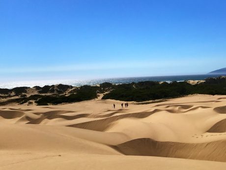
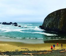
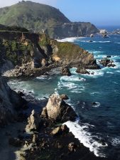
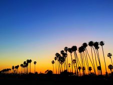
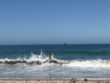
Then, last year, in 2017, we started in Vancouver, B.C., where we rented a van and enjoyed a month-long Epic Road Trip that took us all the way south to Los Angeles. From Vancouver to the San Juan Islands to Seattle, to Portland, to the coasts of Washington, Oregon and California, we immersed ourselves in the cultures of the cities, the wonderful environs of several national parks and beaches, and had another unforgettable adventure.

We still revisit, often, various aspects of both of our Epic trips, which, of course, is what Jerry and I were hoping for when we had this idea of the longer family trips. We wanted for us to create lasting memories and experiences that our family would be able to share forever.

Before continuing, I ‘d like to be completely transparent about something. I would be lying if I said these big trips, and the destinations we choose, have been family decisions. For the most part, they haven’t included a very democratic process. Rather, for the most part, Jerry and I have determined where we’d like to take the family, and then we share our dreams of the particular travel plans, and, at least so far, the boys have been excited and quickly jumped on board.

By the way, whenever it has come to something Jerry and I feel strongly will benefit our family, we have used this tactic. For example, when we first started our family, Jerry and I resolved that we wanted to be an outdoors family. I wrote an article, called “How to get your kids to hike” that explains how we went about raising an outdoors-oriented family. But for purposes of the point I’m trying to make here, I’ll cut to the chase. Whenever we wanted to take the kids hiking, we did not ask them, “Do you want to go hiking today?” Instead, we’d enthusiastically announce to them, “Today, we’re going hiking!” This simple strategy worked, and today our boys are great hikers, and we’ve spent the last 18 years adventuring with them.

When it comes to goals and values you’d like to instill in your family, I highly recommend this strategy. We are the “captains” of our families/kids for only so long, and Jerry and I are trusting that the decisions around travel and outdoors that we have made for our boys, and our family, will offer them lasting benefits.

But back to our upcoming trip. No question, I think Jerry and I are more excited about the Camino de Santiago portion of our trip than our boys are. While we’ll explore cities like Paris, Madrid and Barcelona, our itinerary’s main item includes 160 miles of trekking. Although by now the boys are getting more excited for the experience, I think it’s fair to say choosing a 160-mile-long walk wouldn’t have been their first pick. 🙂  (It’s so funny, when we were first considering this trip last Fall, while at dinner, we’d talk with the boys about the Camino de Santiago and the pilgrimage aspect. And then one day around that time, as I was walking with Fin to school, we were talking about the prospects of such a trip, he said, “You mean we have to walk?” LOL. Um yes, and then thinking to myself, Weren’t you listening at any of our recent conversations?)

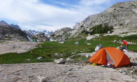
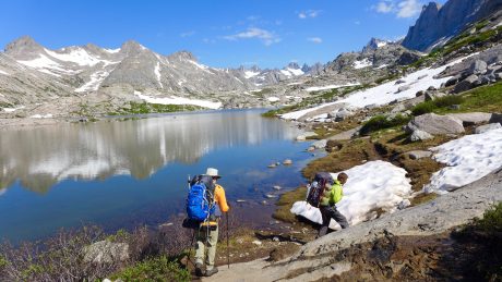
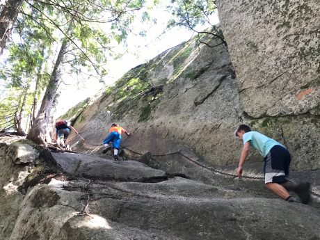
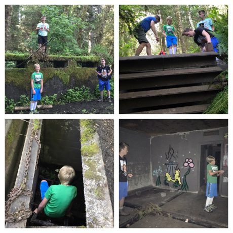
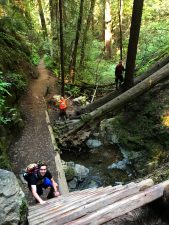
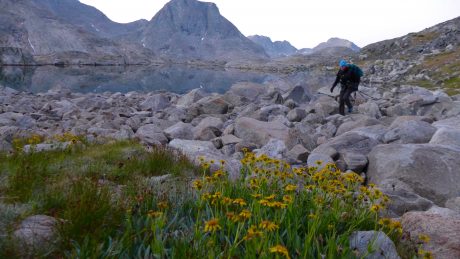
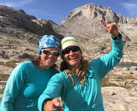
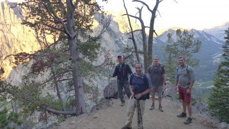
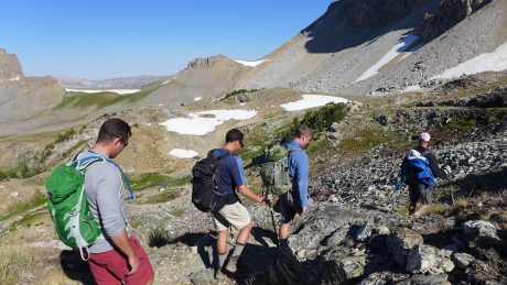
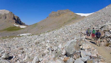
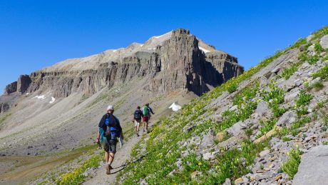
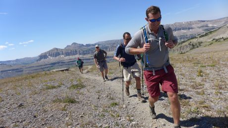
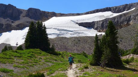
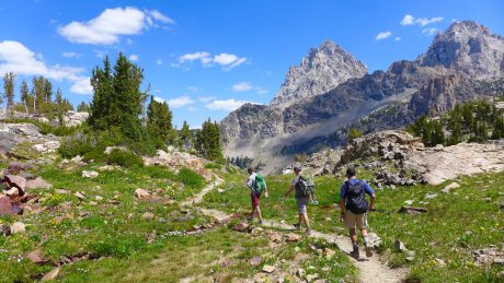
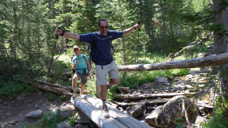
Our boys are big hikers and quite experienced when it comes to the outdoors. Most of our trips and adventures include hiking and/or camping. In Switzerland, we had two different day hikes that were about 20 miles each, and the boys, as long as we fed them often and generously, were champs! Over the years, we’ve taken them on backpacking trips, but those have been no longer than 3-4 days each.

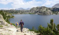
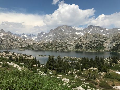
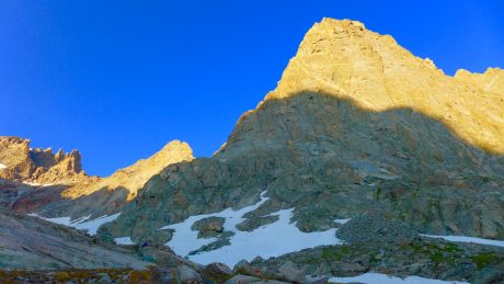
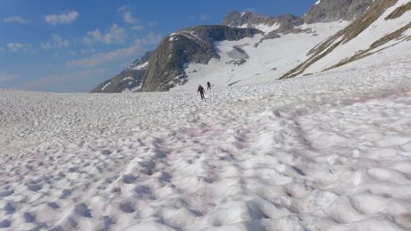
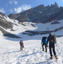
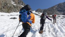
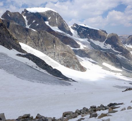
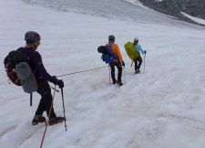
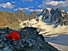
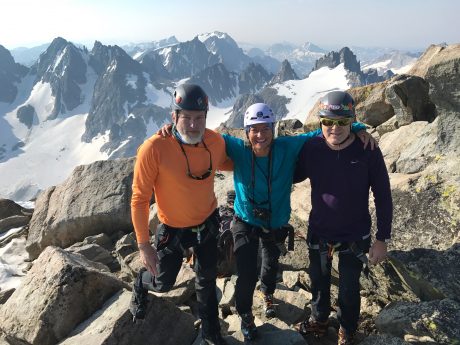
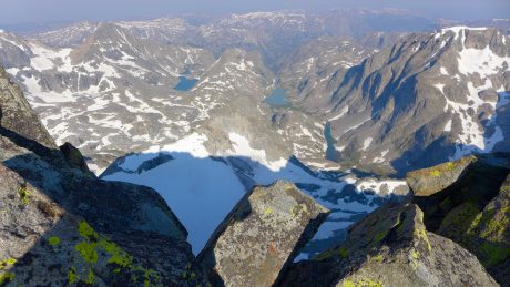
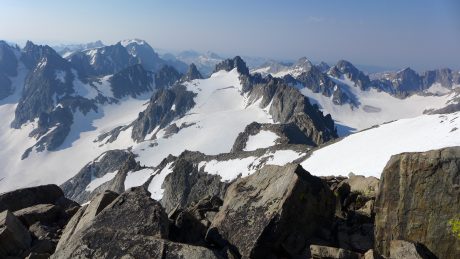
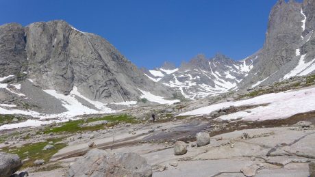
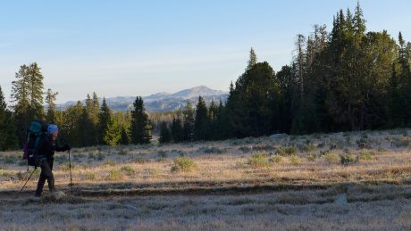
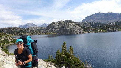
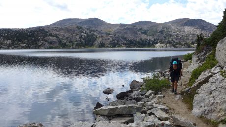
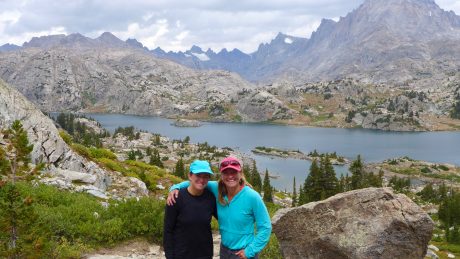
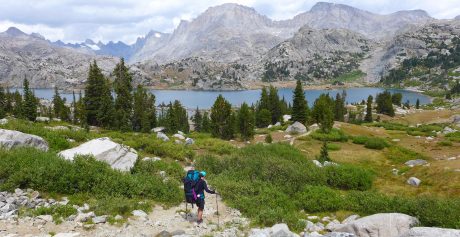
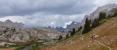
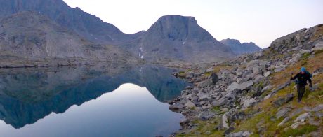
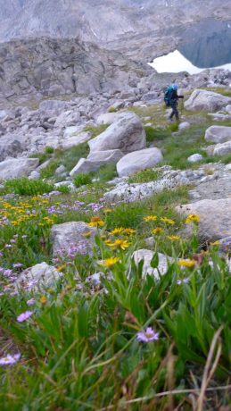
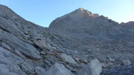
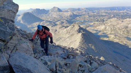
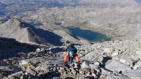
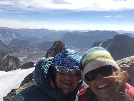
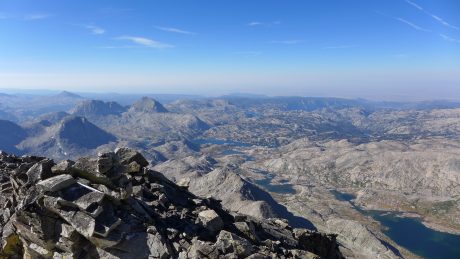
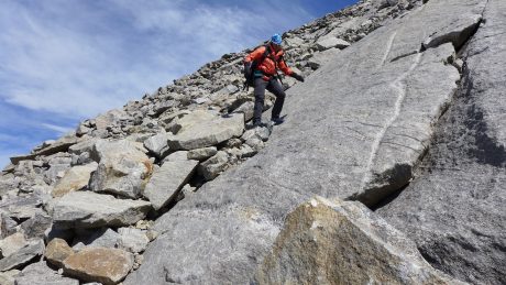
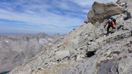
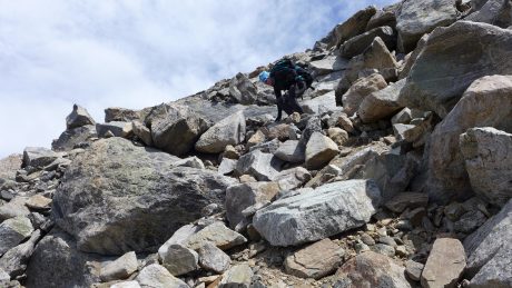
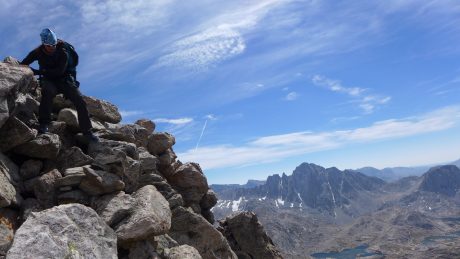
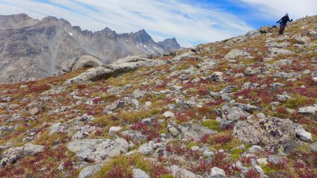
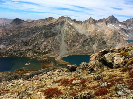
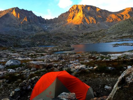
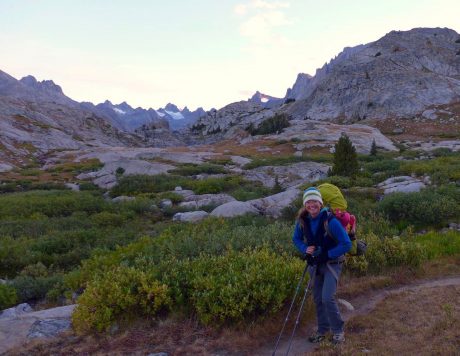
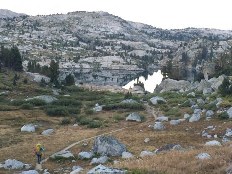
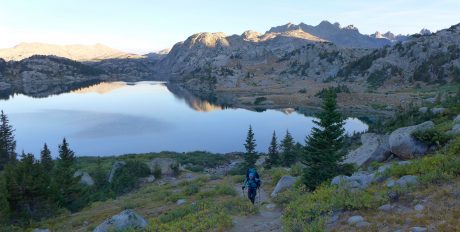
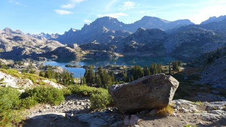
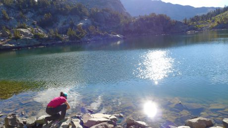
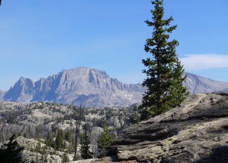
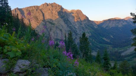
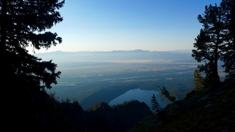
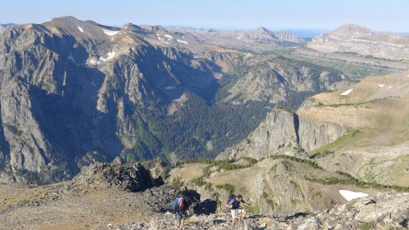
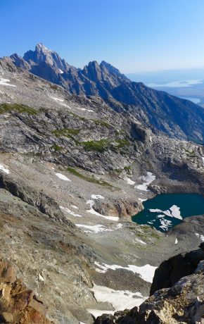
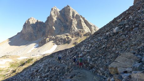
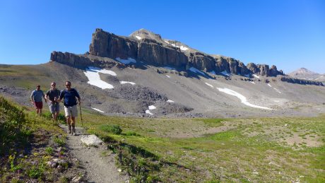
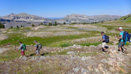
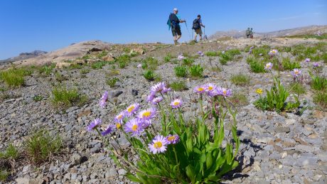
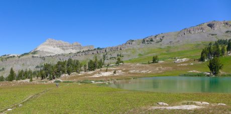
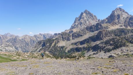
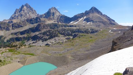
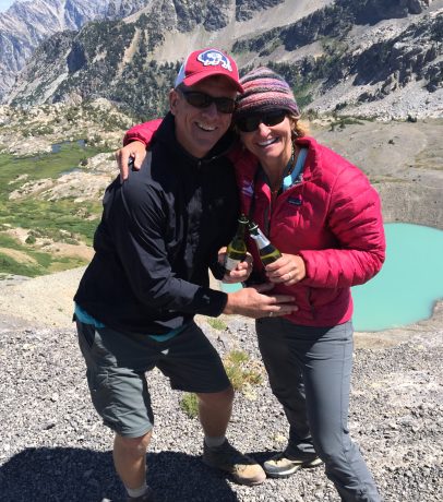
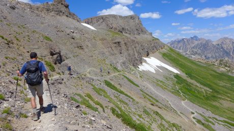
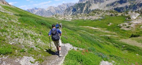
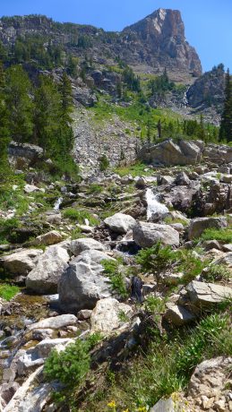
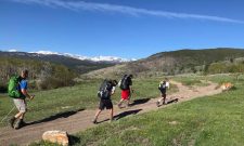
This trip’s pilgrimage on the Camino de Santiago will include 11 days of nothing but trekking. Day after day of nothing but walking. Some of our days are big, including our first and third, which will be 20-plus miles each. The other days range from 12-16 miles. So we’ve been training for the occasion, and these training hikes have added to the experience as we’ve had some memorable times in our “backyard,” the foothills of Wyoming’s Wind River Range.

Jerry and the boys, and our Buddy, on a training hike.

Why make trekking the Camino de Santiago a part of our big trip this year?

For starters, we can credit Martin Sheen and his son, Emilio Estevez. About six years ago, Jerry and I rented the movie, The Way. The movie, written and directed by Estevez, and starring Martin Sheen, is about a father who travels overseas to recover the body of his estranged son who died while trekking the El Camino de Santiago, and decides to take the pilgrimage himself. The movie is fantastic, and after seeing it, Jerry and I were both inspired to someday make the pilgrimage ourselves. Then, in recent years, and months, I’ve read books, and blog posts, and social media posts by people on pilgrimage. Friends, and friends of friends have shared photos and videos and personal accounts that have all re-inspired me about the Camino de Santiago. Various friends I know from my small town of Lander, WY, and the surrounding area, made the pilgrimage as recently as last year and have inspired us. Laureen Lund has a fantastic blog that includes her daily accounts of the experience. The best documentary, in my humble opinion, is Walking the Camino. We also read the book, and watched the documentary called I’ll Push You, which I highly recommend, whether you have interest in the Camino or not.  Other great books I’ve read are The Pilgrimage, by Paulo Coelho, Pilgrim Strong: Rewriting my story on the way of St. James, Sunrises to Santiago: Searching for purpose on the Camino de Santiago, as well as others. All of these have stoked the fire in me that was started when I originally learned about the Camino.

During a Fall hike last year, Jerry and I were brainstorming ideas for our family’s trip this summer, and I mentioned the Camino. We talked about how in Spring 2019, Wolf will will be graduating high school and leaving the nest, and the next year, it will be Hayden’s turn. Fortunately we will have five years after that before our youngest son leaves the nest. The realization that we have only a short time remaining that our whole family will be living under the same roof together ultimately inspired us to want to do this trip, and to do it right now. (I read somewhere that 80% of the time we will spend with our children happens between their birth and age 18. As parents I think we know this, and yet being reminded of it is helpful.)

A pilgrim is a person who journeys to a sacred place. The Camino de Santiago is certainly a sacred place. Often referred to as The Way of Saint James, the Camino de Santiago was one of the most important Christian pilgrimages during the Middle Ages. Legend has it that the remains of Saint James the Great, one of the apostles of Jesus Christ, were carried by boat from Jerusalem to northern Spain, where he was buried in what is now the city of Santiago de Compostela. Once to Santiago, pilgrims often celebrate mass at the spectacular Cathedral of Santiago de Compostela, which marks the traditional end of the pilgrimage route.

Certainly, to walk where millions of others have walked before us in the interest of searching for meaning and to deepen their faith or spirituality will be such a unique experience, and an honor. I’m excited to be a pilgrim, and for my family to be pilgrims, even if it’s for only 11 days.

A pilgrimage is a journey. (In my work – whether in my coaching, or my epic adventure guiding – I’m often trying to lead my clients on an inner pilgrimage. A journey to discover more about themselves, and to, in the process be open to exploring and taking chances.) I know firsthand, and also from my observations of those I work with, how powerful such a personal journey can be. I’m excited beyond words to be embarking on a pilgrimage as a family. The pilgrimage has the opportunity to transform our family in some way, while affecting each of us individually in unique ways.

For days, our only objective will be to put one foot in front of the other.  While it will certainly at times be physically challenging, the other aspects of the pilgrimage are what really intrigue Jerry and I.

Many follow a route of the Camino de Santiago as a form of spiritual path or retreat for their spiritual growth, or any number of very personal meanings.

The Way can take one of dozens of pilgrimage routes to Santiago de Compostela. Traditionally, as with most pilgrimages, the Way of Saint James began at one’s home and ended at the pilgrimage site. However, a few of the routes are considered main ones.

We will be following the Camino Francés – or, The French Way.

During the Middle Ages, the route was highly travelled. (In the 14th Century, a million pilgrims from throughout Europe wold make the pilgrimage every year.) However, the Black Death, the Protestant Reformation, and political unrest in 16th century Europe led to its decline. By the 1980s, only a few hundred pilgrims per year registered in the pilgrim’s office in Santiago. In October 1987, the route was declared the first European Cultural Route by the Council of Europe; it was also named one of UNESCO’s World Heritage Sites. Since the 1980s, the route has attracted a growing number of modern-day international pilgrims.

Today, about 300,000 pilgrims from throughout the world make the pilgrimage each year.

From here on out, I’ll take the lazy route and include some particulars about our journey in the form of bullet points. Feel free to leave a comment if you have questions about anything that might be of interest that I have overlooked.

• We’ll start our trip with 3 days in Paris, taking in the sights and foods there. At least by our family’s standards, this portion of the trip will find us “living large. ” 🙂

• Then we’ll fly to Madrid,  a city we will explore for two days.

• On June 5, we’ll send most of our luggage off, to be transported to the end of our journey, and we’ll head to Astorga. Our pilgrimage will begin on June 6.

• The entire Way is 790km/490 miles. Many people take 30-50 days to walk its entire length. Others will do a portion of it, and return in future years to complete the entire path. As for us, and this trip, we’ll be dedicating 11-12 days to our pilgrimage, and we’ll walk about 160 miles.

• It’s a good thing we’re from high country in Wyoming, and that we’re hikers because we will have some big days, including days 1 and 3, when we’ll walk about 22 miles. Other days will be 12-16 miles each.

• Staying in the albergues/hostels are a big part of the Camino de Santiago experience. I understand that. But we have instead opted to stay in Inns along the way. We have reserved private accommodations for our nights along the Camino. This may seem less adventurous, but after reading accounts of “100 snorers,” our decision was made. I already have 4 personal snorers with me, but also, in addition, due to some of our big mileage days, having some personal space each night feels important to us.

• All of the great books I’ve read include pilgrims’ accounts of carrying wine in their backpack, or enjoying wine along the trek. Okay, okay. Twist my arm and sign me up for some of that. 🙂

• Siestas. I think the whole family is excited about Siestas. Especially if we are in the middle of a big uphill, and suddenly it’s “Siesta time.” We will want to honor the traditions…

• We’re looking so forward to all of the people we meet along the way, and to hearing their stories, and to sharing such a meaningful experiences with “strangers” who are from all over the world. We are each/all likely to make some new friendships.

• I used to know Spanish pretty well. I took Spanish in high school and for two years in college. Unfortunately, I don’t remember much of it, so I have been using the Duolingo app to learn some words and phrases. Wolf and Hayden are pretty good at Spanish, and they are looking forward to trying their best to use the language. We will rely on them to help us communicate our needs along the path, and in Madrid and Barcelona. That will be fun.

• Each of our family members has a “Credencial de Peregrino.” This document dates back to the middle ages, when it was given to pilgrims as a safeguard. This Credencial is only for pilgrims on foot, bicycle or horseback, who wish to make the pilgrimage with a Christian sentiment, even if it is only with an “attitude of search.” The Credencial has the purpose of identifying the pilgrim, provides access to hostels offered by the Christian hospitality of the Way, and to serve as certification in applying for the “Compostela” at the Cathedral of Santiago, which certifies you have made the pilgrimage. Each of us will collect two stamps on our Credencial at every village, etc., we pass through.

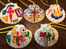
• Scallop shells. The scallop shell, which is often found on the shores in Galicia, has long been the symbol of the Camino de Santiago. When we booked our trip several months ago, we bought scallop shells and then had the idea that we should draw names, and then design the shell for the family member whose name we drew. This was really meaningful. Last night we presented each other with the designed shells, which will be attached to our backpacks during our pilgrimage. (See photo of our designed shells at the bottom of this post.)

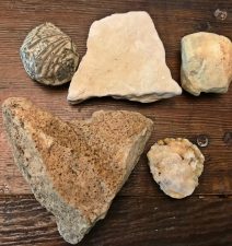
• Rocks from home. The highest point of the pilgrimage is a place called Cruz de Ferro, marked by a towering iron cross. Since the 11th Century, pilgrims have been bringing a stone from their homeland to the Cruz de Ferro. Once there, pilgrims approach the small hill with silence and respect, before placing their rock at the cross. This symbolizes a release of burdens. On one of our training hikes, the main objective for everyone was to find a special rock for purposes of leaving it at the Cruz de Ferro. (See photo of our rocks and brief explanation of why we picked the ones we did.) Most importantly, I have been thinking a lot about the “burden” – what I want to leave behind – on this journey. As a mother, I find I’m grasping. I know it’s understandable that I am trying to hold on tightly to my boys and my/our time with them. Wolf’s leaving in a year, and Hayden’s leaving in two years, and my worries about that are causing this grasping. But I know I need to work to not grasp, to trust and to sort of let go. I’m pretty sure whatever I try to leave on the Camino will be related to that. (If this struggle is something you’re contending with, you might check out these two gems I’ve been meditating on so frequently I have them almost memorized: On Children, by Kahlil Gibran, and She Let Go, by Rev. Safire Rose.)

• We will end in Santiago de Compostela, so we’re starting about 160 miles out from there, near Astorga. We are looking forward to celebrating our pilgrimage’s end in Santiago, where we’ll stand in line to get our stamped Credencials validated and receive certificates for our pilgrimage.

• At Santiago, a highlight for us will be to attend mass at the extraordinary Santiago De Compostela Cathedral. I can imagine it will be one of the most meaningful and unforgettable masses we’ve ever attended. One of the most interesting elements about the cathedral is the famous Botafumeiro, a large censer which disperses incense amid the congregation. Weighing 117 pounds and measuring 5 feet, it is one of the largest in the world, and is suspended 65 feet high above the crowd via a system of ropes and pulleys. On special occasions, and after some masses, the Botafuemeiro is released by team of eight tiraboleiros who swing it across the cathedral at great speeds of up to 42 miles/hr).

• It is thought that this tradition of spreading so much incense over the mass was started in order to cover up the smell of the thousands of pilgrims arriving at the cathedral after their exertions. We’ll soon be among those sweaty pilgrims, and I am pretty certain the incense will be a most welcome scent!

Finally, the Camino de Santiago pilgrimage will surely present us with challenges and blessings. What the journey will mean for each of individually and as a family is a mystery. And I love that it is.

Marcel Proust wrote, “The real voyage of discovery consists not in seeing new landscapes, but in having new eyes.”

We will see new landscapes on this adventure, but we are also sure to return with new eyes.

Thank you so much for reading this blog post, and following along, as I blog from The Way. I really appreciate your stopping by and taking an interest. Truly.

(Note: The guidebook we are trusting for most of our pilgrimage along The French Way is A Pilgrim’s Guide to the Camino de Santiago: Camino Francés.)

When we booked our trip several months ago, we bought scallop shells and then drew names. Then, each of us designed the shell for the family member’s name we drew. We will each have our shell attached to our backpacks during our big trek. (The scallop shell, which is often found on the shores in Galicia, has long been the symbol of the Camino de Santiago.)
These are our rocks. And they are not just any rocks. We each found one of these on a training hike, and have been carrying them in our packs for months. We will each deposit our rock at Cruz de Ferro during a stage (the highest point) of our Camino de Santiago pilgrimage. Since the 11th Century, pilgrims have been bringing a stone from their homeland to the Cruz de Ferro. Once there, pilgrims approach the small hill with silence and respect, before placing their rock at the cross. This symbolizes a release of burdens. (Mine is the heart rock-duh!! Jerry’s is the fossil. Wolf’s is the white square that resembles a little blank page. Hayden’s looks like a slightly roasted marshmallow, and Fin’s has crystals in it.)


Video of a training hike: 

HERE ARE DAILY BLOGs FROM OUR UNFORGETTABLE CAMINO PILGRIMAGE:

Day 1 on the Camino de Santiago.

Day 2 on the Camino de Santiago.

Day 3 on the Camino de Santiago.

Day 4 of the Camino de Santiago.

Day 5 on the Camino de Santiago.

Day 6 on the Camino de Santiago.

Day 7 on the Camino de Santiago.

Day 8 on the Camino de Santiago.

Day 9 on the Camino de Santiago

We made it! Day 10 on te Camino de Santiago

Filed Under: Family, Fitness, Frontier Life, Life and Leadership, Travel & Tourism Tagged With: camino de santiago, epic adventure, epic family vacation, epic life, Family, journey, pilgrimage, shelli johnson, spain

Climbing Wyoming’s Hidden Giant, and its Tallest Mountain, Gannett Peak

August 7, 2017 by Shelli

“You cannot stay on the summit forever; you have to come down again. So why bother in the first place? Just this: What is above knows what is below, but what is below does not know what is above. One climbs, one sees. One descends, one sees no longer, but one has seen. There is an art of conducting oneself in the lower regions by the memory of what one saw higher up. When one can no longer see, one can at least still know.”― René Daumal

Yeehaw! At the top of Wyoming, on Gannett Peak.

As I write this, I feel exhilarated and inspired. You see, I got to stand at the top of Wyoming’s tallest mountain, Gannett Peak, last Thursday.

I hike about 1,000 miles a year, and I’ve climbed several peaks, including Wind River Peak, Fremont Peak, East Temple, Mitchell Peak, Lizard Head, the Grand Teton, Mt. Whitney, and others. But until last week, I had never even laid eyes on my state’s tallest mountain. So excuse me for my exuberance, but now that I’m back in the lower regions, I’m remembering what I saw higher up…

And, just so you know, this is a very long blog post. As Mark Twain said, I would have written less, but I didn’t have time. I am behind at work from being in the wilds for 6 days, and yet I wanted to capture this experience, and to share it with others, while it’s so fresh in my mind. So, thank you in advance if you read what is a long-form article.

The very isolated Gannett Peak stands 13,809’ tall. It is the high point in all of Wyoming, and that fact is what draws many to the area to climb the mountain. For the record, Gannett’s status as being the high point in Wyoming is actually not the main reason I wanted to climb it. I was most interested in seeing what is very much, despite its height, a “hidden” mountain. I also wanted to see and travel over some of the last remaining glaciers in the Lower 48, including Gannett Glacier, on the north side of the peak, which is apparently the largest glacier in the Rocky Mountains south of the Canadian border. I’m always looking for interesting experiences, and climbing Gannett fit the bill, and then some.

I am in mountain climbing shape, and have years of backpacking experience, but I don’t have technical mountaineering expertise. So to climb Gannett, I signed on with Jackson Hole Mountain Guides for a guided expedition. 

There were two others signed up for the same expedition – Rick, from Texas, and Robert, from Mississippi. Rick and Robert are “High Pointers.” If they could summit Gannett Peak, it would be #47 out of 48 for them. (BTW, since my return, I think I am talking with a bit of a Southern accent, the result of being around Rick’s and Robert’s charming southern voices for 6 days.)

Robert and Rick, best friends and “high pointers.”

Nate Opp would be our guide. Nate was one of the guides who led me up the Grand Teton in 2009, and I like his style, so I was psyched he would be the one facilitating the meaningful adventure for us.

From what I can tell, there are three ways to approach Gannett Peak, from the West, via Elkhart Park, or from the East, via Glacier Trail, near Dubois, WY, or via Ink Wells and the Wind River Indian Reservation (with permits, etc.) 

The expedition would be six days, which at first to me, seemed like a long time required to climb a peak. (I don’t recommend it, but I’ve climbed Wind River Peak, and other lesser peaks, in a single day. Most often, though, I will take 3-4 days to hike a long ways and climb a single mountain peak in the Wind Rivers.)

But when I looked at the maps, six days made perfect sense. Anything less than that, from the West side, seemed almost unreasonable, given variables like the weather, and snow depths and conditions, the altitude, etc. I could have signed on with another reputable company and approached from the East side, which was closer to my home of Lander, and the expedition would have required only 5 days’ time. But when I saw the route from the West approach, and realized it went through Titcomb Basin, I was even more excited. I had been into Island Lake and into Indian Basin (and up Fremont Peak) before and it is one of the most stunning regions I have ever seen.

“Summer breezes caressed me, my legs stepped forward as though possessed of their own appetites, and the mountains kept promising. I stopped before the trees were gone, not ready that day to disappear entirely into the vastness. Perhaps these spaces are the best corollary I have found to truth, to clarity, to independence.” – Rebecca Solnit, A Field Guide to Getting Lost

Day 1: I love that quote from one of my favorite writers and books. We started at Elkhart Park trailhead, near Pinedale, WY. From there, we hiked 13 miles, passing many beautiful lakes, including Barbara, Hobbs, Seneca, Upper Seneca, Island and others. As soon as I started hiking, my legs stepped forward as though possessed of their own appetites, and the mountains kept promising… 

Nate, Robert and Rick, hiking alongside Seneca Lake on Day 1.

We pitched our tents in Titcomb Basin, just past the Indian Basin Junction. We had a huge waterfall feature right near our tents, that included several cascades that drained into a lake that was below, in view from our tents. We had stellar views, including one filled with jagged granite peaks and glaciers that beckoned. If all went well, we’d soon find ourselves deep in those mountains and glaciers…


Island Lake, reached at about 11 miles.

We hiked efficiently and arrived, and had our tents pitched by 3pm. I lounged around like a marmot on a big slab of granite under the warmth of the sun, while drinking in the waterfall soundtrack and the breathtaking views.

Not too shabby of a campsite. We’d camp here on nights 1 and 5.

The lounging lasted only an hour or so before the weather changed drastically, and we raced for our tents. While in my tent, thunder echoed raucously against the granite towers that surrounded us, followed by lightning that lit up my tent. I am terrified by lightning, and this reminded me of a night at Clear Lake with my family that was the most scary night of our lives.

That night, lightning lit up our tent repeatedly and thunder roared as rain poured down for several hours. I never prayed so hard, and it felt miraculous that we had survived the night. I had hoped to never find myself so high up in a tent under those circumstances again, which I know is an unrealistic hope. If I am going to play in the high country, there will almost certainly be some thunder and lightning. (And it didn’t help that I recently read the fantastic book, A Bolt from the Blue, about the terrifying (and heroic) rescue in 2003 at 13,000′ on the Grand Teton. The page-turner-of-a-book tells the true story about a colossal lightning bolt that struck and pounded through the body of every climber in a group of six. 

I know, I know – these things are not helpful when laying alone in a tent at 10,500′ that is getting lit up by lightning just seconds after raucous thunder echoes against the nearby granite mountains… I work with leaders and coach people all the time about the opportunity we have to “choose our mindset.” The late Viktor Frankl, an Austrian psychiatrist and a Nazi concentration camp survivor who wrote the influential Man’s Search for Meaning, argued that the last of the human freedoms that cannot be taken from us is our choosing how we will respond to our circumstances. I remembered this, and the work I do, and tried to change my “I’m going to be struck by lightning and die out here” mindset to “What a spectacular storm!” mindset. It didn’t work, but it wasn’t for a lack of effort.

So I lay there, uneasy and a little bummed that this adventure was off to this kind of start. I got out my journal and found notes from each of my three sons and my husband in the back. I read those a few times, and felt comforted. I know how blessed I am to have a family who supports these epic adventures of mine, and their thoughtfulness touched me. Luckily, the storm was short-lived. After about an hour and a half, the storm passed through, and we had blue sky and sunshine again.  

After emerging from the storm, and our tents, Nate made us an epically delicious dinner of tacos, complete with guacamole, and peppers and salsa. We all ate like people who were super duper hungry. 🙂

I was getting to know Rick and Robert by now. After hiking several miles together, and now having shared our first meal together, we were acquaintances. I liked them immediately. They are kind, Southern gentlemen. 

For the first time since starting Epic Life Inc., I chose to forego leading my flagship program, Epic Women, this summer. Every year at this time, I am leading my Epic Women expedition in the Wind Rivers. I coach women individually for several months, and then they all come together to meet for the first time, and we go into the wilderness to backpack and climb mountains.

This year, I wanted to do something personal instead. I was longing to do something new, and that would challenge me and expand my abilities. I also wanted to see some new sights, get inspired, to enjoy some solitude, and to not be in charge.

Like me, Rick and Robert were excited to be in the wilderness, and on an expedition to climb Gannett. Robert and Rick have been best friends for 40+ years. (It’s funny; I’m working right now on a project I’m calling Project Friendship. I’m reading a lot, and writing a lot, about friendship. I’m doing a lot of personal research on friendship, which is a source of great inspiration for me right now. And here on my Gannett Expedition, are two people who have been best friends for 4 decades. I always say, there are no coincidences…)

Robert and Rick are both avid drummers and musicians, and that’s how they originally met. For the last 10-12 years, they’ve been traveling the country bagging the high point in each of the states in the Lower 48. If they could stand on Gannett, it would mark their 47th of 48 high points.

After day 1, I felt reassured that the Universe arranged for Rick and Robert to be my trail comrades for such an epic adventure. And, we had a guide that I trusted. So far, so good…

“Being in the wild gathers me. It astonishes me. It quiets the negative voices inside of me and allows the more constructive ones to talk. It humbles me. It reminds me of how small I am, which has the reverse effect of making me feel gigantic inside.” –Cheryl Strayed


Day 2: We woke up at 7am, and had coffee while Nate cooked us a great breakfast of Huevos Rancheros. Mid-morning, we broke camp, and backpacked to the uppermost reaches of Titcomb Basin.

We hiked through wildflowers, snow, and alongside several lakes that were smooth as glass and that reflected the snow-capped, looming granite peaks in their waters. I was captivated the entire way. I’ve got many favorite trails and areas in my beloved Wind Rivers, and Titcomb Basin is at, or near, the very top of that list. It is incredible.  

Nate and Robert, hiking past one of the many upper Titcomb Basin lakes.
Nate Opp, our very capable guide from Jackson Hole Mountain Guides.

It’s impossible to not feel tiny in this country. And, as writer Cheryl Strayed so eloquently wrote, this has the reverse effect of making me feel gigantic inside. Huge, granite mountains towered above us as we hiked, and only a wide angle lens has any chance of capturing the alpine tundra, lakes and mountains in a single shot.

I spied these goats near our camp in the upper reaches of Titcomb Basin.

After about 6 miles, we pitched our tents as close to the base of Bonney Pass as possible. Ours was truly one of the most scenic campsites I have ever enjoyed. We were right under the towering Mt. Helen, and other tall peaks.

As I was pitching my tent, I spied movement out of the side of my eye. It was a herd of about 20 goats –- bighorn sheep ewes? I wandered quietly toward them and was able to watch them for some minutes. (see photo or video) We were all excited to see the wildlife, as we had only seen some songbirds, squirrels, marmots and pika, and weren’t expecting to see much in the way of wildlife on this trip.

Here’s a short video clip of the goats:

Our tents were right underneath Mt. Helen, lit up by evening alpenglow here.

Our camp was surrounded by massive snow fields that adorned the towering peaks that jutted up from the alpine tundra all around us. We had a huge winter in Wyoming this year, and there was still abundant, melting snow all around us. And, close in our sight, was what would be one of the cruxes of our Gannett Peak summit ascent– Bonney (Dinwoody) Pass.

The pass is about 1,200 feet tall, and it’s steep (like in 45 degrees? steep), and mostly covered in snow. I have fitness for hiking up steep hills, but this would be different. We’d have crampons and helmets on. We’d be roped up. We’d have our ice axe at the ready for self arrest, and it would be, well, a serious undertaking, with high consequence should something go wrong.

The other thing about approaching and summiting Gannett from the West side is you have to not only go up Bonney pass, but down it, and across Dinwoody Glacier before you go up to Gannett’s summit. And, well, what goes up and down and up, goes down and up and down on the way back. It would be a truckload of hard-earned effort, and all of it technical and with high consequence.

I’ve hiked literally thousands of miles in these Wind River mountains during the last 20 years, but never had I spied with my own eyes the state’s tallest peak.

Gannett is remote, and very much hidden. So while I was a bit afraid of the task of ascending the steep pass, I could hardly contain my excitement for the sight that awaited me once we crested it. 

Not only would I see Gannett Peak, but the map I studied indicated the view I’d get from the top of the pass would be full of glaciers. Last year, I climbed Fremont Peak with a friend, and was blown away when we got to the top of Fremont, and was rewarded by sights of the huge Fremont Glacier, and other glaciers in the distance. That sight had whetted my appetite. I wanted to see more glaciers in my backyard.

We enjoyed another great dinner that night, and we all talked nervously, but excitedly, about the next day’s plan.

I didn’t sleep a wink on night 2 because I just couldn’t wait to see Gannett Peak for the first time. I was just too excited for slumber.

“We cannot lower the mountain, therefore we must elevate ourselves.” – Todd Skinner

Day 3: Whenever I’m traveling, or camping in the wilderness, upon first waking, I always am a little disoriented and have to quickly search my brain for where I’m at. As my eyes first opened on Day 3, and I remembered where I was and what I was doing in Titcomb Basin, the above wise words are what came to mind. The late Todd Skinner was a friend, and a climbing legend, and an inspiration to so many. Today would be the first day of this expedition to really test my mettle.

Looking back at Rick and Robert, as we headed toward our first real crux of the expedition, Bonney Pass. That pattern in the snow is called “snow cups.”
That’s Bonney Pass, ahead, and at top left of the photo. This is on Day 3, our start toward Gannett Peak…

I have leveled up my whole life. By leveling up, I mean I have signed up for or tried things I didn’t have the skills to do. Even though I may look like a fool, stumble, or fail, I believe in doing hard stuff. Abraham Maslow called it self actualizing, when we become actually what we are potentially. We can’t ever realize our potential without leveling up and daring to fail and doing hard stuff we don’t know exactly how to do. In short, I get a lot of fulfillment out of learning, and whenever I level up, I am guaranteed to learn new skills, not to mention more about myself.

Although we wouldn’t climb the mountain until Day 4, we’d start our “climb” today, on Bonney Pass. I was uncomfortable just thinking about what would be required. But as Todd said, we cannot lower the mountain, we have to rise up to meet it.

We were all up early, and Nate had coffee on for us before feeding us a breakfast that included bacon. Yes – you read correctly, bacon! Those who know me know that bacon is one of my favorite foods, so this made me extremely happy. The day was already a winner.

Nate was one of the guides who helped lead me to the Grand Teton’s summit in 2009. I like his style, and he’s very experienced, so although our adventure was full of uncertainties, one certainty was that we were in very capable hands.

During the previous day, and again over breakfast on Day 3, Nate shared and reviewed his vision for our expedition, which was to “slim our loads way down,” making them as light as possible while still carrying tent and sleeping bag, cook stove and food and clothing layers. We’d take our slimmed-down backpacks up and over Bonney Pass, down and across Dinwoody Glacier, before ascending a small outcropped ridge that’s situated about 2,000’ below Gannett Peak. There, we’d put in a camp for the short night before our summit attempt.

Nate explained this would make for a more reasonable summit day on Day 4, not to mention a richer overall experience. (Many who approach from the West side, via Elkhart Park, go up and over Bonney pass, across Dinwoody Glacier, then up to Gannett’s summit, and then all the way back. It can make for a 14-hour day for the most fit, and a 20-hour day for “average” adventurers, especially for those coming from sea level.) Even if we had the fitness for it, it didn’t sound very appealing, and Nate’s vision and reasoning were compelling.  

When on a mountain climbing expedition, I want to climb a mountain, but I also want to maximize the experience. I’m willing to wake up at an hour in the wee hours of the morning to get a good start before the sun comes up, but if possible, I’d like for most of the experience to be during the light of day so I can see all of the awe-inspiring sights. I don’t want to experience half of the journey in the dark, and I want to be able to linger at least a little in such an awesome, and hard-to-get-to, setting. Add to that, ascending and descending the treacherous and steep Bonney Pass at the end of a Gannett Peak summit day is hard enough without having to do it twice in a single day. (That’s why when I climbed the Grand Teton in 2009, I opted for the 4-day experience with Jackson Hole Mountain Guides instead of the two-day option. I definitely had the fitness for the accelerated trip, but I wanted an optional summit day in case weather wasn’t favorable, and also, very importantly, I wanted to spend a night in celebration at the incredibly scenic high camp rather than rushing down a steep mountain to re-enter my civilized life more quickly than necessary.)

After breakfast and reviewing our plan, we cached the food and supplies we chose to leave behind, put our crampons and helmets on, and headed toward Bonney Pass.

At first it was easy going. We walked on a gradual uphill to the base of Bonney Pass, and I got used to walking on snow while wearing crampons. Once at the base of the pass, Nate roped us up and gave us some instructions.

Mountaineers rope up to mitigate the risk of of falling on steep, hard snow or ending up in a crevasse. Should a person fall on a steep snow slope, someone, or all, in the roped group will help to use their ice axes to stop the person from falling and/or pulling everyone down the slope with them. Or, if a person were to fall into a crevasse while traversing a glacier, being roped up and spread out will hopefully prevent that person from falling to his/her death or from suffering serious injury.

Roped up and making our way up the steep Bonney Pass.

Nate explained we should keep the rope between each of us taut, not slack. Rick and Robert had much more experience with this kind of travel than I did. (They recently summited Mt. Rainier and Mt. Hood.) For me, this roped travel took some practice, but we were soon moving in a pretty good rhythm up Bonney Pass.

This day’s effort would be a quiet one. There’s not a lot of chit-chatting when you’re mountaineering over terrain that is treacherous, and where the risks are high. Intense focus is required. Your mind doesn’t wander. It can’t, and it doesn’t want to. Thankfully.

When we got about two-thirds of the way up the pass, Nate suggested we move to the rocks on the left to finish our ascent of Bonney Pass. Even though the rock was loose and the slope steep, with its own set of dangers, Nate explained the risk was less significant than a fall on the steep snow slope from upper Bonney Pass. So we de-cramponed, and while remaining roped together, scrambled our way up through boulders and over loose rock until we reached the top of Bonney Pass. At the top, we unroped, and Nate instructed us that once we crested the pass, we should take a load off for a few minutes to drink some water and eat a snack.

Gannett Peak reveals itself. (Look closely at the tiny ant-like specs in the center of this photo. Those are other climbers making their way toward us, traversing Dinwoody Glacier.)

As we crested the pass, the hidden giant that is Gannett Peak revealed itself. It was tall like I expected, but it appeared more massive than I expected. I listened to hear the reaction of Rick and Robert and didn’t hear anything. (One of my very favorite parts about hiking with others in the Wind Rivers, is witnessing their reactions to the beauty that unfolds before them at different points of an expedition.) There was not a peep out of Robert and Rick. I smiled to myself because I assumed they were thinking what I was thinking. Excuse my language, but it went something like this: “Holy Shit.”

I was so excited at seeing Gannett for the first time, and in awe over all of the glaciers that lay before us. There was nothing but snow, glaciers, and towering granite peaks. The sight took my breath away, and mentally, was hard to process. (When I saw the Grand Canyon for the first time, my experience was similar in that I couldn’t find words to describe what I was experiencing, and it took a minute, or more, to fully process that what I was seeing was really real.)

Gannett Peak gets it name from Henry Gannett, who was an American geographer who is described as the “Father of the Quadrangle,” which is the basis for topographical maps in the United States. With 290 miles of isolation from a higher peak, Gannett is the most isolated peak in Wyoming, and the ninth-most isolated peak in the contiguous United States. With 7,076′ of clean prominence, the mountain is the most prominent peak in Wyoming.

It was certainly prominent as I looked at it, in awe.

We didn’t linger because we had a tall order ahead still, and an even taller order the next day. We finished our break, and put on our crampons again. Nate told me I’d go first on the descent. I don’t have much experience with crampons, let alone leading a group of people down a very steep and snow-covered mountain pass. I used crampons briefly, while ascending and descending a gully on my Mt. Whitney mountaineering expedition a few years ago, and briefly on my 2009 Grand Teton expedition, but nothing to this extent.

Did I mention how steep it was? When I asked how to proceed, Nate suggested I just go straight down the pass, with no switchbacking. To start, just try digging your heels in, he said. I used an ice axe in one hand and a trekking pole in the other to help balance myself, and away we went, slowly but surely, down Bonney’s very steep back side.

Me, on the lead, after descending Bonney Pass and heading across Dinwoody Glacier toward Gannett.

Up ahead, I could see several individuals coming toward us, spread out, appearing as tiny as ants, traversing Dinwoody Glacier.

The snowy slope we descended was full of “snow cups.” The sculpted cupped pattern of the snow resembled ocean ripples, only these were white snow ripples. Often, the snowy slopes we traversed, or ascended and descended, resembled corduroy with extra tall “ribs” that stretched the entire vertical length of the slope. It was beautiful.

By the way, four different times during a two-day period, I saw people I know. The Wind Rivers are vast, and remote, and no matter how many people I might know, I’m always surprised when I see someone I know in the remote reaches of the Wind Rivers. As we made our way down and across the lower portion of Dinwoody Glacier, we passed a guide who was roped up to a client. “Hi Shelli,” the client said. I didn’t recognize him at first because he had a helmet and glasses on, so I said, “Who’s that?” It was Kirk VanSlyke, a former Lander man who was a few classes ahead of me in  high school. He now lives with his family in Dillon, MT.

As we continued, silence returned. The day’s work was quiet work. All I could hear was what would become a very familiar soundscape over the next several hours – our measured breathing, and the repeated sounds of our ice axes and crampons digging into the snow.

I noticed the longer I spent attached, literally, to Robert, Rick and Nate, the more connected I felt to them. Each of our safety depended on one another, and even though there weren’t a lot of words spoken when traveling over and through such high consequence terrain, a bond was developing over the course of our expedition. I could feel it, and found comfort in the fact that these guys had my back, and me, theirs.

I also found the single-minded, single-tasking a welcome reprieve from my busy mind. My mind is always thinking and tends to be future-oriented. Traveling on snow and up and down steep terrain, roped to one another, forced me to focus on only the next step, and then the next step, and then next step, for hours at a stretch. It was hard, but also unusual for me – and fantastic. The simplicity of it all was refreshing.

By 2:30pm, we reached the spot at almost 12,000’, situated directly under Gannett Peak, where we would pitch our tents for the short night. This was one of the most scenic campsites I’ve ever had. My tent was pitched under Gannett Peak, which I could clearly see, and on one side was Dinwoody Glacier, and on the other was Gannett Glacier. The rest of the scene was filled in by other glaciers, snow fields and tall, towering granite peaks.

Once we were out of our crampons and on level ground and safe and sound for the time being, I reflected on the day’s adventure. I felt exhilarated. It was a day of leveling up, of seeing new and astonishing sights, and I was filled with anticipation, and nerves, about the summit attempt that was only hours away.

Best high camp ever!

Here’s a short video clip of tentsite at 12,000′, situated under Gannett’s summit and surrounded by glaciers and other tall mountains:

We ate an early dinner that hit the spot – cheesy potato soup with sausage and bacon bits. (Nate’s a great cook!) We reflected on the day’s effort, and agreed on a wakeup time of 3:30am for our summit day. The afternoon and evening were stellar. Blue sky, a fantastic warm and bright orange sunset, and a bright moon bid us good night as we headed into our tents early.

(I am probably being generous, but I think I slept about 20 minutes total. I never sleep well the night before a summit attempt, and well, this summit would be an extra big one for me.)

“You will either step forward into growth or you will step back into safety.” –Abraham Maslow

Day 4: At 3:30am, I woke up from not sleeping, and stumbled out of my tent with my headlamp on to find Nate boiling water for coffee and a quick oatmeal breakfast for us. 

I have always wanted to climb things so I can see what the view is from “up there.” Today, specifically, I hoped to stand at the very top of Wyoming.

Our plan was challenging, yet simple: We’d summit Gannett, then return to our tents, break camp as quickly as possible, and continue down and across Dinwoody Glacier, and up and over Bonney Pass.

If it was just a matter of fitness, it wouldn’t be that big of a day. It would be hard, but not exceptional. But we had all kinds of variables to consider, not to mention risks. We’d be walking across and up snow, across and up glaciers, including the very steep Gooseneck Glacier, scrambling up steep sections of boulders and loose rock, and along Gannett’s exposed ridge which marks the final stretch to the mountain’s summit. And that would be just for the summiting portion. Then we’d reverse all of that, plus add some glacier travel, and a steep and high consequence ascent and descent of Bonney Pass at the very end of our day.

I won’t lie, part of why I signed up for a Gannett Peak climb was to push my limits. I wanted to step forward into growth a lot on this trip, and I knew today would deliver that, and then some.

At 5am, with headlamps, crampons and light packs on, we started up the snow to start our ascent of Gannett. After about 10 minutes of snow travel, we removed our crampons, restocked our water bottles from a spring, and then, roped up, and followed Nate up a steep section of boulders and loose rock.

My trail name is “Sunrise.” I got this name because the first light of day is my favorite time of day, and I often insist on starting in the dark so I can be in the wilderness or on the mountain when the sun comes up. So I was a happy camper when we were soon rewarded with a glorious sunrise! (Watching the sunrise made me recall the words of one of my favorite poems, Why I Wake Early, by Mary Oliver, which I know by heart: Hello, sun in my face | Hello, you who made the morning and spread it over the fields and into the faces of the tulips and the nodding morning glories, and into the windows of, even, the miserable and the crotchety – best preacher that ever was, dear star, that just happens to be where you are in the universe to keep us from ever-darkness, to ease us with warm touching, to hold us in the great hands of light – good morning, good morning, good morning. Watch, now, how I start the day in happiness, in kindness.

Me, very happy because it’s sunrise AND I’m climbing a mountain, two things I love dearly.

Next, we crossed a section of snow toward what’s known as the Gooseneck Glacier bergschrund, a crevasse that opens as the summer gets going and the snow melts. Lucky for us, while the bergschrund was starting to open, it had a “snowbridge”near/over it making it passable. The crux of the route begins here. The Gooseneck Glacier / couloir is steep and narrow, and makes your stomach turn when you look down and imagine the what ifs. I took a deep breath, and took some of the most deliberate steps of my life.

Making our way around the thankfully-not-yet-completely-opened bergschrund on Gooseneck Glacier.
Headed toward the summit, which you can see at top center of the photo.
This is a photo of the final ridge line approach to Gannett’s summit. Look very closely at the upper left to see two mountaineers en route to the summit.

After getting up and through that section, we returned to class 3 rock scrambling, all the way up to the snow-covered face of Gannett, where we put our crampons back on to walk the ridge line to the summit. The final stretch was one of my favorite parts, and certainly one of the most exhilarating. The ridge is narrow, and on the left you can enjoy summit views of lakes and mountains everywhere below. As we made our way to the summit, we’d get glimpses through the rocky ridge on our left to all that was below and beyond. To our right was a steep, completely exposed, snow-covered face.

Steep and exposed, and beautiful snow patterns from the final ridge that leads to Gannett Peak’s top.

Compared to the rest of the effort, the final stretch to the summit is pretty level, even if it’s extremely exposed. I always feel at my fullest potential right before summiting – when the summit is in reach and right before I stand on it. I felt as though I was on top of the world, even if it was actually just on top my beloved state of Wyoming.

We enjoyed a half hour or so taking in the panoramic views and reflecting out loud about what we had just experienced. I sent a couple of texts with a summit photo to my husband and sons, my parents, etc., and then we reminded ourselves that that summit is only the ⅓ way point. (The saying usually is “The summit is only the halfway point.” And, in fact, most injuries occur on the descent of a mountain.)

Yeehaw! Posing with Robert and Rick on the summit of Wyoming’s highest point.
One of our summit views.
Another summit view.

In our case, we had to descend the mountain, break down our camp, and go down, and then up steep Bonney Pass and then descend the steep and treacherous Bonney Pass and eventually get back to our camp, hopefully in one piece, and hopefully before any significant changes in weather. It was a tall order. So we celebrated on top of Gannett, but not for too long, before descending, very carefully, 2,000’ to our tents.

We were methodical and efficient in our descent. After breaking down our camp in short order, we started our return journey.

Just as we imagined, ascending Bonney Pass was a grunt. We took a very short break at the top, and then braced ourselves for what Nate suggested might be the biggest crux of our day – getting safely down a treacherous Bonney Pass on tired legs and lungs. We remained roped up, but removed our crampons at the top of the pass, and followed Nate’s lead down a bunch of rock to mitigate the risk of a steep and dangerous fall on the top of Bonney Pass. About halfway down Bonney, we put our crampons back on and I took the lead and down we went, slowly, but steadily, so as to get this day’s adventure behind us as safely and as soon as possible.

We managed to get back to our main camp at the upper most reaches of Titcomb Basin by 5:30pm. We were all pretty wiped out, but it was great to be on firm and level ground, and finally, to fully celebrate what we had accomplished – standing on the top of Gannett Peak!

As per usual, Nate spoiled us with another hearty dinner. This time it was stuffing, mashed potatoes and gravy. We all ate as if we were very hungry mountaineers. It was a great feast, and we all recalled and replayed the events of the day. We were all filled with joy, but also a sense of relief. We had had success, and suffered no injuries or tragedies.

I shared with the group that my FitBit logged 20,547 steps for the day. And they weren’t just any steps. Every single one of those 20,547 steps were “high consequence” steps. Not many words were spoken during the 12-hour adventure, except for the short time on the summit, and when instruction was offered to us from Nate. Otherwise, Rick, Robert and I were completely focused on every single step. Until then, I had never engaged in such a sustained, high consequence experience. Being on the brink of safety, where the stakes were so high almost constantly, had the effect of making me feel so alive. (By the way, I can’t say enough how impressed I am with Nate, and other guides who must focus on their own individual steps and safety while carefully considering everyone else’s condition and every move.)

I have been fascinated by the concept of flow. Mihaly Csikszentmihalyi, a Hungarian psychologist, named the psychological concept of flow and describes it as “a highly focused state.”

Recently, I’ve read books about flow, including The Rise of Superman, and a more recent follow up book, Stealing Fire.

There are 17 triggers that can lead to flow state, and by all indications, this mountaineering experience we were having included several of them. One thing that is required to reach the flow state of mind is intensely focused attention. Check. Another flow trigger is having a clear goal. Check. We were very clear about our goal. There was no wondering about what our plan was each day on the expedition. Another trigger is the challenge-to-skill ratio. Check. For flow to occur, you need to be doing something that is harder than you’re capable of doing – that requires skills you may not yet have. This will prevent boredom while keeping you engaged and at attention for long periods of time. Another requirement for flow is high consequence. Check. Since we left our camp in the morning, every single step we took, and there were thousands according to my FitBit, were of high consequence. Rich environment is another flow requirement. Check. We were surrounded by a unique environment, rich in glaciers and tall and beautiful mountain peaks. Deep embodiment is another flow trigger. Once again, check. Deep embodiment means total physical awareness. This is when we harness the power of our whole body and pay attention to the task at hand. This also means paying attention to multiple sensory streams at once. No question, my senses were heightened every step on this day. I never felt so alive… even if I was mentally exhausted when we finally returned to our Upper Titcomb Basin camp.

But I digress…

While it was a physical endeavor for me, Gannett taxed me mentally more than it did physically.

So no surprise, once I could let my mind loose, I slept. Hard.

We all slept in, and it was a blissful experience. We had coffee and ate breakfast, and had one of many great mealtime conversations. As is often the case, the deeper we got into the expedition, the more we each let our guards down, and the more meaningful our conversations became. 

Around lunch-time, we broke camp and started our 6-mile hike back to our original camp. We all were still high from our accomplishment and the shared experience. Since today’s was a hike rather than a mountain climb, there were more words. At times we hiked together, but at others we spread out. I don’t know about Rick, Robert and Nate, but I spent my hike on Day 5 replaying the previous days’ events, and recalling the scenery I saw, and also taking notice of all of my spectacular surroundings.

I often go to the wilderness to be alone. I think Solitude is the medium for self realization, and I often yearn for time alone. I have a lot of natural enthusiasm and energy, but I also suffer depressive periods every now and again. I know from experience that getting away and going into the wilds is medicine for my soul. I think about this as I walk alone ahead of the group on Day 5. These days in the wilderness have done me good.

Robert and Rick make their way out of upper Titcomb Basin, as we head toward our last night’s camp.

I was reminded of a quote I highlighted in one of my favorite books, a Field Guide to Getting Lost, by Rebecca Solnit:

“As you step up to the ridgeline… The world doubles in size.”

I knew I would return from this trip as more than I was before.

We had a glorious last night in the wilderness. We had a pasta dinner, and chocolate for dessert, and then enjoyed a sunset that painted the granite walls and peaks around us a deep pinkish-orange. The moon was bright, and almost full. Rick and Robert and I enjoyed the sunset together, and shared more stories and memories with one another, in between our reflections of what we had all experienced and accomplished together.

Here’s a short video clip of our last night in camp:

I went to my tent feeling extra blessed. I had not only climbed Wyoming’s tallest mountain, but I also made two new friends, and reconnected with a guide I deeply respect. I especially felt grateful for my family, who lovingly supports these adventures I want to experience, and felt, once again, restored and rejuvenated by my beloved Wind River mountains.

Day 6: Our last day’s hike out was about 13 miles. I couldn’t wait to see Jerry and the boys. They hiked in to meet me when I had about two miles left. They are the best support team a person could ever dream of having and I had a few happy tears when I spied them coming toward me.

(Side note: I was hiking particularly fast on this last day not only because I was eager to be reunited with my family, but also because I was chasing/trying to hunt down a friend of mine that I’ve never met in person. Her name is Kara, and she lives in New York. We have common interests and some mutual friends. Before our respective expeditions, we compared notes and discovered we’d both be somewhere in the Titcomb Basin region on Aug. 4 and early on the 5th. I looked for her on the trail on Aug. 4, but to no avail, and I tried to catch her on my hike out on Aug. 5. I had asked many incoming hikers if they had seen a group of four women, including one with braids and a headband, which is how Kara described herself when we agreed by email to look for each other “out there.” At one point, a hiker informed me that Kara and her group were only 1.5 miles ahead of me, but that was with only about 3 miles remaining to the trailhead, and unfortunately, I couldn’t close the gap!

My Epic family hiked in to meet me when I had about two miles to go on the last day. They are the best!

As if seeing my family wasn’t enough to make for a perfect ending to my Gannett Peak expedition, Jerry had a cooler of cold beers, an assortment of fresh fruit, and bags of salty chips ready for Nate, Robert, Rick and I at the “finish line.”

As I wrap this up, I’m also grateful for friendship, and the two new friends I made in Robert and Rick. I am looking forward to keeping in touch with them. I also am grateful for Nate, and for his skills and his leadership. Without him, I couldn’t have made this dream come true.

Filed Under: Fitness, Travel & Tourism Tagged With: epic adventure, gannett peak, high point, mountain climbing, titcomb basin, wind river range, wyoming

Notes from our 26-Day, 2,600-Mile Epic Road Trip from Vancouver, B.C. to Los Angeles, CA

June 21, 2017 by Shelli

Hanging loose. Something I don’t do very often, but that I mastered by the time we reached Santa Barbara’s East Beach.

Our family just returned from an Epic, 26-day vacation. It was our second such trip, and we hope we’re on a roll…

For years, when we owned our first company, Yellowstone Journal Corp./YellowstonePark.com, we didn’t take vacations, mostly just weekend adventures that were like “staycations.” Jerry, a teacher, worked hard for our company during what were supposed to be his “summers off.” We sold the company to Active Interest Media in 2008, and in the following years I reinvented myself, and started Epic Life, and ever since, Jerry has enjoyed his summers off, and I’ve worked hard to not work very hard during the summer in the interest of having more family time.

These longer trips are new, and their timing is intentional. Our oldest son will go off to college in just two years, with our middle son not far behind. Thankfully, we have some years before our youngest will follow suit. We are capitalizing on the time we have left before the kids go out into the world on their own. When we’re packed closely together for almost a month, seeing new sights, and making discoveries, we learn more about each other and have some really meaningful conversations. In addition to having many laughs and a whole lot of fun, we also fight a little, get annoyed with each other, lose patience with each other, and all of this is also an important part of the bonding that happens. But most of all, we’re making memories that will hopefully last our lifetimes.

Last year, we embarked on our first international family trip when we took a 29-day to 8 countries in Europe. We didn’t go overseas this year because we determined we could enjoy 26 days mostly in the U.S. for about one-third of the cost of our Europe trip. The overseas trips will continue, just not every year.

Anyhow, after finishing 10 loads of laundry, and coming up for brief air, I wrote a quick & dirty recap of our recent Epic trip, which is this blog post you’re reading now.

If you read no further, just read this little paragraph: Take that trip. Life is short, and in the end, it’s our loved ones, and the time we experience with them, that we’ll value the most. I know this because I’ve asked people who were dear to me who passed away not too long ago, and whose days were numbered, what the most important thing is, and they told me, “the people in your life.” These were people who truly valued each of their remaining days as a precious gift, so I am trusting them.

A trip that is 26 days long requires significant financial planning. As you know, money doesn’t grow on trees, and  Jerry and I don’t earn a huge income. We make sacrifices throughout the year to make these trips possible. Such big trips also require significant planning. During the Christmas holiday last year, we determined our main destinations and proposed travel route , and then, as a family, filled in the details over the last several months.  

One thing that changed from our trip just one year ago, is last year, I traveled with one man (my husband), and three boys. This year, I traveled with 3 men and a boy. Our two oldest boys, Wolf and Hayden, are much taller than me, and well, they’re 17 and 15. They are men more than they are boys. And our youngest son, Fin, is only 10 years old, but he’s almost as tall as I am. So, right from the start, our boys have more of a physical presence than they did last year. Read: They take up more space.

Months ago, I had posted that we were renting a van and going on an Epic road trip that would start in Vancouver, British Columbia, and end in Los Angeles, CA. Many assumed it was a camper van, and that our adventurous family would be camping on our trip. I never said this; it was assumed. And I won’t lie, it was fun to ride that wave. hahaha

But for the record, we did not camp. We camp frequently as a family, but the logistics for finding desired campsites for 25 nights in places on our itinerary was more logistics than we wanted to handle. In short, we aren’t that Epic. We had enough logistics and budgeting to manage without adding the hunt for first-come, first served campsites.

That said, our not roughing it was not that far from roughing it. We stayed in economic 2- and 3-star hotels and motels that had “pretty good” reviews. We only booked hotels and motels that offered free cancellation (to provide flexibility for us if weather forecast caused us to want to change our dates at a particular destination, or cut short, or add days to one of our locations once we were there in real time) and that provided a free breakfast.  With three boys who are eating us out of house and home, this was a must. We were on a budget, and if we weren’t careful, we’d break the bank and blow our entire budget early on just keeping our boys from saying “I’m hungry.” (At home, I sometimes order them to bed at 8pm simply because we have run out of food, and the buffet is therefore closed, if not out of business.)

We loved our van, which was nothing fancy, necessarily. It was a gray, “nondescript” Nissan Quest. But it did have doors that opened and closed automatically for us, and we had more legroom than normal. The boys nicknamed the van the “rolling wet rock” because it looks like a block of wet granite. When we returned to our extended cab pickup truck in Salt Lake City to make our return trip to Wyoming, the youngest son complained, “Darn. Now we have to open and close our own doors again.” Our middle son complained about how we’d each have to sit “at a 90-degree angle, and practically on top of each other” for five hours. The oldest son echoed both complaints. 

All told, we took two plane rides, traveled 2,600 miles on highways and freeways, and took two ferry rides. Our adventure covered one province (Vancouver, British Columbia) and 3 states (Washington, Oregon and California), in 26 days.

Jerry, our resident navigator, drove all of those miles, and, once again proved he is the best for the job of transporting us to where we want to go without getting us lost. (Siri is supposedly automated, but every once in awhile, after having to reroute us several times in a row, it sure seemed like Siri was raising her voice with us. But most of the time, we obeyed her, and it all worked out.)

School got out in our hometown of Lander, Wyoming, on the afternoon of May 25, so we packed our car and drove 5 hours to Salt Lake City, Utah, where we overnighted in a hotel close to the airport.

Then, early on May 26, we flew to Seattle, WA, where we rented the van, and headed directly for Vancouver, B.C. We had heard from many that Vancouver is one of the most beautiful cities in the world, and ever since hearing that we have wanted to see what the fuss was about, so that’s why we started there. After 4 days in Vancouver, we’d go on to explore 15 additional destinations, including Anacortes, the San Juan Islands, Seattle, and Port Townsend, Washington; Astoria, Portland, Florence and Coos Bay, Oregon; Crescent City, San Francisco, San Rafael, Big Sur, Santa Barbara, Malibu, Santa Monica, Venice Beach and Los Angeles, California – and everything in between.

We kept a hand-written journal for the trip. Like we did last year on our Europe trip, at the end of each day, we each contributed something to the journal. I was definitely not the most popular person, nor Mom-of-the-Year, at the end of each day when I asked each family member to take time to reflect on their notable parts of the day, and to write them in the journal. But I feel strongly that we all value the collective notes and memories when the trip is over, and so I’m strict about this. It is worth the wrath.

As we waited to board our return flight in LAX, I rallied the family to help me compute some statistics from our Epic trip. Below is a summary that includes most of them.

We stayed in 11 hotels/motels, 1 amazing beach house (thank you, Mike Kenna), and 1 beautiful home (thank you, Wexlers!)

We spent time at 18 beaches. This was a huge deal for us, given we are from land-locked Wyoming. We love the ocean, and our entire trip was near or along the West coast, and a particular bay or river or the Pacific Ocean.

An active family who loves outdoor adventure, we enjoyed 10 hikes during our 26-day trip. Four of those were “Epic hikes.” (The Epic hikes were Stawamus Chief in Vancouver, BC, which included ascending three peaks, First, Second and Third peaks; the Hoh River Trail to a point beyond five-mile beach, in Olympics National Park; an Epic loop hike in California’s Redwoods, including the James Irvine, Fern Canyon, Gold Bluffs Beach and Miner’s Ridge trails; and 15 miles worth of trails in Muir Woods and the Marin Headlands, near San Francisco, CA).

Climbing the Second Peak of Stawamus Chief, north of Vancouver.
Family selfie from the top of the First Peak of Stawamus Chief.

My company is Epic Life Inc., and part of my work is leading coaching clients on guided Epic adventure, so I know what I think an Epic hike is. I wanted to know what our sons think make a hike an Epic hike. Here’s what they shared: An epic hike is when the hike is longer than I told them it was. An epic hike is when there is more elevation gain than was expected. An epic hike is a hike where they ask several times, “Are we almost there?” An epic hike is when there is amazing, and unusual scenery, especially things we don’t see every day. An epic hike is a hike that may have obstacles such as a ladder or two, some ropes or chains to hold onto, and other technical difficulties. An epic hike is a hike that causes them to be even more hungry than normal. A hike is epic if we aren’t sure we can finish it. An epic hike is a hike that causes our youngest son to say things like, “My rib is going to break if we keep going” and “if i smile for the picture, it will be lying” and “my legs may as well get cut off because they cannot go another step” or “my lungs are exploding.” Based on these criteria, we definitely completed four Epic Hikes.

The other hikes were comparatively easy and more “fun.” They were more like “mini explorations.” Our favorites among these were our 5-mile roundtrip walk to “Glass Beach” in Port Townsend, where we found about one pound of beach glass, plucked one little pebble at a time from a quarter-mile stretch of beach. Another favorite was hiking Tillamook Head, and to an underground, 6-room concrete bunker that was used to house a radar installation during WW2, and also provided a great vantage of “Terrible Tilly,” the Tillamook Rock lighthouse, situated on a tiny island one mile from the shoreline. Additional favorite short hikes were our explorations of the Cape Perpetua area, including little hikes to Devil’s Churn and Spouting Horn. We also loved our 2-mile roundtrip hike to some sand dunes in the Oceano Dune Natural Preserve, near Pismo Beach. We also loved exploring the sand dunes near Florence, OR. Sauntering around Oregon’s Seal Rock and Haystack Rock, and California’s Shark Fin Cove was also memorable.

Hiking the amazing Hoh River Trail, in Olympics National Park.
We aren’t in Wyoming anymore…
Flowers along the primitive Gold Beach, that was the middle of our Redwoods loop hike.
The boys and I, enjoying a picnic at Gold Beach, the halfway mark of our Redwoods loop hike.
Fun “obstacles” on our Redwoods hike.
One of our favorite hikes was Tillamook Head, where we found a 6-room, underground bunker used to house radar installation during WW2.
Exploring Cairn Garden, near Land’s End, in San Francisco.
We had a blast exploring the labyrinth, created by artist Eduardo Aguilera, and located near Land’s End, in San Francisco.
Steep Ravine Trail, Muir Woods.
Exploring Shark Fin Cove, near Santa Cruz, CA.
The boys and I climbing to the top of the dunes in the Oceanic Sand Dunes Preserve, near Pismo Beach, CA.
The boys, in their element on sand dunes near Pismo Beach.
Seal Rock, in Oregon.

So no surprise, ours was definitely an active vacation. My FitBit reports that I walked 487,000 steps – 222 miles – during the 26 days. Multiply this times 5 for a total of 2,437,500 steps – 1,110 miles as a family.     

When you are away from home for almost a month you need to bring a lot of clothes and “stuff.” We had 5 @ 49-pound bags. I don’t mean to brag, but after two annual almost-month-long family trips, we are experts at distributing the loads among our five Patagonia Black Hole Duffel/backpack bags in order to prevent having to pay extra when flying and checking our bags through to our final destination. Jerry deserves a lot of extra credit here. I, for the most part, only had to manage my own suitcase. Because I am in a family of men, and Jerry is the main man, he got stuck with managing the boys’ smelly socks and used clothing. So he managed four bags and I managed one. I owe him something for that, and I will make sure he gets paid. 🙂 Anyway, sometimes I’d ask Jerry for something, and he’d go in search for said item. It was like an Epic challenge to find the thing, and almost always he did. It always felt worthy of some kind of huge prize when he’d present the thing to me several minutes later, often long after I had forgotten what I had requested. Like I said, I owe him.

Speaking of loads, we did laundry three times during the trip. (Since our return home, I had 10 loads of laundry to do. That gives you an idea of how much clothing we packed for our Epic vacation.)

Our sons, especially Hayden and Fin, love playing basketball. On seven occasions, we found a basketball court so we could play hoops. (The most scenic basketball courts were in Astoria, OR, with the Columbia River as a backdrop, and at Venice Beach.) By the way, there should be an app called Hoopsfinder or BasketballCourtFinder. (We learned early on, after hunting down playgrounds and parks, that not all playgrounds and parks have basketball courts.)

We played disc golf two times. One time was at Queen Elizabeth Park in Vancouver, and another in Crescent City, CA. We highly recommend families pack discs on road trips, and take this on as a pastime. It was a fun way to break up long travel days, and is a way to stretch the legs without getting out of breath.

We (well, the boys) saw two movies during the trip, (Pirates of the Caribbean, in Coos Bay, OR, and Wonder Woman, in San Rafael, CA)

Speaking of nighttime activities, Jerry and I managed to have 5 date nights during our trip. With the boys old enough to take care of themselves, we had some great date nights, including wine at sunset beach during sunset (duh), in Vancouver; we went out for sushi one night; We went out for dinner at Buoy Brewing Company in Astoria, we went out for delicious Indian food at the Lotus, in San Rafael, and out with our friends, the Wexlers, to the SoHo House in Malibu.

We ate ice cream 16 times. One of these ice cream stops provided the best ice cream I’ve ever tasted – salted caramel chip – at McConnell’s in Santa Barbara.

We took advantage of being in destinations near the ocean, and ate a lot of fish and seafood. Specifically, we ate 8 types of seafood (calamari, shrimp, crab, oysters, clams, salmon, fish and chips, scallops)

We enjoyed 23 dinners out. These were our only meals out, and it was a treat. At home, for years, except when we travel, we’ve only allowed ourselves to eat dinner out one time a month. Jerry and I started doing this in 1995 when we struggled financially as a way to save money, and to eat healthier and we have since have kept it up. So these dinners out were real treats, and we indulged. We went big. It was Epic! (Scoma’s in San Francisco, Dinesty Dumplings in Vancouver, the clam chowder at Splash Cafe, in Pismo Beach, the peel & eat shrimp at Brophy Bros in Santa Barbara, and the huevos rancheros at the Galvins food truck in Malibu were some of our favorites.)

We enjoyed 24 picnic lunches. To save money, and for a richer experience, we kept a cooler stocked with cold cuts, cheese, bread and fruits for lunches in scenic spots most every day.

We had cinnamon rolls the size of our heads at Camp 18, in Oregon, which were the yummiest cinnamon rolls we’ve ever had, and those big ones took care of our cinnamon roll cravings for six months probably. We had some of the most interesting donuts at Blue Star, in Portland. Speaking of carbs, we had too many pastries and donuts to count…

We saw a lot of wildlife, including: Hundreds of seagulls, about 50 elk, 3 lizards, 1 frog, hundreds of sea lions, 2 California condors, 4 starfish, 3 coyotes, many deer, several bald eagles, 3 otters, 2 harbor seals, and 6 banana slugs.

Speaking of slugs, did you know a slug moves at a rate of .006 miles per hour? We had a couple of days that were slug-like. I know it’s hard to believe, but you’ll have to take my word for it.

We found 1 bomber jacket. This was incredible! Our oldest son, Wolf, was in the market for a bomber jacket. While walking around Vancouver, Seattle and Portland, he browsed shops and dreamed out loud of wanting to get a bomber jacket. I worked hard to talk him out of it, arguing that a bomber jacket is not much of a “souvenir,” and that he could probably find one online for cheaper anyway. But, the Universe was on Wolf’s side and conspired to help grant his wish when, lo and behold, we found a bomber jacket discarded in the weeds, near Mile Rock Beach, while exploring the Cairn Garden and the Labyrinth in the Land’s End area of San Francisco. It was dirty and obviously discarded. It was full of dirt and sand, and was half-buried. And, it fit him perfectly! We are still stunned about his good fortune.

Speaking of striking gold, we found a lot of treasure, especially while combing so many beaches. We found about 30 perfect sand dollars, and more than a pound of beach glass.

Rich. Some beach glass we found on a five-mile hike in Port Townsend, WA.

We did purchase some tours to experience certain destinations at a deeper level. We went on 1 sea kayaking tour (in the San Juan Islands) and 1 ghostly city historic tour (Vancouver).

Four family members (the males in our family) had a haircut about three weeks into our vacation.

We watched about 25 street performers (which we saw in Port Townsend, Seattle, Anacortes, Portland, Venice Beach and near Santa Monica Pier.)

Our oldest son, Wolf, who is a musician and loves playing the piano, played the piano a single time on our vacation when a street performer in Anacortes, WA, let him play his piano. It was sunset at the time, and provided a great opportunity for Wolf, and an unforgettable moment for his Dad and I, to hear his playing in such an idyllic and unexpected “venue.”

We saw a total of 3 movie stars on our trip. You read correctly–we saw movie stars! We found, and got a photo with Angela, from The Office, at Capilano Bridge Park in Vancouver near the beginning of our trip. And later, Jerry and I spotted Owen Wilson and Orlando Bloom in Malibu, when our friends, Alan and Marie, took us for drinks at the SoHo Club.

Jerry and I went to one bookstore – the very best, Powell’s City of Books – in Portland. This was definitely on my bucket list, and we had a great time perusing the store, while drinking phenomenal coffee, and buying too many books.

We went to one maritime museum on this trip, and it was, you guessed it, Epic. We enjoyed exploring the Columbia River Maritime Museum, in Astoria, OR. It was particularly fascinating to learn about the Columbia River’s “River Pilots.”

Speaking of Astoria, OR, we spied the Goonies’ house. The boys enjoyed that movie so it was fun to see the setting of it.

We went to one glass museum, the Chihuly Garden and Glass Museum, in Seattle, which is out of this world.

We were blown away by Seattle’s Chihuly Glass and Garden Museum.

Speaking of Seattle, we also enjoyed the elevator ride up 158 floors, at a rate of 10 miles per hour, to the top of the Space Needle, where we had stellar 360-degree views.

Speaking of going up, we climbed to the top of the Astoria Column, which was another unique adventure.

Whew! That captures most of the things we did, and tallied, at the end of our Epic trip. I wish I had time to blog more in-depth about particular destinations and aspects, and perhaps I will when I get caught up. For now, though, I’m buried under Epic laundry, and a bunch of work that I need to make up. Thank you for reading, and for following my/our family’s various adventures and travels. Please feel free to email me and ask me about any aspects of this trip. I’m happy to share what I know, what we learned, and what we experienced with you on a more personal, and deeper level if you’re interested.

As I mentioned near the start of this post, most importantly, take that trip. Life is short, and in the end, it’s our loved ones, and the time we experience with them that we’ll value the most.

Finally, thank you to all of our friends and family who made recommendations that helped us have a trip of a lifetime. And thanks to my brother, Michael, and family, for meeting up with us in Seattle, and thank you to our dear friends, Mike Kenna, and the Wexlers, who put us up for some nights. And THANK YOU SO MUCH to Melissa Sullivan, and family, who cared for and loved our Buddy while we were away.

Big Sur in all of its glory.


East Beach sunset, Santa Barbara.
Crashing waves at East Beach, Santa Barbara.
Our very happy – and goofy – family.


Filed Under: Family, Frontier Life, Travel & Tourism Tagged With: epic adventure, family vacation, road trip, van life, west coast

Wyoming’s Indian Basin and Fremont Peak – An Unforgettable Epic Adventure

August 30, 2016 by Shelli

You cannot stay on the summit forever; you have to come down again. So why bother in the first place? Just this: What is above knows what is below, but what is below does not know what is above. One climbs, one sees. One descends, one sees no longer, but one has seen. There is an art of conducting oneself in the lower regions by the memory of what one saw higher up. When one can no longer see, one can at least still know.–René Daumal

Howdy!
Howdy!

I am back in the “lower regions,” but still thinking about what I saw up high. As I write this, I’m still exhilarated from an adventure I experienced in my backyard, Wyoming’s Wind River Range, this past weekend. As you have gathered by the many blog posts I’ve published here, I spend a lot of time in Wyoming’s Wind River Range, which is essentially my “backyard.”

This blog post is my attempt to share about what I consider to be one of my most memorable Wind River epic adventures – time in Indian Basin and a climb up Fremont Peak. I apologize in advance for the blog post’s long length. But, as the saying goes, I would have made it shorter, but I didn’t have the time.

I put this adventure together at the last minute when a work trip was cancelled. I invited my dear friend, Kathy Swanson, to accompany me, and she said Yes.

I only had three days, and I wanted to climb Fremont Peak. I also wanted to experience the Indian Basin region, which I had read about in numerous stories and trip reports related to the Titcomb Basin region. My friend, and well-known adventurer and writer, Mark Jenkins, wrote about Indian Basin in a Backpacker article called “Perfect 10–North America’s 10 Most Memorable Hikes, “I’ve hiked trails from Tibet to Timbuktu and found nothing more gorgeous.”

And in 2012, my husband, Jerry, and I had taken a long day hike to Island Lake. I remember taking in the views of the lake, and being awe-struck by the big mountains beyond the lake, which include Fremont Peak. I promised to one day return so I could go deeper into the area. Last weekend was my chance.

The plan was to backpack in about 15 or so miles on Friday to Indian Basin, where we’d camp for 2 nights. On Day 2/Saturday, we’d climb Fremont Peak, and on Day 3/Sunday, we’d backpack back out.

Fremont Peak is the third tallest peak in Wyoming, and the second tallest in the Wind Rivers. At 13,745′ tall, it’s just 64′ lower than Gannett, the tallest, and 31′ lower than the Grand Teton (which I’ve also climbed). Fremont Peak is the tallest peak in Wyoming that doesn’t require technical skills or gear. The main reason I wanted to climb it is because directly on the other side of it (on its north side) is Upper Fremont Glacier, one of the largest and last remaining glaciers in the American Rockies. I couldn’t wait to look over the other side of the mountaintop to see that for the first time.

We started at the popular and well-used Elkhart Park trailhead near Pinedale, WY. We started up the Pole Creek Lakes trail with our too-heavy backpacks at 6am, and made great time. After about four-and-a-half miles, we took our loads off and snapped some photos at an overlook called Photographer’s Point. “There’s Fremont Peak,” I told Kathy. “That’s the mountain we’ll climb tomorrow.” She didn’t say anything, and I think she purposefully looked away from the view at that point. At a little over five miles, we continued on the Seneca Lake Trail.

Kathy, at about 5 miles into our 15.5-mile day.

A major highlight of this route are all of the lakes you pass. We hiked past Eklund Lake, an unnamed lake, and Hobbs Lake, before reaching the stunning, and rather large, Seneca Lake.

Kathy, at the beautiful Seneca Lake, reached after about nine miles.
Kathy, hiking around Seneca Lake.

The views of the mountains from Seneca Lake warrant a break, so we removed our packs and enjoyed a lunch break here before refilling our water bottles and continuing up. Shortly after Seneca lake, we hiked past Little Seneca Lake, and soon after, crossed over the Continental Divide Trail and continued up and toward Island Lake and Titcomb Basin.

At about 11 miles, we reached Island Lake. Seriously – this is such a spectacular scene I always feel like I have to check the map to make sure we’re not in Heaven. It’s that spectacular. We took our loads off here briefly to take some photos and enjoy another snack. I also commented about the clouds over the mountains, which were building up pretty quickly. I knew there was a chance for some weather today, but was hoping we’d reach our destination before it came to pass.

Kathy and I, posing at Island Lake.

I should probably mention here that Kathy doesn’t consider herself a backpacker, nor does she want to be one. She’s a phenomenal athlete, and is very adventurous, and we share a love for long distance day hiking. Kathy and I both “grew up” in Lander, WY, but she’s a year younger, and while we had some friends in common in those early days, we weren’t very well acquainted. It wasn’t until she read about my Grand Canyon rim-to-rim-to-rim, and other epic day hikes, that she reached out to me. That was about six years ago, and Kathy and I have since shared the trail on many epic adventures, mostly epically long day hikes.

But back to the point I was trying to make a minute ago… Kathy pretty much only backpacks when I invite her on one of these trips. In 2012, I roped her into going on a 3-day backpacking and mountain climbing adventure with me, along with two other  friends. The adventure served as a sort of “test drive” for a portion of my Epic Women expedition’s route. She was a great sport, even if she didn’t fall in love with carrying a backpack, “camping” without lawn chairs and a cooler of beer, and climbing mountains. (We climbed Mitchell Peak from Lizard Head Meadows, and she was terribly uncomfortable with every step, and although she did amazing, I wasn’t sure I’d ever find myself leading her up another mountain.)

The night before this adventure, when Kathy tried on her borrowed – and loaded – backpack, she remarked with a few choice words I don’t want to print here, along with “my knees just buckled.” She wasn’t joking. Did I mention Kathy is a trooper? She’s one of the very few friends I call when I have something this epic planned, and on short notice. So far she has always said Yes. But for the record, and to be completely up front, had she said No, I still would have set out on this adventure. That’s how bad I wanted to experience Indian Basin and Fremont Peak. That said, I was thrilled I had a taker in Kathy, because we always have meaningful conversations, a lot of fun and laughter, and we both love pushing our limits.

The reason I’m bringing this all up right here is that a little bit past Island Lake, about 11.5 miles into our backpacking adventure, I could sense that Kathy might be approaching that threshold at which things start to go downhill, and it’s not a lot of fun anymore. This has nothing to do with her fitness level and everything to with her borrowed, and heavy, backpack. Oh, and add to that she was experiencing significant pain in one of her ankles caused by her hiking boot.

All that said, Kathy is one of the toughest people I know, and she has a awesome attitude. About this time I was also worried about the clouds that were developing, and how torrential rains and prospective thunder and lightning might wear on her (us) should those conditions present themselves.

Kathy, leading us down the trail toward Island Lake.

After hiking down to, and around, Island Lake, we made our way up the trail to the Indian Pass junction. Here, we took a right and headed toward Indian Basin. Shortly after the junction, we came upon a young couple, and I asked them if they had been in Indian Basin. They said Yes, and then they asked where we were headed. I told them we were headed into Indian Basin, and that we had plans to climb Fremont Peak the next morning. They shared that they had climbed it earlier in the day.

Before our trip, I had talked to a couple of friends (Hank Williams and Gabe Joyes) about climbing Fremont Peak. Each of them told me that Fremont Peak was a “walk up,” and that I’d have no problem. I believed them, but was still interested in hearing a first-hand report from strangers. The couple, who was visiting from Grand Junction, CO, told us that the route up the SW buttress was pretty straight-forward, but that there were some pretty hairy sections that were loose, and some “Class 4” terrain. “But I’m sure you’re experienced, and will have no problem with it.” I felt assured by this, and yet the Class 4 comment wasn’t something I was expecting. Everything I had read about the SW route to Fremont Peak was that it was Class 3. I filed that interesting tidbit in my mind, but didn’t mention anything to Kathy, who was already terrified at the prospects of climbing a mountain. Before we parted ways with the couple, the man mentioned that there were some established sites protected by boulders in Indian Basin that we should look for, adding, “It’s a bit of a climb into Indian Basin.”

Kathy, heading toward Titcomb Basin, and specifically, Indian Basin.
Almost to our destination, Indian Basin.

That “bit of a climb” the man mentioned to us felt like Jackass Pass, one of my favorite high altitude trails and passes in the southern Wind Rivers near the Cirque of the Towers. Normally a high pass wouldn’t be that challenging for us, but this was coming to us with about 14.5 miles already on our legs, and too-heavy packs on our backs. Oh, and did I mention that those developing clouds were now expressing themselves? At this point, at about 2pm on on Aug. 26, the skies were spitting snow on us. Awesome.

We sucked it up, and continued hiking up the trail in lightly falling snow. I stopped to capture a quick video and take in the moment. Although I would have preferred blue sky, the scene felt magical. When snow falls on an August epic adventure, it makes the whole experience more unforgettable. Kathy and I both agreed that snow was better than rain, and continued, but only after Kathy remarked, “Living the dream.” She took the words right out of my mouth.

Finally, we arrived at Indian Basin, and found a protected and established site for our tent that was up against a rock wall, at about 11,500′ elevation. I instructed Kathy to remove her pack, bundle up with some layers and warmer gloves, and to eat a snack and drink some water. Not to brag, but I set up our tent in record time. As I did so, it wasn’t snowing as much as “spitting”on us. We quickly inflated our sleeping pads, and placed our sleeping bags in the tent. As soon we both climbed in to get horizontal, and out of the elements, the snow really came. (See the video below for proof!)

Suddenly we couldn’t see the lake that was in front of us, or the mountains. (I think Kathy preferred it that Fremont Peak wasn’t visible because it was easier to keep it out of her mind.)

Because we had started our adventure early in the day and made good time, it was only 3pm as we rested in our tent while the snow fell.

“Well that was a solid 9 hours of exercise we had today,” remarked Kathy. I laughed at her choice of words – “solid”– to describe our 15.5-mile trek in with too-heavy packs on our backs, and a route that included 3,500′ of elevation gain. (My FitBit recorded 44,000 steps for the day.)

Kathy rested her sore neck, shoulders and legs, while closing her eyes. As for me, I reached for my book, Consolations, by David Whyte, and read two of his amazing essays in that book, Gratitude, and also, Beauty.

About one hour later, I unzipped the fly, and peeked out. The snow-filled air was gone, and blue sky was emerging. We could see Fremont and Jackson peaks. Yeehaw! I thought to myself.

I made an early Epic noodle dinner for us, and we ate it with gusto. I would share more about the recipe, but it’s complex, and I don’t want to give away my secret wilderness recipe. 🙂 We called it a night when it was still light out, and woke up (from not sleeping!) at around 4am.

The big day was here. We were going to climb Fremont Peak. I love to start mountain climbs before the sun comes up. This is for the obvious reason. Starting early provides us with a bigger window and opportunity to climb a mountain in a place where weather can change quickly. The second reason, though, is I love to be under way when the sun comes up, and to experience alpenglow on the peaks we’re approaching. However, because this was all new country for me, and given Kathy’s – to use her words – “dread,” we opted to depart camp at first light so we could better see the terrain. So I had an extra two or three cups of coffee, while Kathy enjoyed a double hot chocolate, and we ate our breakfast bagels.

Kathy, excited (not so much) about setting off to climb Fremont Peak.

We had instructions from everyone I consulted with before this trip to head for the grassy saddle below Fremont Peak, so from our camp, we started traversing a slope at an angle oriented toward the top of the saddle. The lakes we passed were like mirrors – still, and reflecting the mountains above them.

Kathy, scrambling over some rocks and tundra during early morning reflections in one of the lakes of Indian Basin.
Kathy and flowers and lakes and reflections.
Kathy and flowers and a lake.

I didn’t expect to see many wildflowers on this trip since it was late August, but we were pleasantly surprised.

Kathy.
Kathy.
This was the terrain at the start of our mountain climb. That's Fremont Peak, and this is the terrain leading to the saddle, which you see at center left of this photo.
This was the terrain at the start of our mountain climb. That’s Fremont Peak, and this is the terrain leading to the saddle, which you see at just left of center in this photo.

As we approached the saddle to Fremont Peak, the terrain was mostly rocks. We acted like mountain goats and made pretty good time getting to its top. Once at top of the saddle, we took some photos and I captured a short video. We snarfed a snack and guzzled some water and then found a trail, and followed it toward Fremont’s S/SW face.

Here’s a video of our view from Fremont’s saddle:

The “trail” petered out shortly due to the terrain being mostly rocks and not dirt or tundra. We spied some boot tracks here and there and used those to link routes up the mountain.

Kathy, starting up.
Kathy, starting up.
"Walking up."
“Still climbing.”


A walkup?
A walkup?

The first Wind River mountain I climbed was Wind River Peak (which I’ve climbed two times, including in a day with my husband as a birthday present for me in 2012.) I have since climbed many peaks in the Wind Rivers. I don’t choose peaks based on their height or popularity. Rather, I’m looking for unique experiences, and often, those experiences include climbing a peak. And I won’t lie, I am always curious about what it looks like from the top, and “on the other side.”

Near the beginning of the climb up Fremont, when we stopped to find sections to piece together into a route, I found myself reflecting a bit on the previous mountains I had climbed. I remembered I was only 28 when I climbed Wind River Peak that first time. Today, I’m 48. That’s not helpful right now, I thought to myself. I’m not very young anymore. This caused me to recall a conversation I had recently with a friend, who is also 48, and how I reminded her, “You’re only 48.” I am so grateful for my health and abilities. To reassure myself, I recalled all of the hard training I have done throughout the year so I can embark on adventures like this one.

As I carefully selected routes, I was pushing my mental limits, feeling very aware of Kathy’s discomfort and fear, and also managing some of my own fears. One thing I’ve learned is that most, if not all, of us have an inner critic, and that critic usually shows up when we’re stretching our abilities. Instead of supporting us and encouraging us, our inner critic beats us down in an effort to get us to retreat “to safety,” to the status quo, to our comfort zones.

The climb was not above my abilities, but the stakes in the wilderness, and up on mountains, are high, and I was constantly aware of what those stakes were, as well as Kathy’s trust in me. This made me a little teary-eyed, but (thankfully) my sunglasses concealed my emotions. I was part fearful, but mostly feeling blessed that someone would trust me enough to follow me. This caused me to be grateful for all of the people who sign up to work with me and follow me into the wilderness, and sometimes up mountains. That’s a lot of trust, and I don’t take it lightly.

With only a few steps (moves) to reach the summit, I was filled with anticipation. I couldn’t wait to see what was on the other side. I love this stage of a mountain climb – when the summit is in reach, and you’re about to stand on it. Full of potential is how I would describe this state. I couldn’t wait to get a look at the Upper Fremont Glacier. (In May and June, our family went to Europe, where we explored 7 countries in 30 days. One of many highlights was riding a train to the Gornergrat Glacier, above Zermatt, Switzerland.) I couldn’t believe I was about to get a close-up view of a glacier in my own backyard.

And there it was, before me: Upper Fremont Glacier. I recalled the words of John C. Fremont, for whom this mountain is named. From Fremont’s 1842 Report: “I sprang upon the summit, and another step would have precipitated me to an immense snow field five hundred feet below.” Measuring about 690 acres, Upper Fremont Glacier is one of the highest altitude glaciers in the American Rockies.

Looking over the summit’s edge at the great expanse of old snow was an experience I’ll never forget. The views from Fremont’s top are panoramic, the scenery in all directions, astounding. In addition to the glacier, we could look up (and down) the Continental Divide and see numerous granite peaks, and also, the many lakes that dot Titcomb Basin and beyond.

Kathy and I hugged, and congratulated each other before capturing some summit photos and video.

As if often the case in the Wind Rivers, and during other wilderness experiences, I was for a moment moved to tears. I was inspired by the spectacular beauty, feeling fulfilled by our accomplishment, and filled with gratitude. I remembered what I had read in the tent the day before from Consolations. That gratitude isn’t a passive response to something we have been given, and that it arises from paying attention, from being awake in the presence of everything that lives within and without us.
Gratitude is the understanding that many millions of things come together and live together and mesh together and breathe together in order for us to take even one more breath of air, that the underlying gift of life and incarnation as a living, participating human being is a privilege; that we are miraculously, part of something, rather than nothing. (David Whyte)

Kathy was also overcome with emotion, and used my cell phone to call her husband and daughter, and her parents. I also sent out some texts to special people, and then we snarfed some lunch while taking in the experience.

Summit view.
Summit view.
Upper Fremont Glacier.
Yeehaw! Kathy and I, on the summit.
The view from Fremont's top is epic.
The view from Fremont’s top is epic.

After about 45 minutes, we agreed it was probably time to start down. I always remember that the summit is only the halfway point. We still have to get down off the mountain. And based on our route up, I knew our descent could be more challenging than our ascent.

We took it slow, and I reminded Kathy to be deliberate and to stay focused. I said these words often, and in order for both of us to remember. We took frequent breaks to keep our wits, to breathe, and to look up and take in the views.

Kathy, starting down.
As we descended, we could see more of the mountains up north along the Continental Divide.
Still going down.
Still going down.
Almost to the saddle.

Soon, we were back at the saddle, where now the tundra stood out in its brilliant early Fall colors. There were burnt red patches mixed in with golden tundra, and all around us were greenish-blue lakes, and tall gray granite mountains. The angle of the light on this landscape was breathtaking, and we couldn’t help but stop to soak in the scenery, and to enjoy it for a bit.

Just about back to the saddle.
Beautiful fall colors in the tundra.
Here's a screen capture of our route in Google Earth.
Here’s a screen capture of our route in Google Earth.

(By the way, I have our route saved as a .kml file. If you have Google Earth, and are interested in the file, please send me a note, and I’ll be happy to share it with you.)

While returning to our tent, we passed numerous lakes.
More flowers.
One more lake to hike around before getting back to our site.
One more lake to hike around before getting back to our tent.

We found the trail, and descended the saddle toward the lakes in Indian Basin, and before long we were back at our tent. It was 2pm, and all we wanted to do was rest. We put our sleeping bags on a flat granite slab, got horizontal, and rested under a blue sky, occasionally looking up at the mountain we had just climbed.

Life is good.
Life is good.
Pointing to the top of mountain we climbed.

I fixed us some Epic cheesy quesadillas with spicy tomatoes and we had a bit of a “Happy Hour,” made possible by some special treats we had hauled in. We watched as the sun started to set and marveled at the way the sun highlighted the mountain peaks. It was the perfect end to a perfect day.

Our campsite was stellar. Evening alpenglow.

Morning came early. Our third day would be a big one. We had to pack up our camp, and backpack 15.5 miles to the trailhead, then drive 2 hours to Lander, and then Kathy had an additional 2.5-hour drive to get home to Casper.

We were on the trail before sun up, and we were rewarded accordingly. There was pink in the sky, and perfect reflections of the pink sky, granite and pine trees in the lake.

#BeatsSleepingIn
#BeatsSleepingIn
Headed out.
Me, happy to be hiking at my favorite time of day – during sunrise.
More lake reflections.
The beautiful Island Lake, with morning reflections.
Kathy, ascending a trail above the beautiful Island Lake, with morning reflections.

Unfortunately, once at Island Lake, I led us up a wrong trail. We ascended about 300′ and a quarter of a mile before I had a hunch we were on a wrong trail. Fortunately I realized my hunch was correct and we returned to the lake, skirted it for another quarter mile or so, and then ascended via the correct trail.

Island Lake. One last look.

Once above Island Lake, we stopped for one last look at this spectacular scene. It was almost 8am, so I figured I deserved a Snickers. As usual, it was delicious. While stopped, we watched as a cute pika came out from under a rock.

Pika.
Pika.

For the last 11 miles, we hiked pretty non-stop. We had places to go, and had got what we came for. We stopped briefly at Seneca Lake to refill water bottles, before continuing the rest of the way out.

Refilling water at Seneca Lake.
Fremont Peak, in our rearview mirror. We could make out the route we had climbed the day before.

We were back at the trailhead, and our truck, by 2pm. We bought some chips and cold drinks in Pinedale and headed to Lander, stopping in Farson to get epic servings of ice cream.

This was an adventure I’ll never forget, and one I highly recommend. If you can, though, add more days to the adventure so you can have more time to experience, explore, and enjoy what is truly a magnificent Wonderland.

We did it this Epic Adventure in three days only because we had only three days of available time, and that is much better than zero days.
Ours was a tall order, and we were lucky to achieve what we set out to experience. You’d think I’d be beat, but instead I feel invigorated and “restored” to whole. Which reminds me of a Rebecca Solnit excerpt from one of my favorite books, Wanderlust: A History of Walking:

“Suddenly I came out of my thoughts to notice everything around me again-the catkins on the willows, the lapping of the water, the leafy patterns of the shadows across the path. And then myself, walking with the alignment that only comes after miles, the loose diagonal rhythm of arms swinging in synchronization with legs in a body that felt long and stretched out, almost as sinuous as a snake…when you give yourself to places, they give you yourself back; the more one comes to know them, the more one seeds them with the invisible crop of memories and associations that will be waiting for when you come back, while new places offer up new thoughts, new possibilities. Exploring the world is one the best ways of exploring the mind, and walking travels both terrains.”

Filed Under: Family, Fitness, Frontier Life, Life and Leadership, Travel & Tourism Tagged With: epic adventure, fremont peak, indian basin, island lake, titcomb basin, wind river range, wyoming, Wyoming backpacking

Teton Crest Epic Anniversary Day Hike – 24 miles for 24 years together

August 18, 2016 by Shelli

Howdy!
Howdy!

Some years ago, my husband, Jerry, and I had the idea to embark on an “epic anniversary day hike.” Every year, around our wedding anniversary, on a single day we’ll hike one mile for every year of marriage. Over the years, we have enjoyed some amazing, inspiring, fun and unforgettable anniversary day hikes.

On Aug. 22, Jerry and I will celebrate our 24th wedding anniversary. So this year’s annual anniversary epic hike would need to be, you guessed it, 24 miles.

Go ahead and say it. I know what you’re thinking. What about our 50th anniversary? Or our 40th – or 35th or 30th for that matter? I had to get a calculator out to learn that when we celebrate our 50th, I’ll be 74, and Jerry will be almost 80! (One friend joked that our plan to hike a mile for every year could end up being an “incentive for divorce.” LOL. I don’t think so, but I do think we’ll get more creative.)

But I digress. This is a blog post about our 24th Anniversary Epic day hike, and it’s a good one…

For some time now, we have wanted to hike the famous Teton Crest Trail. The Teton Crest Trail’s full route is about 40 miles long, and extends from Phillips Pass, on the border of Bridger Teton and Caribou-Targhee National Forests, to String Lake in Grand Teton National Park. 

Backpacker Magazine calls the Teton Crest Trail one of the “Best Hikes Ever,” with “mesmerizing and constant views of jagged peaks.” I consulted with my good friend, and fellow adventurer, Michael Lanza, about an “approximately 24-mile portion” of the Teton Crest Trail that we were hoping to hike. He gave me some tips, and as usual, Michael’s advice turned out to be stellar. (Thank you Michael!)

We would start at Death Canyon Trailhead, and hike almost 4 miles to the Death Canyon Patrol Cabin, at which point we’d turn onto the Static Divide Trail. We determined in advance that we’d definitely take a little extra time to scramble to the top of Static Peak, and after that, we’d continue through Alaska Basin and to Sunset Lake, before ascending Hurricane Pass. From Hurricane Pass, we’d descend through the South Fork of Cascade Canyon, before returning by way of Jenny Lake boat shuttle to Jenny Lake for a pickup vehicle, and hopefully some cold beers.

Normally we do our hike around our Aug. 22 anniversary, but this year two of our three sons start school on that day. And besides, some dear friends of ours, Alan and Marie Wexler, and their daughter, Margot, would be visiting their home in Jackson Hole earlier in the month, so Jerry and I decided on Aug. 13 for the big hike. We invited Alan, and were looking forward to celebrating our anniversary on the trail with him. (I had shared an Epic adventure with Alan in 2014, and I was looking forward to sharing the trail with him again.) Soon after, Alan invited one of his friends, Andrew, who was visiting from California, and Andrew invited one of his friends, Allen, who was visiting from Big Sky, MT. These guys were all great company, and Jerry and I made a couple of new friends, and will recall fondly the wonderful time we shared with these guys when we recall this Anniversary epic hike.

I think the best way to share about this hike is to show you photos and some video. But before I do that, my final words are these: We have been on many jaw-dropping, inspiring and epic trails over the years. After all, our backyard is the Wind River Range of Wyoming, and we’ve enjoyed countless unforgettable and spectacular hikes in our favorite mountains. Yet I am here to tell you, and hopefully show you, that we concur with Backpacker Magazine. The Teton Crest Trail is indeed one of “Best Hikes Ever.”

We had challenge: 6,300′ of elevation gain. We had unbelievable scenery. After hiking up switchbacks surrounded by tall granite mountains with alpenglow on their tops, and fireweed in the foreground, we crossed over a ridge and were rewarded with a stunning view of Phelps Lake, the Snake River, and the Gros Ventre Mountains below. Then we started across Static Divide, including a quick scramble to Static Peak’s top, from which we could spy a turquoise lake with ice still on it, and a unique perspective of the Grand Teton in a distance. By the way, I think Static Divide gets its name from the effect of lightning. You wouldn’t want to hike across Static Divide in lightning, that is for sure. Thankfully, during our hike, we had the opposite – a clear and blue sky.

Then we hiked through some really cool, and very old rock, fields of a bazillion wildflowers of every color, and around the impressive Buck Mountain. We hiked through long stretches at high altitudes, in country that was huge and expansive. After enjoying some miles in the spectacular Alaska Basin, we reached Sunset Lake, which is striking and emerald green in color. We then hiked up Hurricane Pass, where we saw a glacier, and hiked around the back of the Grand Teton – enjoyed some champagne and an anniversary toast – before hiking our final miles on a trail that parallels beautiful cascades of water through the aptly-named Cascade Canyon.

Here are photos and some video:

Flowers and granite and alpenglow.
On the way up, up, up.
At 6.5 miles in, this view of Phelps Lake, the Snake River and the Gros Ventre Mountains.
Alan and Jerry, climbing Static Peak.
View from the top of Static Peak.
Jerry and I.
Jerry and I.
Cool rock.
Cool rock.
Hiking toward and around Buck Mountain.
Alan, and wildflowers.
Hiking in big country.
The scenery was expansive, and well, staggering.
Hiking by more flowers.
Group selfie at Buck Mountain Pass.
Heading into Alaska Basin.
Alaska Basin.
Alaska Basin.
More flowers. Alaska Basin.
Sunset Lake, and Hurricane Pass in the background.
Almost to the top of Hurricane Pass.
Hurricane Pass, and the "back" of the Tetons.
Hurricane Pass, and the “back” of the Tetons.
Flowers and snow.
Flowers and snow.
Jerry, looking tiny on the expanse that is Hurricane Pass.
Schoolroom Glacier and Lake, and the back of the Tetons.
Cheers to 24 years! Champagne toast at Hurricane Pass.
Starting the descent.
Alan and Jerry, leading us to greener pastures... :)
Alan and Jerry, leading us to greener pastures… 🙂
Looking back at Jerry and the pass above and behind that we were just on.
A "Grand" view.
A “Grand” view.
Not quite like horses to the barn, but it was all downhill from here...
Not quite like horses to the barn, but it was all downhill from here…
Not quite like horses to the barn, but it was all downhill from here...
Not quite like horses to the barn, but it was all downhill from here…
Our friends, leading us down.
Cascades in the south fork of Cascade Canyon.
Alan, crossing a raging river.
Lush terrain near the end of our hike.
Jerry, Alan and Andrew, on a slow boat across Jenny Lake, with dreams of cold beers...
Jerry, Alan and Andrew, on a slow boat across Jenny Lake, with dreams of cold beers…

Filed Under: Family, Fitness, Frontier Life, National Parks, Travel & Tourism Tagged With: alaska basin, cascade canyon, epic, epic adventure, epic hikes, grand teton, hurricane pass, jackson hole, shelli johnson, static divide, teton crest trail, wyoming, yourepifelife.com

  • « Go to Previous Page
  • Page 1
  • Page 2
  • Page 3
  • Page 4
  • Go to Next Page »

Primary Sidebar

About Shelli

Hi. My name is Shelli Johnson. I live on the frontier in Lander, Wyoming. I’m a wife, a mother, an entrepreneur, certified life/leadership coach, wellness coach, keynote presenter and inspired speaker, leadership development facilitator, personal development strategist, writer and adventure guide. This blog mostly includes stories about adventures and travel, but other passions are reading/books, technology, fitness, nutrition, and national parks, so you’ll find a wide range of articles here. I am founder of Yellowstone Journal and YellowstonePark.com, and NationalParkTrips.com, which was my first business. My current company, Epic Life Inc., is in its 7th year, and going gangbusters. If you’re interested in learning more about my current work, I hope you’ll jump over there and learn more about that. I have a more personal blog, more directly related to life and living and leadership, at YourEpicLife.com/blog. I’d love it if you’d also check out that collection of my writings. Thank you for stopping by! Finally, if you’d like to connect with me directly, please email me if you’d like to connect.

  • Facebook
  • Instagram
  • LinkedIn
  • Twitter

Subscribe For Email Updates

Check your inbox or spam folder to confirm your subscription.

Archives

Links

  • Your Epic Life
Copyright © 2025 · Have Media Will Travel